Uraniborg site
Near the middle of the island, the site of Tycho Brahe's observatory and its reconstructed garden forms a small, deliberate geometric figure among the surrounding farmland.
פוסטר מפה מינימליסטי · שוודיה
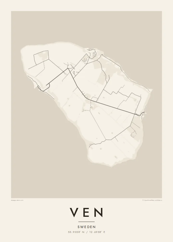
55.9058° N / 12.6958° E
A small, flat-topped island in the Øresund, ringed by steep banks and crossed by quiet lanes between open fields.




עיר אחת, חמש אווירות
הקישו על סגנון כדי לראות אותו על הקיר. כל הסגנונות עולים אותו מחיר — מודפס, ממוסגר או כקבצי HD.
 פיקסלים אמיתיים · קובץ הדפסה 24 × 36″
חדות של הדפסה
זהו קטע בגודל 100% מקובץ ההדפסה האמיתי. כל פוסטר — מודפס, ממוסגר או מורד — מעובד בשרתים שלנו ברזולוציה של 300 DPI, עד 7,200 × 10,800 פיקסלים, כך שאפילו הרחובות הקטנים ביותר נשארים חדים בהדפסה בגודל 24 × 36″.
על הקיר


המפה
Ven sits in the middle of the Øresund, the strait between Sweden and Denmark, and belongs to Landskrona municipality on the Swedish side. It is a compact oval island, a raised plateau of farmland whose steep slopes and cliffs drop to narrow beaches. From above, the patchwork of fields and the thin lanes crossing them give the interior a gentle, almost ruled texture.
The island is best known for Tycho Brahe, the Danish astronomer who was granted Ven in the 1570s and built two observatories there, Uraniborg and the partly underground Stjerneborg. His precise observations of the stars and planets later helped Johannes Kepler work out the laws of planetary motion. The site is now a museum, and its Renaissance garden has been reconstructed in a clear geometric plan.
The harbours of Bäckviken and Kyrkbacken sit on the east and west coasts respectively, and the lanes between them are mostly travelled by bicycle. A Ven map poster shows the whole island at a glance. A little of the Swedish or Danish shore at the edge hints at how close the island is to both countries, and how separate from them.
Near the middle of the island, the site of Tycho Brahe's observatory and its reconstructed garden forms a small, deliberate geometric figure among the surrounding farmland.
The plateau ends abruptly at steep grassy slopes that drop to the water, so the coastline on the map is a firm, clean edge rather than a ragged one.
The ferry from Landskrona arrives at this small east-coast harbour. From there a short road climbs off the water onto the plateau and fans out into the island's lanes.
התאימו אישית
הוסיפו תאריך, שם או שורה משלכם, והחליפו סגנון, גודל או כיוון.
התצוגה המקדימה החינמית היא ברזולוציה נמוכה ועם סימן מים. ההדפסים וקבצי ה-HD מעובדים ברזולוציה של 300 DPI, עד 7,200 × 10,800 px, ללא סימן מים.
למה Ven
Ven suits anyone drawn to the history of astronomy, and the many people who have cycled its lanes on a summer day out from Landskrona or Copenhagen. Its tidy oval shape is easy to recognise and holds a surprising amount of history for so small a place.
Personalise the title, subtitle and coordinates line, perhaps with the date of that ride or a line about Tycho, and choose one of five styles. Noir makes a fitting night sky. The files come as 300 DPI PNG and print-ready PDF in six sizes for $9, or you can order a printed poster, framed if you like.
הזמינו את פוסטר Ven| גודל הדפסה | רזולוציה | קבצים |
|---|---|---|
| 30 × 40 cm (11.8 × 15.7″) | 3,543 × 4,724 px | PNG · PDF |
| 29.7 × 42 cm (A3, 11.7 × 16.5″) | 3,508 × 4,961 px | PNG · PDF |
| 42 × 59.4 cm (A2, 16.5 × 23.4″) | 4,961 × 7,016 px | PNG · PDF |
| 45.7 × 61 cm (18 × 24″) | 5,400 × 7,200 px | PNG · PDF |
| 50 × 70 cm (19.7 × 27.6″) | 5,906 × 8,268 px | PNG · PDF |
| 61 × 91.4 cm (24 × 36″) | 7,200 × 10,800 px | PNG · PDF |
לשם השוואה, התצוגה המקדימה החינמית ברוחב 900 פיקסלים, עם סימן מים ומיועדת למסכים. לקובצי ה־HD רזולוציה גבוהה עד פי 8 בכל כיוון, והם מודפסים בצורה נקייה בגודל פוסטר מלא.
בחרו סגנון בראש העמוד, ואז בחרו פוסטר מודפס — גודל, ואם תרצו, גם מסגרת — או קבצי HD דיגיטליים. התשלום מתבצע בשלב אחד, ועמוד ההזמנה שלכם מתעדכן ברגע שהתשלום מאושר.
הוא מודפס על נייר מאט פרימיום במשקל 200 גרם, באחד משישה גדלים, מ-30 × 40 ס״מ ועד 24 × 36″. פוסטרים מודפסים מתחילים ב-{printFrom}, כולל משלוח.
כן. בחרו מסגרת מעץ מלא בשחור, לבן, אלון טבעי או עץ כהה. המסגרת מגיעה עם זכוכית בטיחותית ומוכנה לתלייה. פוסטרים ממוסגרים מתחילים ב-{framedFrom}, כולל משלוח.
המשלוח חינם בכל העולם. כל פוסטר מודפס אצל שותף ההדפסה הקרוב ביותר מבין למעלה מ-30 מדינות, ולרוב מגיע תוך 3–7 ימי עסקים. אפשר לעקוב אחרי הסטטוס והמעקב בעמוד ההזמנות שלי.
שלחו לנו תמונה תוך 14 יום מקבלת המשלוח, ואנחנו נדפיס אותו מחדש בחינם או נחזיר לכם את הכסף.
כן. בעורך שבעמוד הזה אפשר לשנות את הכותרת, כותרת המשנה ושורת הקואורדינטות לכל מה שתרצו, ולבחור סגנון וגודל. הזמנות מודפסות, ממוסגרות ודיגיטליות משתמשות בדיוק בעיצוב שלכם.
תמורת $9 תקבלו קבצי PNG ו-PDF מוכנים להדפסה ברזולוציה של 300 DPI, בכל שישה הגדלים, ללא סימן מים, להדפסה בכל מקום. עוד לא בטוחים? הורידו קודם תצוגה מקדימה חינמית עם סימן מים.
