University campuses
The University of Waterloo and Wilfrid Laurier take up large parcels near the centre. On the map they read as open, lightly built areas surrounded by residential streets.
פוסטר מפה מינימליסטי · קנדה
43.4668° N / 80.5164° W
A university city of curving suburban streets and green corridors, with two large campuses at its centre and Kitchener to the south.



עיר אחת, חמש אווירות
הקישו על סגנון כדי לראות אותו על הקיר. כל הסגנונות עולים אותו מחיר — מודפס, ממוסגר או כקבצי HD.
 פיקסלים אמיתיים · קובץ הדפסה 24 × 36″
חדות של הדפסה
זהו קטע בגודל 100% מקובץ ההדפסה האמיתי. כל פוסטר — מודפס, ממוסגר או מורד — מעובד בשרתים שלנו ברזולוציה של 300 DPI, עד 7,200 × 10,800 פיקסלים, כך שאפילו הרחובות הקטנים ביותר נשארים חדים בהדפסה בגודל 24 × 36″.
על הקיר


המפה
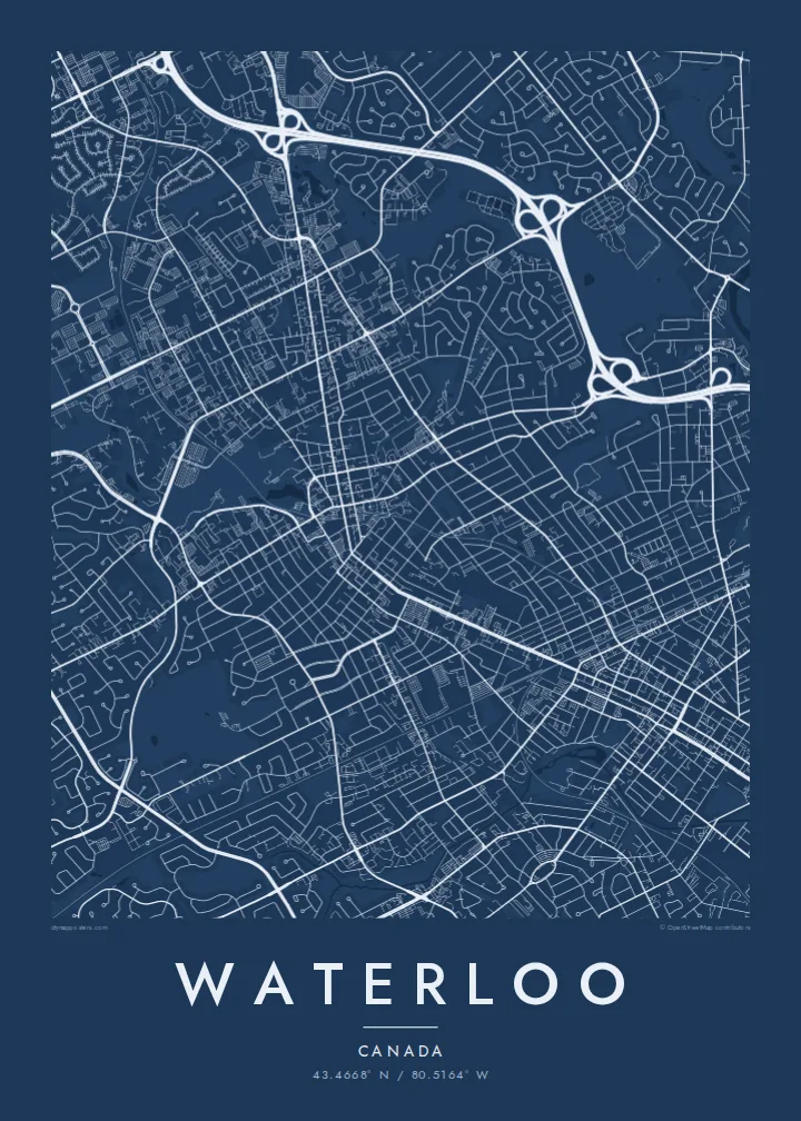
Waterloo runs directly into Kitchener, and on a map the two form one continuous urban area in southwestern Ontario. Waterloo's part is defined by its two universities. The University of Waterloo campus spreads across a wide open parcel north of Uptown, and Wilfrid Laurier sits closer to the centre. Around them, suburban streets curve and loop in the patterns of postwar planning.
Laurel Creek winds through the city from the northwest and feeds Silver Lake in Waterloo Park, which forms a long green band between the campuses and Uptown. The ION light rail line runs north–south through the middle. Waterloo is known for its technology sector, including BlackBerry's origins here, and for research institutions such as the Perimeter Institute for Theoretical Physics.
A Waterloo map poster captures a university town that has grown into a city. In black and white, the campuses and parks appear as large open shapes, Uptown's small grid as a dense knot, and the curving subdivisions as a soft texture reaching out to the farmland on the edges.
The University of Waterloo and Wilfrid Laurier take up large parcels near the centre. On the map they read as open, lightly built areas surrounded by residential streets.
A long stretch of parkland along Laurel Creek and Silver Lake links the campuses to Uptown, a green spine through the middle of the city.
The light rail line runs north–south, connecting Waterloo to Kitchener and marking a straight path through the curving suburban streets.
התאימו אישית
הוסיפו תאריך, שם או שורה משלכם, והחליפו סגנון, גודל או כיוון.
התצוגה המקדימה החינמית היא ברזולוציה נמוכה ועם סימן מים. ההדפסים וקבצי ה-HD מעובדים ברזולוציה של 300 DPI, עד 7,200 × 10,800 px, ללא סימן מים.
למה Waterloo
Graduates, researchers and anyone who spent formative years here often feel strongly about Waterloo. A map of the campus and the surrounding streets makes a thoughtful graduation or farewell gift.
Add a class year, a name or a campus as the title and subtitle, keep or adjust the coordinates, and choose one of five styles. Download the HD files for $9 or order a framed or unframed printed poster.
הזמינו את פוסטר Waterloo| גודל הדפסה | רזולוציה | קבצים |
|---|---|---|
| 30 × 40 cm (11.8 × 15.7″) | 3,543 × 4,724 px | PNG · PDF |
| 29.7 × 42 cm (A3, 11.7 × 16.5″) | 3,508 × 4,961 px | PNG · PDF |
| 42 × 59.4 cm (A2, 16.5 × 23.4″) | 4,961 × 7,016 px | PNG · PDF |
| 45.7 × 61 cm (18 × 24″) | 5,400 × 7,200 px | PNG · PDF |
| 50 × 70 cm (19.7 × 27.6″) | 5,906 × 8,268 px | PNG · PDF |
| 61 × 91.4 cm (24 × 36″) | 7,200 × 10,800 px | PNG · PDF |
לשם השוואה, התצוגה המקדימה החינמית ברוחב 900 פיקסלים, עם סימן מים ומיועדת למסכים. לקובצי ה־HD רזולוציה גבוהה עד פי 8 בכל כיוון, והם מודפסים בצורה נקייה בגודל פוסטר מלא.
בחרו סגנון בראש העמוד, ואז בחרו פוסטר מודפס — גודל, ואם תרצו, גם מסגרת — או קבצי HD דיגיטליים. התשלום מתבצע בשלב אחד, ועמוד ההזמנה שלכם מתעדכן ברגע שהתשלום מאושר.
הוא מודפס על נייר מאט פרימיום במשקל 200 גרם, באחד משישה גדלים, מ-30 × 40 ס״מ ועד 24 × 36″. פוסטרים מודפסים מתחילים ב-{printFrom}, כולל משלוח.
כן. בחרו מסגרת מעץ מלא בשחור, לבן, אלון טבעי או עץ כהה. המסגרת מגיעה עם זכוכית בטיחותית ומוכנה לתלייה. פוסטרים ממוסגרים מתחילים ב-{framedFrom}, כולל משלוח.
המשלוח חינם בכל העולם. כל פוסטר מודפס אצל שותף ההדפסה הקרוב ביותר מבין למעלה מ-30 מדינות, ולרוב מגיע תוך 3–7 ימי עסקים. אפשר לעקוב אחרי הסטטוס והמעקב בעמוד ההזמנות שלי.
שלחו לנו תמונה תוך 14 יום מקבלת המשלוח, ואנחנו נדפיס אותו מחדש בחינם או נחזיר לכם את הכסף.
כן. בעורך שבעמוד הזה אפשר לשנות את הכותרת, כותרת המשנה ושורת הקואורדינטות לכל מה שתרצו, ולבחור סגנון וגודל. הזמנות מודפסות, ממוסגרות ודיגיטליות משתמשות בדיוק בעיצוב שלכם.
תמורת $9 תקבלו קבצי PNG ו-PDF מוכנים להדפסה ברזולוציה של 300 DPI, בכל שישה הגדלים, ללא סימן מים, להדפסה בכל מקום. עוד לא בטוחים? הורידו קודם תצוגה מקדימה חינמית עם סימן מים.
