Connaught Place
A circular commercial centre built as concentric rings of colonnaded buildings, with roads radiating outward. It is one of the most recognisable geometric shapes in the city.
Postè kat minimalis · India
28.6519° N / 77.2315° E
A river city of layered capitals, from the walled lanes of Shahjahanabad to the radial avenues of New Delhi


Yon vil, senk atmosfè
Peze yon style pou wè li sou mi a. Chak style koute menm pri — enprime, ankadre oswa kòm fichye HD.
 Piksèl reyèl · fichye enpresyon 24 × 36″
Byen klè pou enprime
Sa a se yon zoom 100% sou vrè fichye enpresyon an. Chak afich — enprime, ankadre oswa telechaje — jenere sou sèvè nou yo nan 300 DPI, jiska 7,200 × 10,800 piksèl, konsa menm pi piti wout yo rete klè sou yon enpresyon 24 × 36″.
Sou mi a


Kat la
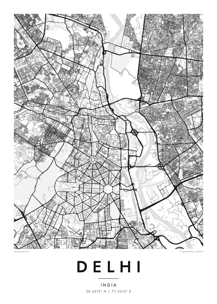
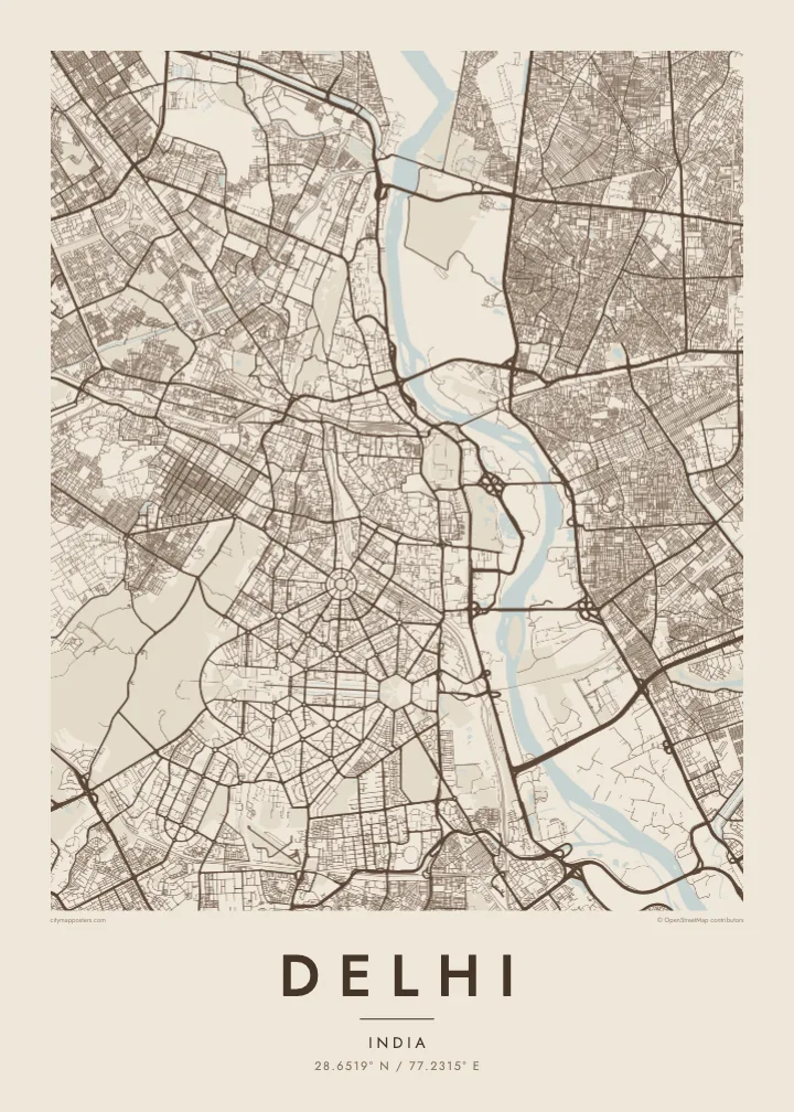
Delhi spreads mainly along the western bank of the Yamuna River, with the forested Ridge, an old extension of the Aravalli hills, running through it from north to south. The city is built in layers, each capital placed beside the last, so the map shows distinct patterns side by side: medieval ruins to the south, the Mughal walled city to the north, and the ordered avenues of New Delhi in between.
Shahjahanabad, now Old Delhi, is a dense web of lanes around the Red Fort and the Jama Masjid, with Chandni Chowk running straight through it. To the south, New Delhi was laid out in the 1910s and 1920s with broad tree-lined avenues, roundabouts and hexagonal blocks. Connaught Place forms a set of concentric circles, and Kartavya Path runs east from Rashtrapati Bhavan to India Gate.
Three UNESCO World Heritage Sites lie within the city: the Red Fort Complex, Humayun’s Tomb and the Qutb Minar with its monuments. A Delhi map poster brings together the contrasts between these eras, the organic lanes of Old Delhi and the formal geometry of the colonial capital, framed by the Ring Road and the Yamuna.
A circular commercial centre built as concentric rings of colonnaded buildings, with roads radiating outward. It is one of the most recognisable geometric shapes in the city.
The ceremonial avenue, formerly Rajpath, runs in a straight line between Rashtrapati Bhavan and India Gate, flanked by lawns and water channels, forming the central axis of New Delhi.
Around the Red Fort and Chandni Chowk, a tight network of lanes and bazaars fills the former walled city, creating the finest, densest texture anywhere on the map.
Fè l pou ou
Ajoute yon dat, yon non oswa pwòp fraz pa w, chanje estil, gwosè oswa oryantasyon.
Apèsi gratis la se nan rezolisyon ba avèk yon watèrmak. Enpresyon ak fichye HD yo jenere nan 300 DPI, jiska 7,200 × 10,800 px, san watèrmak.
Poukisa Delhi
Delhi is a city of neighbourhoods and memories: a family house in Old Delhi, college years on the North Campus, a first flat somewhere in the south. A map poster keeps those places in one frame and shows how they connect.
Title it Delhi, New Delhi or the name of your colony, and add a subtitle with a date or a message. Edit the coordinates line as you like, and choose from Classic black & white, Noir, Paper, Blueprint and Sand in any of six print sizes.
Kòmande afich Delhi a| Gwosè enpresyon | Rezolisyon | Fichye |
|---|---|---|
| 30 × 40 cm (11.8 × 15.7″) | 3,543 × 4,724 px | PNG · PDF |
| 29.7 × 42 cm (A3, 11.7 × 16.5″) | 3,508 × 4,961 px | PNG · PDF |
| 42 × 59.4 cm (A2, 16.5 × 23.4″) | 4,961 × 7,016 px | PNG · PDF |
| 45.7 × 61 cm (18 × 24″) | 5,400 × 7,200 px | PNG · PDF |
| 50 × 70 cm (19.7 × 27.6″) | 5,906 × 8,268 px | PNG · PDF |
| 61 × 91.4 cm (24 × 36″) | 7,200 × 10,800 px | PNG · PDF |
Pou konpare, apèsi gratis la gen 900 px lajè, li gen filigràn epi li fèt pou ekran. Fichye HD yo gen jiska 8 fwa plis rezolisyon nan chak direksyon epi yo enprime pwòp nan gwosè postè konplè.
Chwazi yon style anlè paj la, epi chwazi Afich Enprime — yon gwosè epi, si w vle, yon kad — oswa Fichye Dijital HD. Peman an fèt nan yon sèl etap, epi paj kòmand ou a mete ajou kou peman an konfime.
Li enprime sou papye mat premium 200 gsm nan youn nan sis gwosè, soti nan 30 × 40 cm rive nan 24 × 36″. Afich enprime yo kòmanse nan $39, livrezon enkli.
Wi. Chwazi yon kad an bwa solid nan koulè nwa, blan, chenn natirèl oswa bwa fonse. Li vin ak yon vit ki pa kase epi li pare pou pandye. Afich ankadre yo kòmanse nan $99, livrezon enkli.
Livrezon an gratis nan tout mond lan. Se pi pwòch nan patnè enprimri nou yo nan plis pase 30 peyi ki enprime chak afich la, epi li anjeneral rive nan 3–7 jou ouvrab. Ou ka swiv estati ak swivi kolis la nan Kòmand mwen yo. Gen kèk peyi ki pran 2–5 semèn, e kote nou poko livre a, sit la di w anvan ou peye.
Voye nou yon foto nan 14 jou apre livrezon an epi nou ap reenprime li gratis oswa remèt ou lajan w.
Wi. Nan editè a sou paj sa a, chanje tit la, soutit la ak liy kowòdone yo pou nenpòt sa w vle, epi chwazi yon style ak yon gwosè. Kòmand enprime, ankadre ak dijital yo tout itilize egzakteman desen w lan.
Pou $9 ou jwenn fichye PNG 300 DPI ak PDF pare-pou-enprime nan tout sis gwosè yo, san watèrmak, pou enprime kote w vle. Pa sèten toujou? Telechaje yon apèsi gratis ak watèrmak anvan.
