Durgapur Barrage
A long straight line across the Damodar, with the wide river on one side and the start of the irrigation canals on the other. It is one of the most graphic shapes on the map.
Postè kat minimalis · India
23.5158° N / 87.3080° E
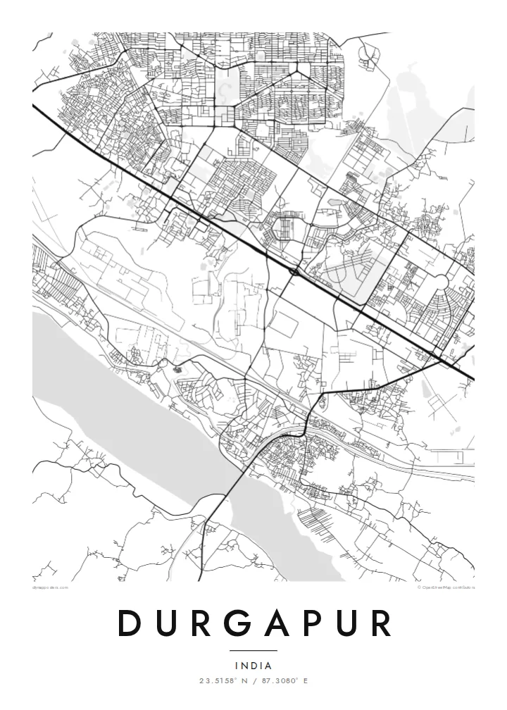
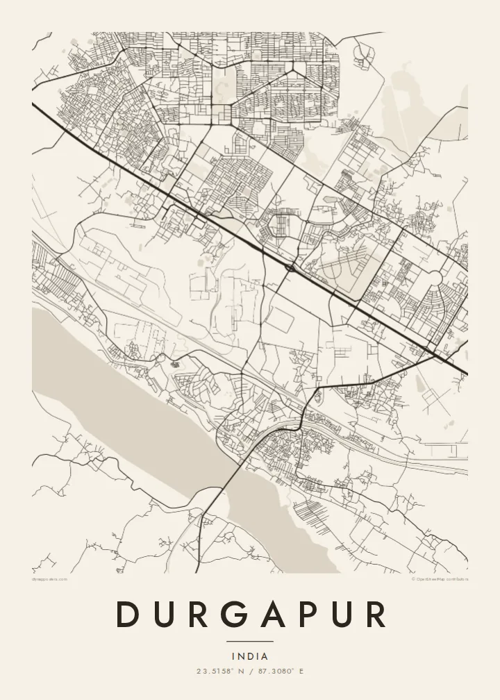
A planned steel town laid out in sectors between the Damodar River and the long rail and highway corridor to Kolkata



Yon vil, senk atmosfè
Peze yon style pou wè li sou mi a. Chak style koute menm pri — enprime, ankadre oswa kòm fichye HD.
 Piksèl reyèl · fichye enpresyon 24 × 36″
Byen klè pou enprime
Sa a se yon zoom 100% sou vrè fichye enpresyon an. Chak afich — enprime, ankadre oswa telechaje — jenere sou sèvè nou yo nan 300 DPI, jiska 7,200 × 10,800 piksèl, konsa menm pi piti wout yo rete klè sou yon enpresyon 24 × 36″.
Sou mi a


Kat la
Durgapur is a planned city, and it shows from above. It was built after independence around a large state steel plant, and residential sectors sit in separate blocks divided by broad roads and green buffers. The result is a map that looks organised rather than grown, with industrial land, townships and open ground each clearly separated from the others.
The Damodar River forms the southern edge. The Durgapur Barrage, completed in the 1950s, stretches across its wide sandy bed and feeds irrigation canals that run across the plain. North of the river, the national highway and the railway to Kolkata run side by side through the city, and most of the urban area lines up along this single east–west band.
A Durgapur map poster brings all these layers onto one sheet: the geometric sectors, the plant with its rail sidings, the canals and the pale width of the river. Durgapur is also home to a National Institute of Technology, whose campus shows up as its own neat block. In black and white, the city looks like the engineering drawing it once started as.
A long straight line across the Damodar, with the wide river on one side and the start of the irrigation canals on the other. It is one of the most graphic shapes on the map.
Residential areas were planned as separate units with their own internal street loops. Seen from above, they read as a series of distinct, self-contained patterns set apart by main roads.
The highway and the railway run in parallel across the city from west to east, a strong double line that ties the plant, the townships and the station together.
Fè l pou ou
Ajoute yon dat, yon non oswa pwòp fraz pa w, chanje estil, gwosè oswa oryantasyon.
Apèsi gratis la se nan rezolisyon ba avèk yon watèrmak. Enpresyon ak fichye HD yo jenere nan 300 DPI, jiska 7,200 × 10,800 px, san watèrmak.
Poukisa Durgapur
Many people here have a family connection to the plant, the college or one of the townships, and a map of Durgapur records that planned landscape in a way a photograph cannot. It suits a study, an office wall or a gift for someone who has moved away.
You can change the title and subtitle, for example to name a sector or add a year, and adjust the coordinates line. Choose from five styles: Classic black & white, Noir, Paper, Blueprint or Sand. Blueprint suits a city that began as a plan.
Kòmande afich Durgapur a| Gwosè enpresyon | Rezolisyon | Fichye |
|---|---|---|
| 30 × 40 cm11.8 × 15.7″ | 3,543 × 4,724 px | PNG · PDF |
| 29.7 × 42 cm (A3)11.7 × 16.5″ | 3,508 × 4,961 px | PNG · PDF |
| 42 × 59.4 cm (A2)16.5 × 23.4″ | 4,961 × 7,016 px | PNG · PDF |
| 45.7 × 61 cm18 × 24″ | 5,400 × 7,200 px | PNG · PDF |
| 50 × 70 cm19.7 × 27.6″ | 5,906 × 8,268 px | PNG · PDF |
| 61 × 91.4 cm24 × 36″ | 7,200 × 10,800 px | PNG · PDF |
Pou konpare, apèsi gratis la gen 900 px lajè, li gen filigràn epi li fèt pou ekran. Fichye HD yo gen jiska 8 fwa plis rezolisyon nan chak direksyon epi yo enprime pwòp nan gwosè postè konplè.
Chwazi yon style anlè paj la, epi chwazi Afich Enprime — yon gwosè epi, si w vle, yon kad — oswa Fichye Dijital HD. Peman an fèt nan yon sèl etap, epi paj kòmand ou a mete ajou kou peman an konfime.
Li enprime sou papye mat premium 200 gsm nan youn nan sis gwosè, soti nan 30 × 40 cm rive nan 24 × 36″. Afich enprime yo kòmanse nan $39, livrezon enkli.
Wi. Chwazi yon kad an bwa solid nan koulè nwa, blan, chenn natirèl oswa bwa fonse. Li vin ak yon vit ki pa kase epi li pare pou pandye. Afich ankadre yo kòmanse nan $99, livrezon enkli.
Livrezon gratis nan plis pase 60 peyi. Chak afich enprime pa patnè enprimeri ki pi pre w la nan plis pase 30 peyi, e anjeneral li rive nan 3 a 7 jou ouvrab. Ou ka suiv estati a ak swivi kolis la nan Kòmand mwen yo. Kèk peyi pran 2 a 5 semèn, e kote nou poko livre, sit la di w sa anvan w peye.
Voye nou yon foto nan 14 jou apre livrezon an epi nou ap reenprime li gratis oswa remèt ou lajan w.
Wi. Nan editè a sou paj sa a, chanje tit la, soutit la ak liy kowòdone yo pou nenpòt sa w vle, epi chwazi yon style ak yon gwosè. Kòmand enprime, ankadre ak dijital yo tout itilize egzakteman desen w lan.
Pou $9 ou jwenn fichye PNG 300 DPI ak PDF pare-pou-enprime nan tout sis gwosè yo, san watèrmak, pou enprime kote w vle. Pa sèten toujou? Telechaje yon apèsi gratis ak watèrmak anvan.
