The Old City walls
The Ottoman walls, completed under Suleiman the Magnificent in the 1530s, enclose the Old City in an unmistakable outline. Gates such as Damascus Gate and Herod's Gate open onto the northern districts.
Postè kat minimalis · Palestinian Territories
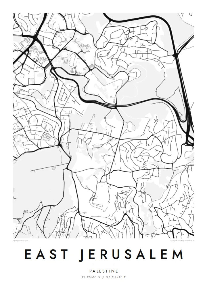
31.7868° N / 35.2449° E
Walled Old City at the centre, the Kidron Valley and Mount of Olives to the east, neighbourhoods spreading north and south


Yon vil, senk atmosfè
Peze yon style pou wè li sou mi a. Chak style koute menm pri — enprime, ankadre oswa kòm fichye HD.
 Piksèl reyèl · fichye enpresyon 24 × 36″
Byen klè pou enprime
Sa a se yon zoom 100% sou vrè fichye enpresyon an. Chak afich — enprime, ankadre oswa telechaje — jenere sou sèvè nou yo nan 300 DPI, jiska 7,200 × 10,800 piksèl, konsa menm pi piti wout yo rete klè sou yon enpresyon 24 × 36″.
Sou mi a


Kat la
From above, East Jerusalem arranges itself around the walled Old City. The walls form a clear, slightly skewed quadrilateral. Roads leave its gates and climb into the hills in every direction. To the east, the ground drops into the Kidron Valley and rises again to the Mount of Olives. Its slopes are marked by terraced cemeteries and a thin line of roads that follows the contours.
North of Damascus Gate, the street pattern becomes denser and more regular. Neighbourhoods such as Sheikh Jarrah spread along the road towards Ramallah. Further out, the map fragments into hilltop quarters separated by wadis and main roads. Because the terrain shapes almost every street, a East Jerusalem map poster reads as much like a relief study as a plan of a city.
The eastern side of the city has been contested since 1967, when Israel took control of the area. Its status remains central to Israeli–Palestinian negotiations. On paper, the lines are quieter. Gates, valleys, ridges and the long road descending towards Jericho are all shown with the same even weight. That lets the geography speak before the politics does.
The Ottoman walls, completed under Suleiman the Magnificent in the 1530s, enclose the Old City in an unmistakable outline. Gates such as Damascus Gate and Herod's Gate open onto the northern districts.
A deep, narrow valley runs north to south between the Old City and the Mount of Olives. On the map it shows as a clean gap between two dense areas of streets.
The ridge east of the Old City carries winding roads and large cemetery grounds. From above, its streets curve with the slope rather than following a grid.
Fè l pou ou
Ajoute yon dat, yon non oswa pwòp fraz pa w, chanje estil, gwosè oswa oryantasyon.
Apèsi gratis la se nan rezolisyon ba avèk yon watèrmak. Enpresyon ak fichye HD yo jenere nan 300 DPI, jiska 7,200 × 10,800 px, san watèrmak.
Poukisa East Jerusalem
People who have lived in, studied in or prayed in this part of Jerusalem often want a map that is honest and restrained. A black-and-white plan of streets and slopes keeps the focus on the place itself, not on the headlines.
You can set your own title and add a subtitle with a date, a family name or a line of coordinates. Then choose from five styles: Classic black & white, Noir, Paper, Blueprint or Sand. The same composition can suit a study wall or a quiet hallway.
Kòmande afich East Jerusalem a| Gwosè enpresyon | Rezolisyon | Fichye |
|---|---|---|
| 30 × 40 cm11.8 × 15.7″ | 3,543 × 4,724 px | PNG · PDF |
| 29.7 × 42 cm (A3)11.7 × 16.5″ | 3,508 × 4,961 px | PNG · PDF |
| 42 × 59.4 cm (A2)16.5 × 23.4″ | 4,961 × 7,016 px | PNG · PDF |
| 45.7 × 61 cm18 × 24″ | 5,400 × 7,200 px | PNG · PDF |
| 50 × 70 cm19.7 × 27.6″ | 5,906 × 8,268 px | PNG · PDF |
| 61 × 91.4 cm24 × 36″ | 7,200 × 10,800 px | PNG · PDF |
Pou konpare, apèsi gratis la gen 900 px lajè, li gen filigràn epi li fèt pou ekran. Fichye HD yo gen jiska 8 fwa plis rezolisyon nan chak direksyon epi yo enprime pwòp nan gwosè postè konplè.
Chwazi yon style anlè paj la, epi chwazi Afich Enprime — yon gwosè epi, si w vle, yon kad — oswa Fichye Dijital HD. Peman an fèt nan yon sèl etap, epi paj kòmand ou a mete ajou kou peman an konfime.
Li enprime sou papye mat premium 200 gsm nan youn nan sis gwosè, soti nan 30 × 40 cm rive nan 24 × 36″. Afich enprime yo kòmanse nan $39, livrezon enkli.
Wi. Chwazi yon kad an bwa solid nan koulè nwa, blan, chenn natirèl oswa bwa fonse. Li vin ak yon vit ki pa kase epi li pare pou pandye. Afich ankadre yo kòmanse nan $99, livrezon enkli.
Livrezon gratis nan plis pase 60 peyi. Chak afich enprime pa patnè enprimeri ki pi pre w la nan plis pase 30 peyi, e anjeneral li rive nan 3 a 7 jou ouvrab. Ou ka suiv estati a ak swivi kolis la nan Kòmand mwen yo. Kèk peyi pran 2 a 5 semèn, e kote nou poko livre, sit la di w sa anvan w peye.
Voye nou yon foto nan 14 jou apre livrezon an epi nou ap reenprime li gratis oswa remèt ou lajan w.
Wi. Nan editè a sou paj sa a, chanje tit la, soutit la ak liy kowòdone yo pou nenpòt sa w vle, epi chwazi yon style ak yon gwosè. Kòmand enprime, ankadre ak dijital yo tout itilize egzakteman desen w lan.
Pou $9 ou jwenn fichye PNG 300 DPI ak PDF pare-pou-enprime nan tout sis gwosè yo, san watèrmak, pou enprime kote w vle. Pa sèten toujou? Telechaje yon apèsi gratis ak watèrmak anvan.
Toupre
