Downtown street grid
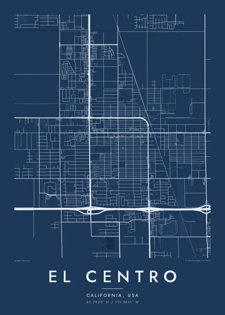
The centre of El Centro is a tidy grid of straight north–south and east–west streets, laid out on flat ground with no hills or rivers to bend it.
Postè kat minimalis · United States
32.7920° N / 115.5631° W
A desert grid below sea level, ringed by a patchwork of irrigated fields stretching toward the Mexican border



Yon vil, senk atmosfè
Peze yon style pou wè li sou mi a. Chak style koute menm pri — enprime, ankadre oswa kòm fichye HD.
 Piksèl reyèl · fichye enpresyon 24 × 36″
Byen klè pou enprime
Sa a se yon zoom 100% sou vrè fichye enpresyon an. Chak afich — enprime, ankadre oswa telechaje — jenere sou sèvè nou yo nan 300 DPI, jiska 7,200 × 10,800 piksèl, konsa menm pi piti wout yo rete klè sou yon enpresyon 24 × 36″.
Sou mi a


Kat la
El Centro lies in the Imperial Valley of southern California, a basin that sits below sea level and was turned from desert into farmland by irrigation. The city itself is laid out on a regular grid of straight streets, and the surrounding countryside repeats that logic at a larger scale, with square and rectangular fields divided by canals and section-line roads.
It is the seat of Imperial County and among the largest American cities located below sea level. Interstate 8 runs along its southern side on the way between San Diego and Arizona, and the border towns of Calexico and Mexicali lie a short drive to the south. The flat terrain means almost nothing interrupts the rectilinear pattern.
An El Centro map poster is an exercise in geometry. Streets meet at right angles, irrigation channels run in long straight lines, and the edges of town dissolve into a checkerboard of agricultural plots. In black and white this becomes almost abstract, a study in order and repetition that works well in modern, minimal interiors.
The centre of El Centro is a tidy grid of straight north–south and east–west streets, laid out on flat ground with no hills or rivers to bend it.
Beyond the city limits, farmland divided by canals and section-line roads forms a regular checkerboard that gives the outer edges of the map a strong graphic rhythm.
The interstate cuts across the south side of the city in a long, clean line, a clear horizontal anchor through the otherwise uniform grid.
Fè l pou ou
Ajoute yon dat, yon non oswa pwòp fraz pa w, chanje estil, gwosè oswa oryantasyon.
Apèsi gratis la se nan rezolisyon ba avèk yon watèrmak. Enpresyon ak fichye HD yo jenere nan 300 DPI, jiska 7,200 × 10,800 px, san watèrmak.
Poukisa El Centro
El Centro suits anyone who grew up in the Imperial Valley, served at the nearby naval air facility or simply likes the purity of a desert grid. The map reads as both a place and a pattern.
Personalise the title, subtitle and coordinates line and pick one of five styles: Classic black & white, Noir, Paper, Blueprint or Sand. Blueprint and Sand both suit the desert setting. Choose $9 HD files in six sizes or a printed poster shipped from a local partner.
Kòmande afich El Centro a| Gwosè enpresyon | Rezolisyon | Fichye |
|---|---|---|
| 30 × 40 cm11.8 × 15.7″ | 3,543 × 4,724 px | PNG · PDF |
| 29.7 × 42 cm (A3)11.7 × 16.5″ | 3,508 × 4,961 px | PNG · PDF |
| 42 × 59.4 cm (A2)16.5 × 23.4″ | 4,961 × 7,016 px | PNG · PDF |
| 45.7 × 61 cm18 × 24″ | 5,400 × 7,200 px | PNG · PDF |
| 50 × 70 cm19.7 × 27.6″ | 5,906 × 8,268 px | PNG · PDF |
| 61 × 91.4 cm24 × 36″ | 7,200 × 10,800 px | PNG · PDF |
Pou konpare, apèsi gratis la gen 900 px lajè, li gen filigràn epi li fèt pou ekran. Fichye HD yo gen jiska 8 fwa plis rezolisyon nan chak direksyon epi yo enprime pwòp nan gwosè postè konplè.
Chwazi yon style anlè paj la, epi chwazi Afich Enprime — yon gwosè epi, si w vle, yon kad — oswa Fichye Dijital HD. Peman an fèt nan yon sèl etap, epi paj kòmand ou a mete ajou kou peman an konfime.
Li enprime sou papye mat premium 200 gsm nan youn nan sis gwosè, soti nan 30 × 40 cm rive nan 24 × 36″. Afich enprime yo kòmanse nan $39, livrezon enkli.
Wi. Chwazi yon kad an bwa solid nan koulè nwa, blan, chenn natirèl oswa bwa fonse. Li vin ak yon vit ki pa kase epi li pare pou pandye. Afich ankadre yo kòmanse nan $99, livrezon enkli.
Livrezon gratis nan plis pase 60 peyi. Chak afich enprime pa patnè enprimeri ki pi pre w la nan plis pase 30 peyi, e anjeneral li rive nan 3 a 7 jou ouvrab. Ou ka suiv estati a ak swivi kolis la nan Kòmand mwen yo. Kèk peyi pran 2 a 5 semèn, e kote nou poko livre, sit la di w sa anvan w peye.
Voye nou yon foto nan 14 jou apre livrezon an epi nou ap reenprime li gratis oswa remèt ou lajan w.
Wi. Nan editè a sou paj sa a, chanje tit la, soutit la ak liy kowòdone yo pou nenpòt sa w vle, epi chwazi yon style ak yon gwosè. Kòmand enprime, ankadre ak dijital yo tout itilize egzakteman desen w lan.
Pou $9 ou jwenn fichye PNG 300 DPI ak PDF pare-pou-enprime nan tout sis gwosè yo, san watèrmak, pou enprime kote w vle. Pa sèten toujou? Telechaje yon apèsi gratis ak watèrmak anvan.
