Udi escarpment
The high ground at the edge of the city limits growth in that direction, so streets thin out and curve as the terrain rises toward the hills where coal was once mined.
Postè kat minimalis · Nigeria
6.4413° N / 7.4988° E
A city spread across rolling land at the foot of an escarpment, cut by river valleys and wide layouts


Yon vil, senk atmosfè
Peze yon style pou wè li sou mi a. Chak style koute menm pri — enprime, ankadre oswa kòm fichye HD.
 Piksèl reyèl · fichye enpresyon 24 × 36″
Byen klè pou enprime
Sa a se yon zoom 100% sou vrè fichye enpresyon an. Chak afich — enprime, ankadre oswa telechaje — jenere sou sèvè nou yo nan 300 DPI, jiska 7,200 × 10,800 piksèl, konsa menm pi piti wout yo rete klè sou yon enpresyon 24 × 36″.
Sou mi a


Kat la
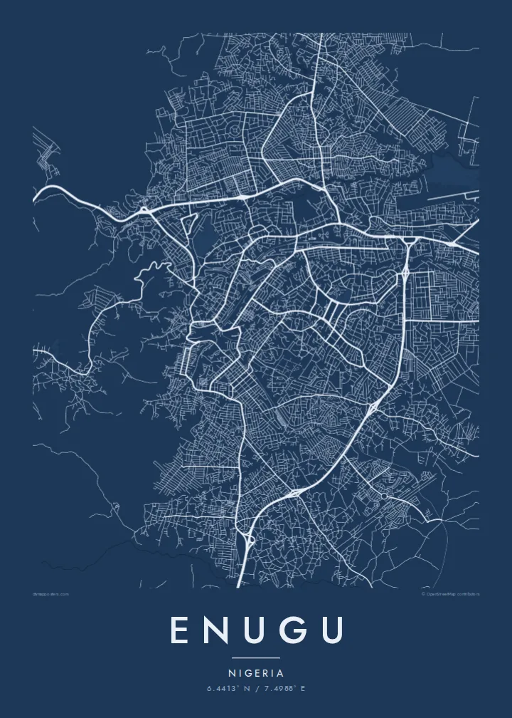
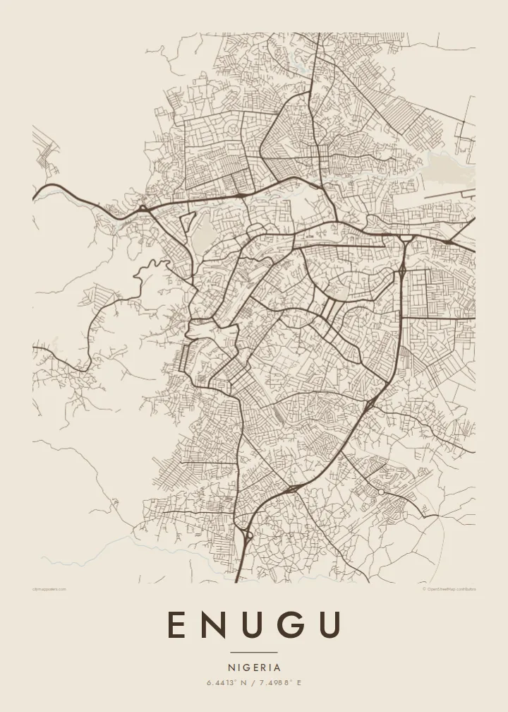
Enugu sits at the base of the Udi escarpment, and its map reflects that setting. The street pattern is uneven, bending around low ridges and dropping into valleys. The Ekulu River and its tributaries run through the city, leaving gaps and green corridors between neighbourhoods. In places the plan becomes more regular, where planned residential layouts were drawn out in grids and loops.
The city grew around coal. Deposits were found in the nearby hills in the early twentieth century, a railway followed to carry the coal south to the coast, and a town took shape around the mines. That origin gave Enugu its lasting nickname, the Coal City, and it later became an important administrative centre for the region.
An Enugu map poster traces the city across uneven ground, showing how roads follow valleys and ridgelines rather than a single axis. The eastern hills create a natural edge, while the city fans outward on gentler land to the west and south. It is a map shaped as much by terrain as by planning.
The high ground at the edge of the city limits growth in that direction, so streets thin out and curve as the terrain rises toward the hills where coal was once mined.
The river and its small tributaries wind through the urban area, opening green, unbuilt corridors that divide the city into clearly separated districts on the map.
Several residential areas were laid out with regular grids, crescents and looping roads, giving parts of the map a more geometric texture than the older, organic quarters.
Fè l pou ou
Ajoute yon dat, yon non oswa pwòp fraz pa w, chanje estil, gwosè oswa oryantasyon.
Apèsi gratis la se nan rezolisyon ba avèk yon watèrmak. Enpresyon ak fichye HD yo jenere nan 300 DPI, jiska 7,200 × 10,800 px, san watèrmak.
Poukisa Enugu
Enugu matters to people who grew up there, studied there or keep family ties to the region. Its irregular street pattern and river valleys give the map a textured, handmade quality that works well on a wall at home or in an office.
Add a custom title, subtitle and coordinates, perhaps a family name or a year. Pick from Classic black & white, Noir, Paper, Blueprint or Sand. Digital files include six print sizes, and printed posters ship from partners in more than 30 countries.
Kòmande afich Enugu a| Gwosè enpresyon | Rezolisyon | Fichye |
|---|---|---|
| 30 × 40 cm11.8 × 15.7″ | 3,543 × 4,724 px | PNG · PDF |
| 29.7 × 42 cm (A3)11.7 × 16.5″ | 3,508 × 4,961 px | PNG · PDF |
| 42 × 59.4 cm (A2)16.5 × 23.4″ | 4,961 × 7,016 px | PNG · PDF |
| 45.7 × 61 cm18 × 24″ | 5,400 × 7,200 px | PNG · PDF |
| 50 × 70 cm19.7 × 27.6″ | 5,906 × 8,268 px | PNG · PDF |
| 61 × 91.4 cm24 × 36″ | 7,200 × 10,800 px | PNG · PDF |
Pou konpare, apèsi gratis la gen 900 px lajè, li gen filigràn epi li fèt pou ekran. Fichye HD yo gen jiska 8 fwa plis rezolisyon nan chak direksyon epi yo enprime pwòp nan gwosè postè konplè.
Chwazi yon style anlè paj la, epi chwazi Afich Enprime — yon gwosè epi, si w vle, yon kad — oswa Fichye Dijital HD. Peman an fèt nan yon sèl etap, epi paj kòmand ou a mete ajou kou peman an konfime.
Li enprime sou papye mat premium 200 gsm nan youn nan sis gwosè, soti nan 30 × 40 cm rive nan 24 × 36″. Afich enprime yo kòmanse nan $39, livrezon enkli.
Wi. Chwazi yon kad an bwa solid nan koulè nwa, blan, chenn natirèl oswa bwa fonse. Li vin ak yon vit ki pa kase epi li pare pou pandye. Afich ankadre yo kòmanse nan $99, livrezon enkli.
Livrezon gratis nan plis pase 60 peyi. Chak afich enprime pa patnè enprimeri ki pi pre w la nan plis pase 30 peyi, e anjeneral li rive nan 3 a 7 jou ouvrab. Ou ka suiv estati a ak swivi kolis la nan Kòmand mwen yo. Kèk peyi pran 2 a 5 semèn, e kote nou poko livre, sit la di w sa anvan w peye.
Voye nou yon foto nan 14 jou apre livrezon an epi nou ap reenprime li gratis oswa remèt ou lajan w.
Wi. Nan editè a sou paj sa a, chanje tit la, soutit la ak liy kowòdone yo pou nenpòt sa w vle, epi chwazi yon style ak yon gwosè. Kòmand enprime, ankadre ak dijital yo tout itilize egzakteman desen w lan.
Pou $9 ou jwenn fichye PNG 300 DPI ak PDF pare-pou-enprime nan tout sis gwosè yo, san watèrmak, pou enprime kote w vle. Pa sèten toujou? Telechaje yon apèsi gratis ak watèrmak anvan.
