Guldborgsund
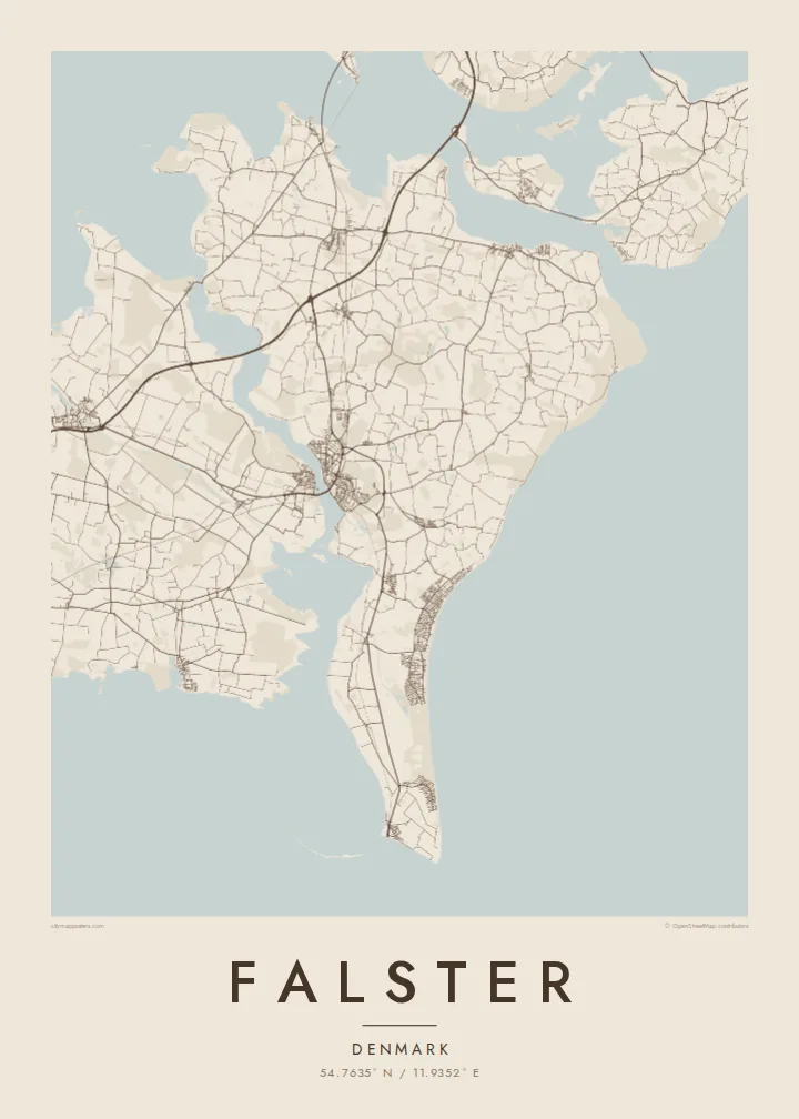
The narrow sound on the west side runs almost the full length of the island. On the map it looks like a river, dividing Falster from Lolland with a thin ribbon of water.
Postè kat minimalis · Denmark
54.7635° N / 11.9352° E
A flat Danish island between Lolland and Zealand, tapering south to Gedser Odde, the country's southernmost point.


Yon vil, senk atmosfè
Peze yon style pou wè li sou mi a. Chak style koute menm pri — enprime, ankadre oswa kòm fichye HD.
 Piksèl reyèl · fichye enpresyon 24 × 36″
Byen klè pou enprime
Sa a se yon zoom 100% sou vrè fichye enpresyon an. Chak afich — enprime, ankadre oswa telechaje — jenere sou sèvè nou yo nan 300 DPI, jiska 7,200 × 10,800 piksèl, konsa menm pi piti wout yo rete klè sou yon enpresyon 24 × 36″.
Sou mi a


Kat la
Falster lies south of Zealand in the Baltic, a low and fertile island shaped like a wedge that narrows to the south. Its west coast follows the Guldborgsund, a slender sound separating it from Lolland, while the east faces open water with a long, smooth beach. Farmland fills the interior, and the map shows an even spread of country roads between villages.
Nykøbing Falster, the main town, sits on the Guldborgsund, where bridges cross to Lolland. At the northern end, road and railway reach Zealand across the Storstrøm crossing and the Farø bridges. At the southern tip lies Gedser, with its ferry harbour for Rostock and the headland of Gedser Odde, the southernmost point of Denmark.
The east coast is lined with holiday houses around Marielyst, a long stretch of sand popular with Danish families for generations. A Falster map poster brings all of this into one frame: the thin sound to the west, the beach to the east, bridges at the top and a ferry at the bottom, with a quiet agricultural island in between.
The narrow sound on the west side runs almost the full length of the island. On the map it looks like a river, dividing Falster from Lolland with a thin ribbon of water.
The island's main town sits on the sound, its streets gathered around the bridges to Lolland. It is the densest cluster of lines on the poster and its natural centre.
The southern point of the island, and of Denmark, where the land ends in a narrow tip beside the ferry harbour that links the island to Germany.
Fè l pou ou
Ajoute yon dat, yon non oswa pwòp fraz pa w, chanje estil, gwosè oswa oryantasyon.
Apèsi gratis la se nan rezolisyon ba avèk yon watèrmak. Enpresyon ak fichye HD yo jenere nan 300 DPI, jiska 7,200 × 10,800 px, san watèrmak.
Poukisa Falster
Falster is a summer-house island for many Danes, and a first or last stop for travellers using the Gedser ferry. A map of the whole island captures the drive from the northern bridges down to the beach and the southern tip.
Add the name of a summer house, a family or a year to the title and subtitle, and set the coordinates line. Pick one of five styles, from Classic black & white and Noir to Paper, Blueprint and Sand, as a $9 HD download or a printed poster.
Kòmande afich Falster a| Gwosè enpresyon | Rezolisyon | Fichye |
|---|---|---|
| 30 × 40 cm (11.8 × 15.7″) | 3,543 × 4,724 px | PNG · PDF |
| 29.7 × 42 cm (A3, 11.7 × 16.5″) | 3,508 × 4,961 px | PNG · PDF |
| 42 × 59.4 cm (A2, 16.5 × 23.4″) | 4,961 × 7,016 px | PNG · PDF |
| 45.7 × 61 cm (18 × 24″) | 5,400 × 7,200 px | PNG · PDF |
| 50 × 70 cm (19.7 × 27.6″) | 5,906 × 8,268 px | PNG · PDF |
| 61 × 91.4 cm (24 × 36″) | 7,200 × 10,800 px | PNG · PDF |
Pou konpare, apèsi gratis la gen 900 px lajè, li gen filigràn epi li fèt pou ekran. Fichye HD yo gen jiska 8 fwa plis rezolisyon nan chak direksyon epi yo enprime pwòp nan gwosè postè konplè.
Chwazi yon style anlè paj la, epi chwazi Afich Enprime — yon gwosè epi, si w vle, yon kad — oswa Fichye Dijital HD. Peman an fèt nan yon sèl etap, epi paj kòmand ou a mete ajou kou peman an konfime.
Li enprime sou papye mat premium 200 gsm nan youn nan sis gwosè, soti nan 30 × 40 cm rive nan 24 × 36″. Afich enprime yo kòmanse nan $39, livrezon enkli.
Wi. Chwazi yon kad an bwa solid nan koulè nwa, blan, chenn natirèl oswa bwa fonse. Li vin ak yon vit ki pa kase epi li pare pou pandye. Afich ankadre yo kòmanse nan $99, livrezon enkli.
Livrezon an gratis nan tout mond lan. Se pi pwòch nan patnè enprimri nou yo nan plis pase 30 peyi ki enprime chak afich la, epi li anjeneral rive nan 3–7 jou ouvrab. Ou ka swiv estati ak swivi kolis la nan Kòmand mwen yo. Gen kèk peyi ki pran 2–5 semèn, e kote nou poko livre a, sit la di w anvan ou peye.
Voye nou yon foto nan 14 jou apre livrezon an epi nou ap reenprime li gratis oswa remèt ou lajan w.
Wi. Nan editè a sou paj sa a, chanje tit la, soutit la ak liy kowòdone yo pou nenpòt sa w vle, epi chwazi yon style ak yon gwosè. Kòmand enprime, ankadre ak dijital yo tout itilize egzakteman desen w lan.
Pou $9 ou jwenn fichye PNG 300 DPI ak PDF pare-pou-enprime nan tout sis gwosè yo, san watèrmak, pou enprime kote w vle. Pa sèten toujou? Telechaje yon apèsi gratis ak watèrmak anvan.
