The Kame
A towering cliff on the west coast, among the highest in Britain, where the land drops almost vertically to the sea. On the map the contour lines crowd together sharply.
Postè kat minimalis · United Kingdom
60.1338° N / 2.0779° W
A small, high Shetland island rising to great western cliffs, with its few crofts spread along the eastern side.

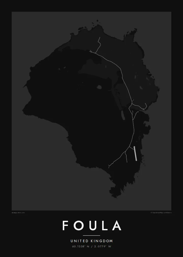


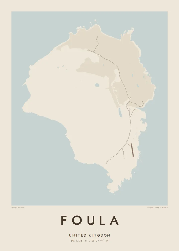
Yon vil, senk atmosfè
Peze yon style pou wè li sou mi a. Chak style koute menm pri — enprime, ankadre oswa kòm fichye HD.
 Piksèl reyèl · fichye enpresyon 24 × 36″
Byen klè pou enprime
Sa a se yon zoom 100% sou vrè fichye enpresyon an. Chak afich — enprime, ankadre oswa telechaje — jenere sou sèvè nou yo nan 300 DPI, jiska 7,200 × 10,800 piksèl, konsa menm pi piti wout yo rete klè sou yon enpresyon 24 × 36″.
Sou mi a


Kat la
Foula lies well west of mainland Shetland and is one of the most remote inhabited islands in Britain. On a map it is a compact, rounded block of land, but the relief tells the real story. High hills rise steeply toward the west and end in sheer sea cliffs. The eastern side slopes gently down to the shore, where the crofts and the small harbour are.
The Kame, on the west coast, is among the highest sea cliffs in the United Kingdom. The hills and moorland hold large seabird colonies, including great skuas. Foula also keeps an old custom: the community still follows the Julian calendar for its festive season and celebrates Christmas in early January.
Only a few dozen people live here, and the island is reached by a small ferry or light aircraft when the weather allows. A Foula map poster shows a place where human lines are few and faint. There is a single road along the east, and height, wind and the Atlantic shape almost everything else.
A towering cliff on the west coast, among the highest in Britain, where the land drops almost vertically to the sea. On the map the contour lines crowd together sharply.
The island's homes and fields are spread along the gentler east side. A single road links them and makes up nearly all of the map's human detail.
Several steep hills fill the heart of the island. They give the map strong relief and a sense of height that is unusual for such a small place.
Fè l pou ou
Ajoute yon dat, yon non oswa pwòp fraz pa w, chanje estil, gwosè oswa oryantasyon.
Apèsi gratis la se nan rezolisyon ba avèk yon watèrmak. Enpresyon ak fichye HD yo jenere nan 300 DPI, jiska 7,200 × 10,800 px, san watèrmak.
Poukisa Foula
Foula draws people who love the far edges of the British Isles: birdwatchers, walkers and those with Shetland roots. Its high, lonely form gives the print real presence, even at the smallest size.
Personalise the title and subtitle with a name, a crossing date or a line of verse, keep the coordinates, and choose one of five styles. Order a matte poster, framed or unframed, or download the full set of HD files.
Kòmande afich Foula a| Gwosè enpresyon | Rezolisyon | Fichye |
|---|---|---|
| 30 × 40 cm (11.8 × 15.7″) | 3,543 × 4,724 px | PNG · PDF |
| 29.7 × 42 cm (A3, 11.7 × 16.5″) | 3,508 × 4,961 px | PNG · PDF |
| 42 × 59.4 cm (A2, 16.5 × 23.4″) | 4,961 × 7,016 px | PNG · PDF |
| 45.7 × 61 cm (18 × 24″) | 5,400 × 7,200 px | PNG · PDF |
| 50 × 70 cm (19.7 × 27.6″) | 5,906 × 8,268 px | PNG · PDF |
| 61 × 91.4 cm (24 × 36″) | 7,200 × 10,800 px | PNG · PDF |
Pou konpare, apèsi gratis la gen 900 px lajè, li gen filigràn epi li fèt pou ekran. Fichye HD yo gen jiska 8 fwa plis rezolisyon nan chak direksyon epi yo enprime pwòp nan gwosè postè konplè.
Chwazi yon style anlè paj la, epi chwazi Afich Enprime — yon gwosè epi, si w vle, yon kad — oswa Fichye Dijital HD. Peman an fèt nan yon sèl etap, epi paj kòmand ou a mete ajou kou peman an konfime.
Li enprime sou papye mat premium 200 gsm nan youn nan sis gwosè, soti nan 30 × 40 cm rive nan 24 × 36″. Afich enprime yo kòmanse nan $39, livrezon enkli.
Wi. Chwazi yon kad an bwa solid nan koulè nwa, blan, chenn natirèl oswa bwa fonse. Li vin ak yon vit ki pa kase epi li pare pou pandye. Afich ankadre yo kòmanse nan $99, livrezon enkli.
Livrezon an gratis nan tout mond lan. Se pi pwòch nan patnè enprimri nou yo nan plis pase 30 peyi ki enprime chak afich la, epi li anjeneral rive nan 3–7 jou ouvrab. Ou ka swiv estati ak swivi kolis la nan Kòmand mwen yo. Gen kèk peyi ki pran 2–5 semèn, e kote nou poko livre a, sit la di w anvan ou peye.
Voye nou yon foto nan 14 jou apre livrezon an epi nou ap reenprime li gratis oswa remèt ou lajan w.
Wi. Nan editè a sou paj sa a, chanje tit la, soutit la ak liy kowòdone yo pou nenpòt sa w vle, epi chwazi yon style ak yon gwosè. Kòmand enprime, ankadre ak dijital yo tout itilize egzakteman desen w lan.
Pou $9 ou jwenn fichye PNG 300 DPI ak PDF pare-pou-enprime nan tout sis gwosè yo, san watèrmak, pou enprime kote w vle. Pa sèten toujou? Telechaje yon apèsi gratis ak watèrmak anvan.
