Harbour mouth
The narrow entrance to Portsmouth Harbour separates Gosport from Old Portsmouth. The short ferry crossing between them is one of the defining lines on the map.
Postè kat minimalis · United Kingdom
50.7951° N / 1.1290° W
A low peninsula between Portsmouth Harbour and the Solent, edged with forts, creeks, shingle and naval yards.



Yon vil, senk atmosfè
Peze yon style pou wè li sou mi a. Chak style koute menm pri — enprime, ankadre oswa kòm fichye HD.
 Piksèl reyèl · fichye enpresyon 24 × 36″
Byen klè pou enprime
Sa a se yon zoom 100% sou vrè fichye enpresyon an. Chak afich — enprime, ankadre oswa telechaje — jenere sou sèvè nou yo nan 300 DPI, jiska 7,200 × 10,800 piksèl, konsa menm pi piti wout yo rete klè sou yon enpresyon 24 × 36″.
Sou mi a


Kat la
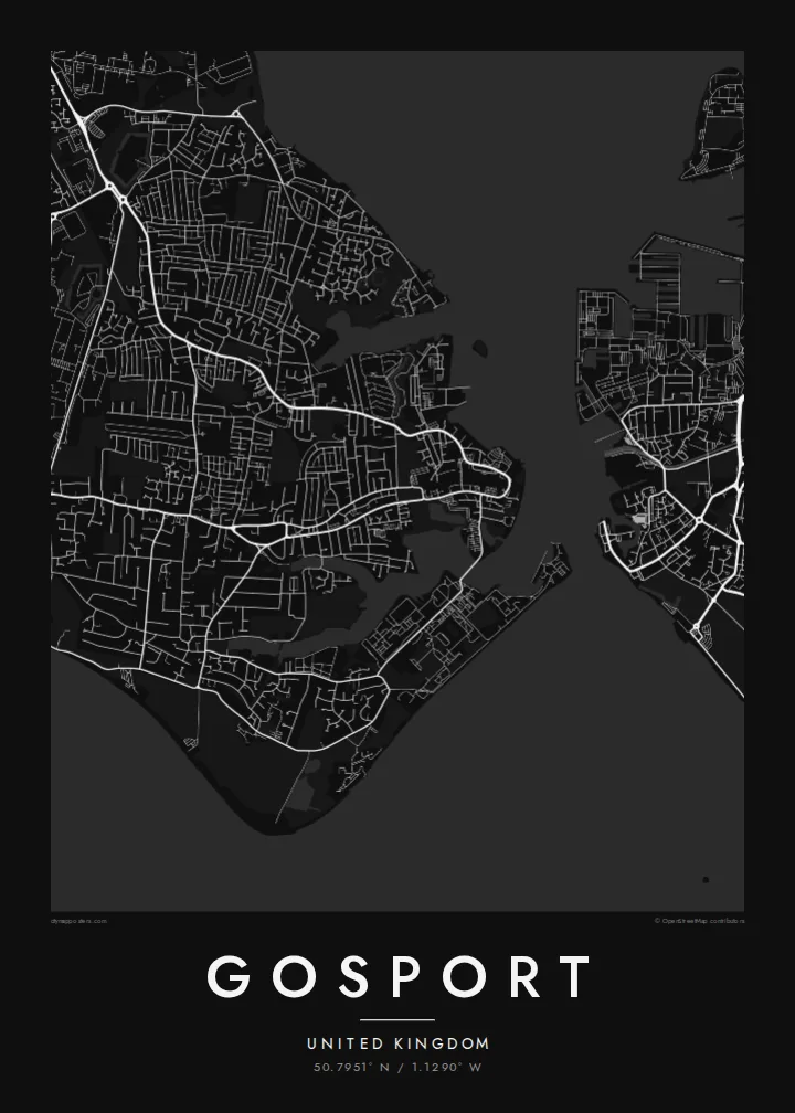
Gosport sits on a peninsula on the western side of Portsmouth Harbour, facing the city across a narrow stretch of water. On a map the town is framed almost entirely by sea: the harbour to the east, the Solent and Stokes Bay to the south, and tidal creeks cutting into its western edge. Much of its shoreline has long belonged to the Royal Navy.
The street pattern shows that history. The old town and ferry pontoon crowd the harbour mouth. Large institutional sites, including the former Royal Hospital Haslar and a string of Victorian forts, take up blocks that no ordinary street runs through. Beyond them, twentieth-century housing spreads west toward Fareham in looser curves and cul-de-sacs.
A Gosport map poster suits anyone who has served here, grown up here, or crossed on the Gosport Ferry more times than they can count. It also works as a companion print to Portsmouth, because the two towns share a harbour and read best side by side. The Submarine Museum on the waterfront is one of the town's best-known sights.
The narrow entrance to Portsmouth Harbour separates Gosport from Old Portsmouth. The short ferry crossing between them is one of the defining lines on the map.
The southern coast runs as a long, gentle curve of shingle facing the Isle of Wight. It gives the lower edge of the poster a clean, open line.
Victorian forts and former naval sites show up as large enclosed shapes among the terraced streets, a pattern that is typical of a garrison town.
Fè l pou ou
Ajoute yon dat, yon non oswa pwòp fraz pa w, chanje estil, gwosè oswa oryantasyon.
Apèsi gratis la se nan rezolisyon ba avèk yon watèrmak. Enpresyon ak fichye HD yo jenere nan 300 DPI, jiska 7,200 × 10,800 px, san watèrmak.
Poukisa Gosport
Gosport is a place many people pass through with the navy and remember for good. A map of the peninsula, harbour and all, suits a hallway, a study or the wall of anyone whose family story includes these docks.
You can change the title, subtitle and coordinates, for example to add a ship's name, a posting or a date. Choose from Classic black & white, Noir, Paper, Blueprint or Sand. Blueprint suits the naval shoreline particularly well.
Kòmande afich Gosport a| Gwosè enpresyon | Rezolisyon | Fichye |
|---|---|---|
| 30 × 40 cm11.8 × 15.7″ | 3,543 × 4,724 px | PNG · PDF |
| 29.7 × 42 cm (A3)11.7 × 16.5″ | 3,508 × 4,961 px | PNG · PDF |
| 42 × 59.4 cm (A2)16.5 × 23.4″ | 4,961 × 7,016 px | PNG · PDF |
| 45.7 × 61 cm18 × 24″ | 5,400 × 7,200 px | PNG · PDF |
| 50 × 70 cm19.7 × 27.6″ | 5,906 × 8,268 px | PNG · PDF |
| 61 × 91.4 cm24 × 36″ | 7,200 × 10,800 px | PNG · PDF |
Pou konpare, apèsi gratis la gen 900 px lajè, li gen filigràn epi li fèt pou ekran. Fichye HD yo gen jiska 8 fwa plis rezolisyon nan chak direksyon epi yo enprime pwòp nan gwosè postè konplè.
Chwazi yon style anlè paj la, epi chwazi Afich Enprime — yon gwosè epi, si w vle, yon kad — oswa Fichye Dijital HD. Peman an fèt nan yon sèl etap, epi paj kòmand ou a mete ajou kou peman an konfime.
Li enprime sou papye mat premium 200 gsm nan youn nan sis gwosè, soti nan 30 × 40 cm rive nan 24 × 36″. Afich enprime yo kòmanse nan $39, livrezon enkli.
Wi. Chwazi yon kad an bwa solid nan koulè nwa, blan, chenn natirèl oswa bwa fonse. Li vin ak yon vit ki pa kase epi li pare pou pandye. Afich ankadre yo kòmanse nan $99, livrezon enkli.
Livrezon gratis nan plis pase 60 peyi. Chak afich enprime pa patnè enprimeri ki pi pre w la nan plis pase 30 peyi, e anjeneral li rive nan 3 a 7 jou ouvrab. Ou ka suiv estati a ak swivi kolis la nan Kòmand mwen yo. Kèk peyi pran 2 a 5 semèn, e kote nou poko livre, sit la di w sa anvan w peye.
Voye nou yon foto nan 14 jou apre livrezon an epi nou ap reenprime li gratis oswa remèt ou lajan w.
Wi. Nan editè a sou paj sa a, chanje tit la, soutit la ak liy kowòdone yo pou nenpòt sa w vle, epi chwazi yon style ak yon gwosè. Kòmand enprime, ankadre ak dijital yo tout itilize egzakteman desen w lan.
Pou $9 ou jwenn fichye PNG 300 DPI ak PDF pare-pou-enprime nan tout sis gwosè yo, san watèrmak, pou enprime kote w vle. Pa sèten toujou? Telechaje yon apèsi gratis ak watèrmak anvan.
