Barrier beaches
A narrow strip of sand runs along the Atlantic shore, holding bays and ponds behind it and giving the southern edge of the map a double outline.
Postè kat minimalis · United States
40.8974° N / 72.3736° W
A chain of villages along Long Island's South Fork, between barrier beaches, ponds and bays, ending at Montauk Point



Yon vil, senk atmosfè
Peze yon style pou wè li sou mi a. Chak style koute menm pri — enprime, ankadre oswa kòm fichye HD.
 Piksèl reyèl · fichye enpresyon 24 × 36″
Byen klè pou enprime
Sa a se yon zoom 100% sou vrè fichye enpresyon an. Chak afich — enprime, ankadre oswa telechaje — jenere sou sèvè nou yo nan 300 DPI, jiska 7,200 × 10,800 piksèl, konsa menm pi piti wout yo rete klè sou yon enpresyon 24 × 36″.
Sou mi a


Kat la
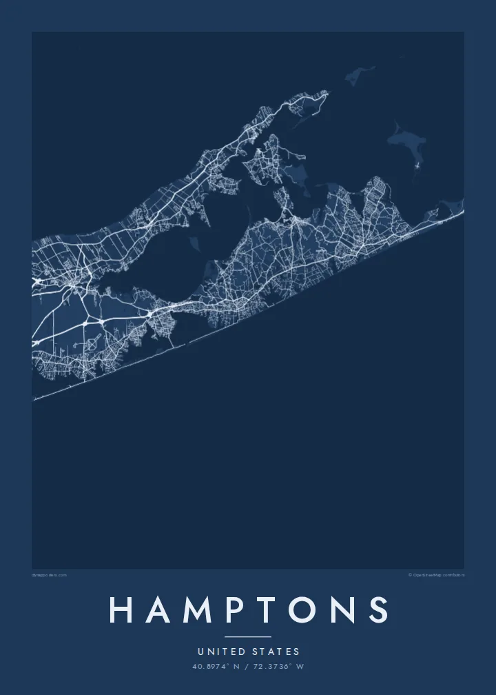
The Hamptons occupy the South Fork of Long Island, at the eastern end of New York State. The map shows a long, tapering strip of land with the Atlantic along its southern side and a network of bays to the north. Along the ocean edge, barrier beaches enclose a series of coastal ponds and inlets, while inland the villages sit among farmland and woods.
Southampton, East Hampton and several neighbouring villages were settled in the seventeenth century, and Sag Harbor grew into a whaling port. From the late nineteenth century the area became a summer retreat for New Yorkers and artists. At the eastern tip stands the Montauk Point Lighthouse, authorised under George Washington, at the very end of the fork.
A Hamptons map poster follows Montauk Highway, which links the villages from west to east, with smaller lanes leading down to the ocean beaches. Shinnecock Bay and its canal mark the western approach, and ponds such as Mecox and Georgica cut into the shoreline. Toward Montauk the land narrows further, and the settlements thin out.
A narrow strip of sand runs along the Atlantic shore, holding bays and ponds behind it and giving the southern edge of the map a double outline.
The former whaling village faces the sheltered bays on the north side of the fork, with its small street network gathered around the harbour.
The fork ends in a blunt headland, and the lighthouse at its tip marks the easternmost point of New York State.
Fè l pou ou
Ajoute yon dat, yon non oswa pwòp fraz pa w, chanje estil, gwosè oswa oryantasyon.
Apèsi gratis la se nan rezolisyon ba avèk yon watèrmak. Enpresyon ak fichye HD yo jenere nan 300 DPI, jiska 7,200 × 10,800 px, san watèrmak.
Poukisa Hamptons
It suits families with a summer house, people who come back every season and anyone who spent formative summers on the South Fork. Put a village, a house name or a surname in the title, and use the subtitle for a year or a date.
Choose one of five styles: Classic black & white, Noir, Paper, Blueprint or Sand. The $9 digital download includes six print sizes as 300 DPI PNG and print-ready PDF files, with no watermark. Printed posters on matte paper are also available.
Kòmande afich Hamptons a| Gwosè enpresyon | Rezolisyon | Fichye |
|---|---|---|
| 30 × 40 cm (11.8 × 15.7″) | 3,543 × 4,724 px | PNG · PDF |
| 29.7 × 42 cm (A3, 11.7 × 16.5″) | 3,508 × 4,961 px | PNG · PDF |
| 42 × 59.4 cm (A2, 16.5 × 23.4″) | 4,961 × 7,016 px | PNG · PDF |
| 45.7 × 61 cm (18 × 24″) | 5,400 × 7,200 px | PNG · PDF |
| 50 × 70 cm (19.7 × 27.6″) | 5,906 × 8,268 px | PNG · PDF |
| 61 × 91.4 cm (24 × 36″) | 7,200 × 10,800 px | PNG · PDF |
Pou konpare, apèsi gratis la gen 900 px lajè, li gen filigràn epi li fèt pou ekran. Fichye HD yo gen jiska 8 fwa plis rezolisyon nan chak direksyon epi yo enprime pwòp nan gwosè postè konplè.
Chwazi yon style anlè paj la, epi chwazi Afich Enprime — yon gwosè epi, si w vle, yon kad — oswa Fichye Dijital HD. Peman an fèt nan yon sèl etap, epi paj kòmand ou a mete ajou kou peman an konfime.
Li enprime sou papye mat premium 200 gsm nan youn nan sis gwosè, soti nan 30 × 40 cm rive nan 24 × 36″. Afich enprime yo kòmanse nan {printFrom}, livrezon enkli.
Wi. Chwazi yon kad an bwa solid nan koulè nwa, blan, chenn natirèl oswa bwa fonse. Li vin ak yon vit ki pa kase epi li pare pou pandye. Afich ankadre yo kòmanse nan {framedFrom}, livrezon enkli.
Livrezon gratis toupatou nan mond lan. Chak afich enprime nan patnè enpresyon ki pi pre nan plis pase 30 peyi, e li rive jeneralman nan 3–7 jou ouvrab. Ou ka swiv estati ak suivi anba My Orders.
Voye nou yon foto nan 14 jou apre livrezon an epi nou ap reenprime li gratis oswa remèt ou lajan w.
Wi. Nan editè a sou paj sa a, chanje tit la, soutit la ak liy kowòdone yo pou nenpòt sa w vle, epi chwazi yon style ak yon gwosè. Kòmand enprime, ankadre ak dijital yo tout itilize egzakteman desen w lan.
Pou $9 ou jwenn fichye PNG 300 DPI ak PDF pare-pou-enprime nan tout sis gwosè yo, san watèrmak, pou enprime kote w vle. Pa sèten toujou? Telechaje yon apèsi gratis ak watèrmak anvan.
