Point Cruz
A small point projecting into the sea near the town centre and home to the port. It gives the otherwise straight coastline a single, distinctive notch.
Postè kat minimalis · Solomon Islands
9.4333° S / 159.9500° E
A long, thin town stretched along a northern shore, with a river mouth, a small point and steep ridges behind.



Yon vil, senk atmosfè
Peze yon style pou wè li sou mi a. Chak style koute menm pri — enprime, ankadre oswa kòm fichye HD.
 Piksèl reyèl · fichye enpresyon 24 × 36″
Byen klè pou enprime
Sa a se yon zoom 100% sou vrè fichye enpresyon an. Chak afich — enprime, ankadre oswa telechaje — jenere sou sèvè nou yo nan 300 DPI, jiska 7,200 × 10,800 piksèl, konsa menm pi piti wout yo rete klè sou yon enpresyon 24 × 36″.
Sou mi a


Kat la
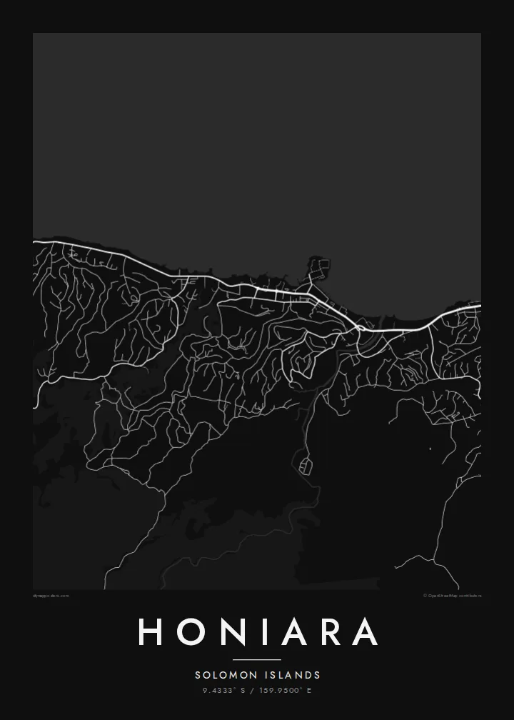
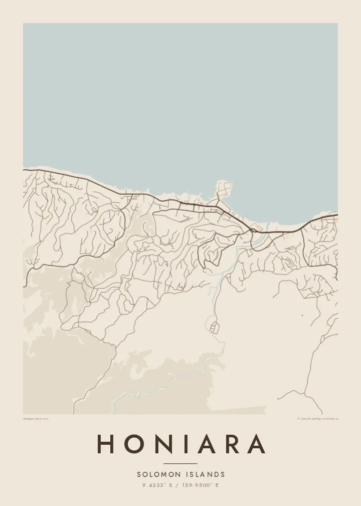
Honiara lies on the northern coast of Guadalcanal in the Solomon Islands, facing the stretch of water known as Iron Bottom Sound. Its map is strongly linear. The town follows the shoreline for several kilometres, with the main coastal road acting as a spine and neighbourhoods reaching up into the valleys and onto the ridges that rise quickly behind the coast.
Near the centre, the small projection of Point Cruz marks the port area, while the Mataniko River cuts through the town from the hills to the sea, dividing the map into clear sections. Inland, residential roads twist along ridgelines and around gullies. They give the southern edge of the drawing a branching, tree-like pattern that contrasts with the straight coastal strip.
Honiara grew from the base Allied forces built during the Guadalcanal campaign of the Second World War, and it replaced Tulagi as the capital after the war. The sound in front of it takes its name from the many ships sunk there in 1942 and 1943. A Honiara map poster shows a town defined by one long coastline and the hills that press against it.
A small point projecting into the sea near the town centre and home to the port. It gives the otherwise straight coastline a single, distinctive notch.
The river flows down from the hills and through the town to the coast. It is drawn as a winding line that splits Honiara into eastern and western halves.
Behind the coast, roads climb and branch along steep ridges and valleys, creating finger-like shapes that spread into the hills above the town.
Fè l pou ou
Ajoute yon dat, yon non oswa pwòp fraz pa w, chanje estil, gwosè oswa oryantasyon.
Apèsi gratis la se nan rezolisyon ba avèk yon watèrmak. Enpresyon ak fichye HD yo jenere nan 300 DPI, jiska 7,200 × 10,800 px, san watèrmak.
Poukisa Honiara
Honiara is home to Solomon Islanders from many provinces and a temporary base for volunteers, aid workers and people tracing wartime history. A map of the town brings together sea, river and ridges in a composition that feels both specific and understated.
Give it a personal title and a subtitle with a date, a name or a province, and adjust the coordinates if you wish. Choose one of five styles, then download the HD files in six sizes or order a framed print.
Kòmande afich Honiara a| Gwosè enpresyon | Rezolisyon | Fichye |
|---|---|---|
| 30 × 40 cm (11.8 × 15.7″) | 3,543 × 4,724 px | PNG · PDF |
| 29.7 × 42 cm (A3, 11.7 × 16.5″) | 3,508 × 4,961 px | PNG · PDF |
| 42 × 59.4 cm (A2, 16.5 × 23.4″) | 4,961 × 7,016 px | PNG · PDF |
| 45.7 × 61 cm (18 × 24″) | 5,400 × 7,200 px | PNG · PDF |
| 50 × 70 cm (19.7 × 27.6″) | 5,906 × 8,268 px | PNG · PDF |
| 61 × 91.4 cm (24 × 36″) | 7,200 × 10,800 px | PNG · PDF |
Pou konpare, apèsi gratis la gen 900 px lajè, li gen filigràn epi li fèt pou ekran. Fichye HD yo gen jiska 8 fwa plis rezolisyon nan chak direksyon epi yo enprime pwòp nan gwosè postè konplè.
Chwazi yon style anlè paj la, epi chwazi Afich Enprime — yon gwosè epi, si w vle, yon kad — oswa Fichye Dijital HD. Peman an fèt nan yon sèl etap, epi paj kòmand ou a mete ajou kou peman an konfime.
Li enprime sou papye mat premium 200 gsm nan youn nan sis gwosè, soti nan 30 × 40 cm rive nan 24 × 36″. Afich enprime yo kòmanse nan $39, livrezon enkli.
Wi. Chwazi yon kad an bwa solid nan koulè nwa, blan, chenn natirèl oswa bwa fonse. Li vin ak yon vit ki pa kase epi li pare pou pandye. Afich ankadre yo kòmanse nan $99, livrezon enkli.
Livrezon an gratis nan tout mond lan. Se pi pwòch nan patnè enprimri nou yo nan plis pase 30 peyi ki enprime chak afich la, epi li anjeneral rive nan 3–7 jou ouvrab. Ou ka swiv estati ak swivi kolis la nan Kòmand mwen yo. Gen kèk peyi ki pran 2–5 semèn, e kote nou poko livre a, sit la di w anvan ou peye.
Voye nou yon foto nan 14 jou apre livrezon an epi nou ap reenprime li gratis oswa remèt ou lajan w.
Wi. Nan editè a sou paj sa a, chanje tit la, soutit la ak liy kowòdone yo pou nenpòt sa w vle, epi chwazi yon style ak yon gwosè. Kòmand enprime, ankadre ak dijital yo tout itilize egzakteman desen w lan.
Pou $9 ou jwenn fichye PNG 300 DPI ak PDF pare-pou-enprime nan tout sis gwosè yo, san watèrmak, pou enprime kote w vle. Pa sèten toujou? Telechaje yon apèsi gratis ak watèrmak anvan.
