Irrigation ponds
Dozens of small reservoirs sit among the northern neighbourhoods. They are old farming ponds of the Senshu plain and read as quiet, solid shapes inside the street pattern.
Postè kat minimalis · Japan
34.4833° N / 135.4333° E
A long inland city climbing from the flat Senshu plain toward the wooded Izumi Mountains on the Wakayama border


Yon vil, senk atmosfè
Peze yon style pou wè li sou mi a. Chak style koute menm pri — enprime, ankadre oswa kòm fichye HD.
 Piksèl reyèl · fichye enpresyon 24 × 36″
Byen klè pou enprime
Sa a se yon zoom 100% sou vrè fichye enpresyon an. Chak afich — enprime, ankadre oswa telechaje — jenere sou sèvè nou yo nan 300 DPI, jiska 7,200 × 10,800 piksèl, konsa menm pi piti wout yo rete klè sou yon enpresyon 24 × 36″.
Sou mi a


Kat la
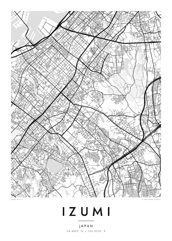
Izumi stretches across southern Osaka Prefecture in the Senshu area, between Sakai and Kishiwada. It is an inland city, so on a map it runs from the flat plain toward the hills instead of along the bay. The northern districts carry the dense street network of the Osaka suburbs. Further south the lines loosen into valleys, terraced slopes and the forested ridges of the Izumi Mountains, which mark the prefectural border.
Rail shapes the city. The JR Hanwa Line crosses the older western districts, and the Semboku Rapid Railway ends at Izumi-Chūō, near the newer planned housing areas. Across the plain, small irrigation ponds are scattered between neighbourhoods. These reservoirs are typical of the Senshu landscape and appear on the map as neat, rounded shapes set among the streets.
An Izumi map poster covers more than a commuter suburb. The Ikegami-Sone site, one of the best-known Yayoi-period settlements in Japan, lies partly within the city. High in the southern hills stands Sefuku-ji on Mount Makinoo, a stop on the Saigoku Kannon pilgrimage. The Kubosō Memorial Museum of Arts is here too, known for its collection of East Asian art.
Dozens of small reservoirs sit among the northern neighbourhoods. They are old farming ponds of the Senshu plain and read as quiet, solid shapes inside the street pattern.
The Semboku Rapid Railway ends at Izumi-Chūō. Around it, the curving roads and larger blocks of planned residential districts contrast with the older grid to the west.
South of the city, roads narrow into valleys that climb toward the Izumi Mountains. The map opens into wide wooded ground on the way up to Mount Makinoo.
Fè l pou ou
Ajoute yon dat, yon non oswa pwòp fraz pa w, chanje estil, gwosè oswa oryantasyon.
Apèsi gratis la se nan rezolisyon ba avèk yon watèrmak. Enpresyon ak fichye HD yo jenere nan 300 DPI, jiska 7,200 × 10,800 px, san watèrmak.
Poukisa Izumi
Izumi suits anyone with ties to southern Osaka: a childhood home near the ponds, a daily train from Izumi-Chūō, or a pilgrimage walk up to Makinoo. From above, the city runs from plain to mountain in one long line, which gives the poster a clear direction.
You can edit the title, subtitle and coordinates line to add a street name, a moving-in date or a family name. Then choose one of five styles: Classic black & white, Noir, Paper, Blueprint or Sand.
Kòmande afich Izumi a| Gwosè enpresyon | Rezolisyon | Fichye |
|---|---|---|
| 30 × 40 cm11.8 × 15.7″ | 3,543 × 4,724 px | PNG · PDF |
| 29.7 × 42 cm (A3)11.7 × 16.5″ | 3,508 × 4,961 px | PNG · PDF |
| 42 × 59.4 cm (A2)16.5 × 23.4″ | 4,961 × 7,016 px | PNG · PDF |
| 45.7 × 61 cm18 × 24″ | 5,400 × 7,200 px | PNG · PDF |
| 50 × 70 cm19.7 × 27.6″ | 5,906 × 8,268 px | PNG · PDF |
| 61 × 91.4 cm24 × 36″ | 7,200 × 10,800 px | PNG · PDF |
Pou konpare, apèsi gratis la gen 900 px lajè, li gen filigràn epi li fèt pou ekran. Fichye HD yo gen jiska 8 fwa plis rezolisyon nan chak direksyon epi yo enprime pwòp nan gwosè postè konplè.
Chwazi yon style anlè paj la, epi chwazi Afich Enprime — yon gwosè epi, si w vle, yon kad — oswa Fichye Dijital HD. Peman an fèt nan yon sèl etap, epi paj kòmand ou a mete ajou kou peman an konfime.
Li enprime sou papye mat premium 200 gsm nan youn nan sis gwosè, soti nan 30 × 40 cm rive nan 24 × 36″. Afich enprime yo kòmanse nan $39, livrezon enkli.
Wi. Chwazi yon kad an bwa solid nan koulè nwa, blan, chenn natirèl oswa bwa fonse. Li vin ak yon vit ki pa kase epi li pare pou pandye. Afich ankadre yo kòmanse nan $99, livrezon enkli.
Livrezon gratis nan plis pase 60 peyi. Chak afich enprime pa patnè enprimeri ki pi pre w la nan plis pase 30 peyi, e anjeneral li rive nan 3 a 7 jou ouvrab. Ou ka suiv estati a ak swivi kolis la nan Kòmand mwen yo. Kèk peyi pran 2 a 5 semèn, e kote nou poko livre, sit la di w sa anvan w peye.
Voye nou yon foto nan 14 jou apre livrezon an epi nou ap reenprime li gratis oswa remèt ou lajan w.
Wi. Nan editè a sou paj sa a, chanje tit la, soutit la ak liy kowòdone yo pou nenpòt sa w vle, epi chwazi yon style ak yon gwosè. Kòmand enprime, ankadre ak dijital yo tout itilize egzakteman desen w lan.
Pou $9 ou jwenn fichye PNG 300 DPI ak PDF pare-pou-enprime nan tout sis gwosè yo, san watèrmak, pou enprime kote w vle. Pa sèten toujou? Telechaje yon apèsi gratis ak watèrmak anvan.
