Port Island
A large artificial island south of the city centre, laid out in regular blocks and linked by bridge. Its straight edges contrast with the natural shoreline.
Postè kat minimalis · Japan
34.6913° N / 135.1830° E
A slim port city pressed between the Rokkō mountains and Osaka Bay, with two artificial islands offshore.


Yon vil, senk atmosfè
Peze yon style pou wè li sou mi a. Chak style koute menm pri — enprime, ankadre oswa kòm fichye HD.
 Piksèl reyèl · fichye enpresyon 24 × 36″
Byen klè pou enprime
Sa a se yon zoom 100% sou vrè fichye enpresyon an. Chak afich — enprime, ankadre oswa telechaje — jenere sou sèvè nou yo nan 300 DPI, jiska 7,200 × 10,800 piksèl, konsa menm pi piti wout yo rete klè sou yon enpresyon 24 × 36″.
Sou mi a


Kat la
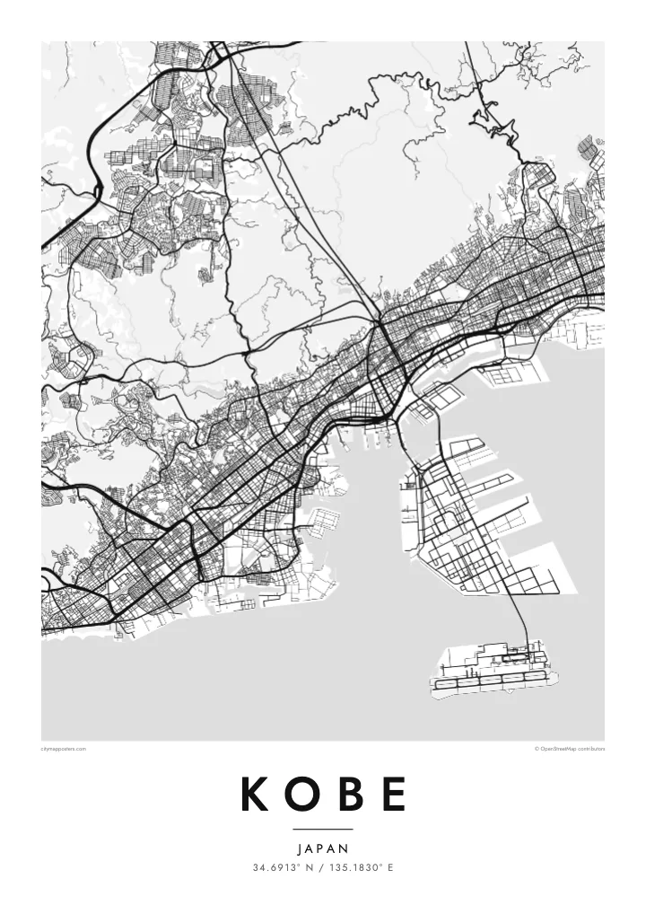
Kobe is a city of limited width. The Rokkō range rises steeply just behind the centre, so the streets are squeezed into a long band along the shore of Osaka Bay. Railway lines, expressways and main roads all run parallel to the water, while shorter streets climb north toward the slopes, giving the map a clear east–west grain.
The port has long been central to the city's identity. Port Island and Rokkō Island, two large reclaimed islands, extend into the bay as rectangular shapes connected by bridges. Much of the city was rebuilt after the 1995 Great Hanshin earthquake, and on its western edge the Akashi Kaikyō Bridge links Kobe to Awaji Island across the strait.
A Kobe map poster captures a rare composition: dense blocks along a strip of coast, the mountains as a quiet empty space above, and the crisp geometry of the islands below. The Kitano district, with its old foreign merchants' houses, and the harbour at Meriken Park sit within easy reach of one another, all on one sheet.
A large artificial island south of the city centre, laid out in regular blocks and linked by bridge. Its straight edges contrast with the natural shoreline.
The mountain range behind the city, where streets thin out and give way to wooded hills. On the poster it forms a calm upper border.
At the western end of the city, this suspension bridge spans the strait to Awaji Island and adds a slender line of connection across the water.
Fè l pou ou
Ajoute yon dat, yon non oswa pwòp fraz pa w, chanje estil, gwosè oswa oryantasyon.
Apèsi gratis la se nan rezolisyon ba avèk yon watèrmak. Enpresyon ak fichye HD yo jenere nan 300 DPI, jiska 7,200 × 10,800 px, san watèrmak.
Poukisa Kobe
Kobe is a city people remember by its slopes and its harbour, whether they grew up there, studied there or arrived by ship. Its narrow shape makes it especially readable as a poster, and it holds up well in both large and small formats.
Add a personal title and subtitle, keep or adjust the coordinates line, and pick from five styles; Noir makes the islands and coastline stand out sharply. Buy the digital files for $9 with no watermark, or order a matte print, framed if you like.
Kòmande afich Kobe a| Gwosè enpresyon | Rezolisyon | Fichye |
|---|---|---|
| 30 × 40 cm (11.8 × 15.7″) | 3,543 × 4,724 px | PNG · PDF |
| 29.7 × 42 cm (A3, 11.7 × 16.5″) | 3,508 × 4,961 px | PNG · PDF |
| 42 × 59.4 cm (A2, 16.5 × 23.4″) | 4,961 × 7,016 px | PNG · PDF |
| 45.7 × 61 cm (18 × 24″) | 5,400 × 7,200 px | PNG · PDF |
| 50 × 70 cm (19.7 × 27.6″) | 5,906 × 8,268 px | PNG · PDF |
| 61 × 91.4 cm (24 × 36″) | 7,200 × 10,800 px | PNG · PDF |
Pou konpare, apèsi gratis la gen 900 px lajè, li gen filigràn epi li fèt pou ekran. Fichye HD yo gen jiska 8 fwa plis rezolisyon nan chak direksyon epi yo enprime pwòp nan gwosè postè konplè.
Chwazi yon style anlè paj la, epi chwazi Afich Enprime — yon gwosè epi, si w vle, yon kad — oswa Fichye Dijital HD. Peman an fèt nan yon sèl etap, epi paj kòmand ou a mete ajou kou peman an konfime.
Li enprime sou papye mat premium 200 gsm nan youn nan sis gwosè, soti nan 30 × 40 cm rive nan 24 × 36″. Afich enprime yo kòmanse nan {printFrom}, livrezon enkli.
Wi. Chwazi yon kad an bwa solid nan koulè nwa, blan, chenn natirèl oswa bwa fonse. Li vin ak yon vit ki pa kase epi li pare pou pandye. Afich ankadre yo kòmanse nan {framedFrom}, livrezon enkli.
Livrezon gratis toupatou nan mond lan. Chak afich enprime nan patnè enpresyon ki pi pre nan plis pase 30 peyi, e li rive jeneralman nan 3–7 jou ouvrab. Ou ka swiv estati ak suivi anba My Orders.
Voye nou yon foto nan 14 jou apre livrezon an epi nou ap reenprime li gratis oswa remèt ou lajan w.
Wi. Nan editè a sou paj sa a, chanje tit la, soutit la ak liy kowòdone yo pou nenpòt sa w vle, epi chwazi yon style ak yon gwosè. Kòmand enprime, ankadre ak dijital yo tout itilize egzakteman desen w lan.
Pou $9 ou jwenn fichye PNG 300 DPI ak PDF pare-pou-enprime nan tout sis gwosè yo, san watèrmak, pou enprime kote w vle. Pa sèten toujou? Telechaje yon apèsi gratis ak watèrmak anvan.
