Patuxent River edge
The river runs along the northern side of the old town, where the mill once stood, drawing a soft natural line against the regular streets.
Postè kat minimalis · United States
39.0993° N / 76.8483° W
A former mill town on the Patuxent River, set between Baltimore and Washington along old and new corridors.


Yon vil, senk atmosfè
Peze yon style pou wè li sou mi a. Chak style koute menm pri — enprime, ankadre oswa kòm fichye HD.
 Piksèl reyèl · fichye enpresyon 24 × 36″
Byen klè pou enprime
Sa a se yon zoom 100% sou vrè fichye enpresyon an. Chak afich — enprime, ankadre oswa telechaje — jenere sou sèvè nou yo nan 300 DPI, jiska 7,200 × 10,800 piksèl, konsa menm pi piti wout yo rete klè sou yon enpresyon 24 × 36″.
Sou mi a


Kat la
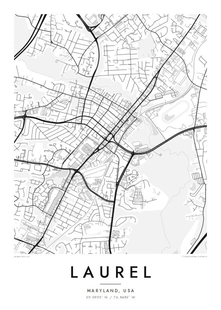
Laurel sits on the Patuxent River in Maryland, roughly midway between Baltimore and Washington. The city grew in the nineteenth century around a cotton mill powered by the river, and its historic Main Street still runs down toward the water. On a map, the river forms a clear boundary to the north, with the older grid of the centre sitting just above later suburban growth.
Route 1 and the railway line connect Laurel to both larger cities, and the city has expanded along those routes. Laurel Park, a thoroughbred racetrack, lies near the town, and the Patuxent Research Refuge, a large area of protected forest and wetland, occupies land to the east, adding broad natural areas to the regional map.
A Laurel map poster shows that mix of older and newer layers: the compact Main Street grid, the curve of the Patuxent, the straight rail line and the suburban streets that grew around them. It is a composition with clear structure, well suited to a minimalist print.
The river runs along the northern side of the old town, where the mill once stood, drawing a soft natural line against the regular streets.
Historic Main Street and the railway line form the backbone of the centre, linking the city's mill-town origins with its role as a commuter town.
The Patuxent Research Refuge and nearby parkland create large calm areas on the map, contrasting with the dense neighbourhoods around the centre.
Fè l pou ou
Ajoute yon dat, yon non oswa pwòp fraz pa w, chanje estil, gwosè oswa oryantasyon.
Apèsi gratis la se nan rezolisyon ba avèk yon watèrmak. Enpresyon ak fichye HD yo jenere nan 300 DPI, jiska 7,200 × 10,800 px, san watèrmak.
Poukisa Laurel
Laurel suits people who have lived between Baltimore and Washington and found a home here, or who remember Main Street from childhood. The map records a real sense of place in a region often seen only from the highway.
Personalise the title, subtitle and coordinates line with a date or a name, and choose from five styles. Paper suits the mill-town history, while Noir gives the river and rail lines a strong graphic contrast.
Kòmande afich Laurel a| Gwosè enpresyon | Rezolisyon | Fichye |
|---|---|---|
| 30 × 40 cm11.8 × 15.7″ | 3,543 × 4,724 px | PNG · PDF |
| 29.7 × 42 cm (A3)11.7 × 16.5″ | 3,508 × 4,961 px | PNG · PDF |
| 42 × 59.4 cm (A2)16.5 × 23.4″ | 4,961 × 7,016 px | PNG · PDF |
| 45.7 × 61 cm18 × 24″ | 5,400 × 7,200 px | PNG · PDF |
| 50 × 70 cm19.7 × 27.6″ | 5,906 × 8,268 px | PNG · PDF |
| 61 × 91.4 cm24 × 36″ | 7,200 × 10,800 px | PNG · PDF |
Pou konpare, apèsi gratis la gen 900 px lajè, li gen filigràn epi li fèt pou ekran. Fichye HD yo gen jiska 8 fwa plis rezolisyon nan chak direksyon epi yo enprime pwòp nan gwosè postè konplè.
Chwazi yon style anlè paj la, epi chwazi Afich Enprime — yon gwosè epi, si w vle, yon kad — oswa Fichye Dijital HD. Peman an fèt nan yon sèl etap, epi paj kòmand ou a mete ajou kou peman an konfime.
Li enprime sou papye mat premium 200 gsm nan youn nan sis gwosè, soti nan 30 × 40 cm rive nan 24 × 36″. Afich enprime yo kòmanse nan $39, livrezon enkli.
Wi. Chwazi yon kad an bwa solid nan koulè nwa, blan, chenn natirèl oswa bwa fonse. Li vin ak yon vit ki pa kase epi li pare pou pandye. Afich ankadre yo kòmanse nan $99, livrezon enkli.
Livrezon gratis nan plis pase 60 peyi. Chak afich enprime pa patnè enprimeri ki pi pre w la nan plis pase 30 peyi, e anjeneral li rive nan 3 a 7 jou ouvrab. Ou ka suiv estati a ak swivi kolis la nan Kòmand mwen yo. Kèk peyi pran 2 a 5 semèn, e kote nou poko livre, sit la di w sa anvan w peye.
Voye nou yon foto nan 14 jou apre livrezon an epi nou ap reenprime li gratis oswa remèt ou lajan w.
Wi. Nan editè a sou paj sa a, chanje tit la, soutit la ak liy kowòdone yo pou nenpòt sa w vle, epi chwazi yon style ak yon gwosè. Kòmand enprime, ankadre ak dijital yo tout itilize egzakteman desen w lan.
Pou $9 ou jwenn fichye PNG 300 DPI ak PDF pare-pou-enprime nan tout sis gwosè yo, san watèrmak, pou enprime kote w vle. Pa sèten toujou? Telechaje yon apèsi gratis ak watèrmak anvan.
Toupre
