The ferry crossing
The short ferry route between Lévis and Quebec City crosses one of the narrowest parts of the St. Lawrence, linking the two cities facing each other.
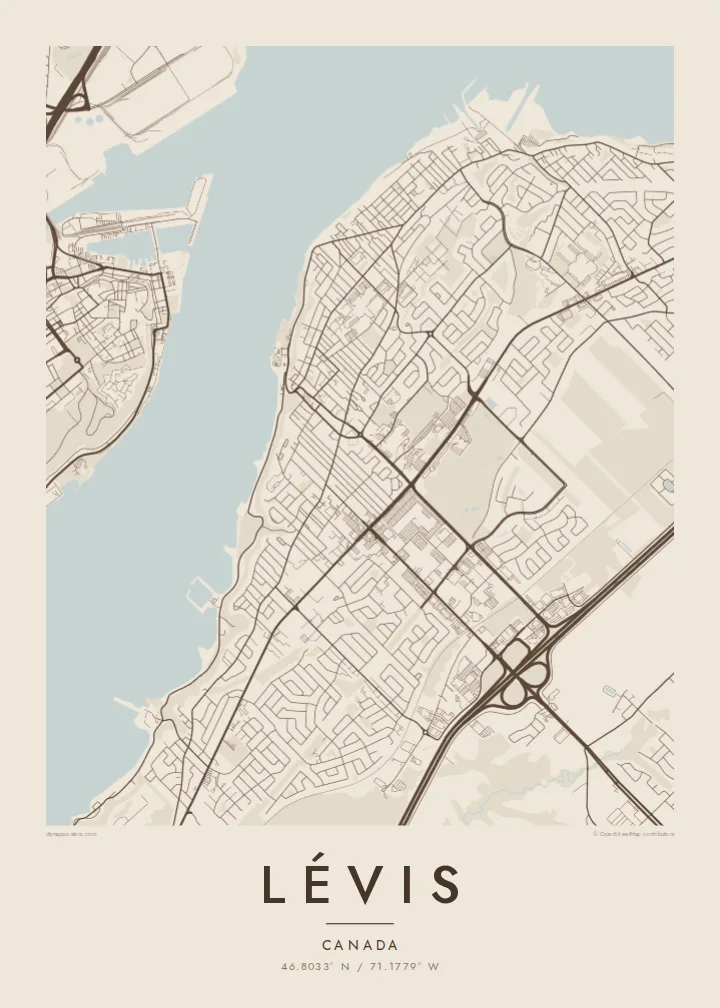
Postè kat minimalis · Canada
46.8033° N / 71.1779° W
A long shoreline city along the south bank of the St. Lawrence, facing the cliffs and old walls of Quebec City


Yon vil, senk atmosfè
Peze yon style pou wè li sou mi a. Chak style koute menm pri — enprime, ankadre oswa kòm fichye HD.
 Piksèl reyèl · fichye enpresyon 24 × 36″
Byen klè pou enprime
Sa a se yon zoom 100% sou vrè fichye enpresyon an. Chak afich — enprime, ankadre oswa telechaje — jenere sou sèvè nou yo nan 300 DPI, jiska 7,200 × 10,800 piksèl, konsa menm pi piti wout yo rete klè sou yon enpresyon 24 × 36″.
Sou mi a


Kat la
Lévis stretches along the south shore of the St. Lawrence River, directly across from Quebec City. On a map, the city is long and narrow in its older parts, following the river for many kilometres. A steep escarpment separates the lower waterfront from the upper town, and later neighbourhoods have spread inland across the plateau.
A ferry has linked Lévis to Quebec City for generations, and the crossing is a short trip across a narrow reach of the river. At the western end, the Quebec Bridge and the Pierre Laporte Bridge span the St. Lawrence close together. Lévis is also where Alphonse Desjardins founded the first caisse populaire in 1900, the origin of the Desjardins cooperative movement.
A Lévis map poster draws the south bank as a strong line of streets facing the wide river. The Chaudière River reaches the St. Lawrence to the west, and the two bridges add clean strokes across the water. If the frame is slightly wider, the old city of Quebec appears on the opposite shore.
The short ferry route between Lévis and Quebec City crosses one of the narrowest parts of the St. Lawrence, linking the two cities facing each other.
The Quebec Bridge and the Pierre Laporte Bridge cross the river side by side at the western end of the city, forming two parallel lines over the water.
A cliff separates the narrow riverside strip from the upper town, and roads climb it on steep curving routes that stand out against the grid above.
Fè l pou ou
Ajoute yon dat, yon non oswa pwòp fraz pa w, chanje estil, gwosè oswa oryantasyon.
Apèsi gratis la se nan rezolisyon ba avèk yon watèrmak. Enpresyon ak fichye HD yo jenere nan 300 DPI, jiska 7,200 × 10,800 px, san watèrmak.
Poukisa Lévis
Lévis is often seen as the view of Quebec City, but for people who live there it is a city with its own identity. A map that puts its shoreline first gives the south bank the attention it deserves.
You can change the title, the subtitle and the coordinates line, in English or French. Five styles are available: Classic black and white, Noir, Paper, Blueprint and Sand. Noir makes the river an especially deep, dramatic band.
Kòmande afich Lévis a| Gwosè enpresyon | Rezolisyon | Fichye |
|---|---|---|
| 30 × 40 cm (11.8 × 15.7″) | 3,543 × 4,724 px | PNG · PDF |
| 29.7 × 42 cm (A3, 11.7 × 16.5″) | 3,508 × 4,961 px | PNG · PDF |
| 42 × 59.4 cm (A2, 16.5 × 23.4″) | 4,961 × 7,016 px | PNG · PDF |
| 45.7 × 61 cm (18 × 24″) | 5,400 × 7,200 px | PNG · PDF |
| 50 × 70 cm (19.7 × 27.6″) | 5,906 × 8,268 px | PNG · PDF |
| 61 × 91.4 cm (24 × 36″) | 7,200 × 10,800 px | PNG · PDF |
Pou konpare, apèsi gratis la gen 900 px lajè, li gen filigràn epi li fèt pou ekran. Fichye HD yo gen jiska 8 fwa plis rezolisyon nan chak direksyon epi yo enprime pwòp nan gwosè postè konplè.
Chwazi yon style anlè paj la, epi chwazi Afich Enprime — yon gwosè epi, si w vle, yon kad — oswa Fichye Dijital HD. Peman an fèt nan yon sèl etap, epi paj kòmand ou a mete ajou kou peman an konfime.
Li enprime sou papye mat premium 200 gsm nan youn nan sis gwosè, soti nan 30 × 40 cm rive nan 24 × 36″. Afich enprime yo kòmanse nan {printFrom}, livrezon enkli.
Wi. Chwazi yon kad an bwa solid nan koulè nwa, blan, chenn natirèl oswa bwa fonse. Li vin ak yon vit ki pa kase epi li pare pou pandye. Afich ankadre yo kòmanse nan {framedFrom}, livrezon enkli.
Livrezon gratis toupatou nan mond lan. Chak afich enprime nan patnè enpresyon ki pi pre nan plis pase 30 peyi, e li rive jeneralman nan 3–7 jou ouvrab. Ou ka swiv estati ak suivi anba My Orders.
Voye nou yon foto nan 14 jou apre livrezon an epi nou ap reenprime li gratis oswa remèt ou lajan w.
Wi. Nan editè a sou paj sa a, chanje tit la, soutit la ak liy kowòdone yo pou nenpòt sa w vle, epi chwazi yon style ak yon gwosè. Kòmand enprime, ankadre ak dijital yo tout itilize egzakteman desen w lan.
Pou $9 ou jwenn fichye PNG 300 DPI ak PDF pare-pou-enprime nan tout sis gwosè yo, san watèrmak, pou enprime kote w vle. Pa sèten toujou? Telechaje yon apèsi gratis ak watèrmak anvan.
Toupre
