Radiating regional roads
Several routes meet at Malamulele and head off toward neighbouring villages and towns. On the poster they form a clear star pattern that anchors the whole design.
Postè kat minimalis · South Africa
22.9711° S / 30.6736° E
A spread-out Limpopo town whose roads fan out across the bushveld toward surrounding villages and the edge of Kruger country.

Yon vil, senk atmosfè
Peze yon style pou wè li sou mi a. Chak style koute menm pri — enprime, ankadre oswa kòm fichye HD.
 Piksèl reyèl · fichye enpresyon 24 × 36″
Byen klè pou enprime
Sa a se yon zoom 100% sou vrè fichye enpresyon an. Chak afich — enprime, ankadre oswa telechaje — jenere sou sèvè nou yo nan 300 DPI, jiska 7,200 × 10,800 piksèl, konsa menm pi piti wout yo rete klè sou yon enpresyon 24 × 36″.
Sou mi a


Kat la
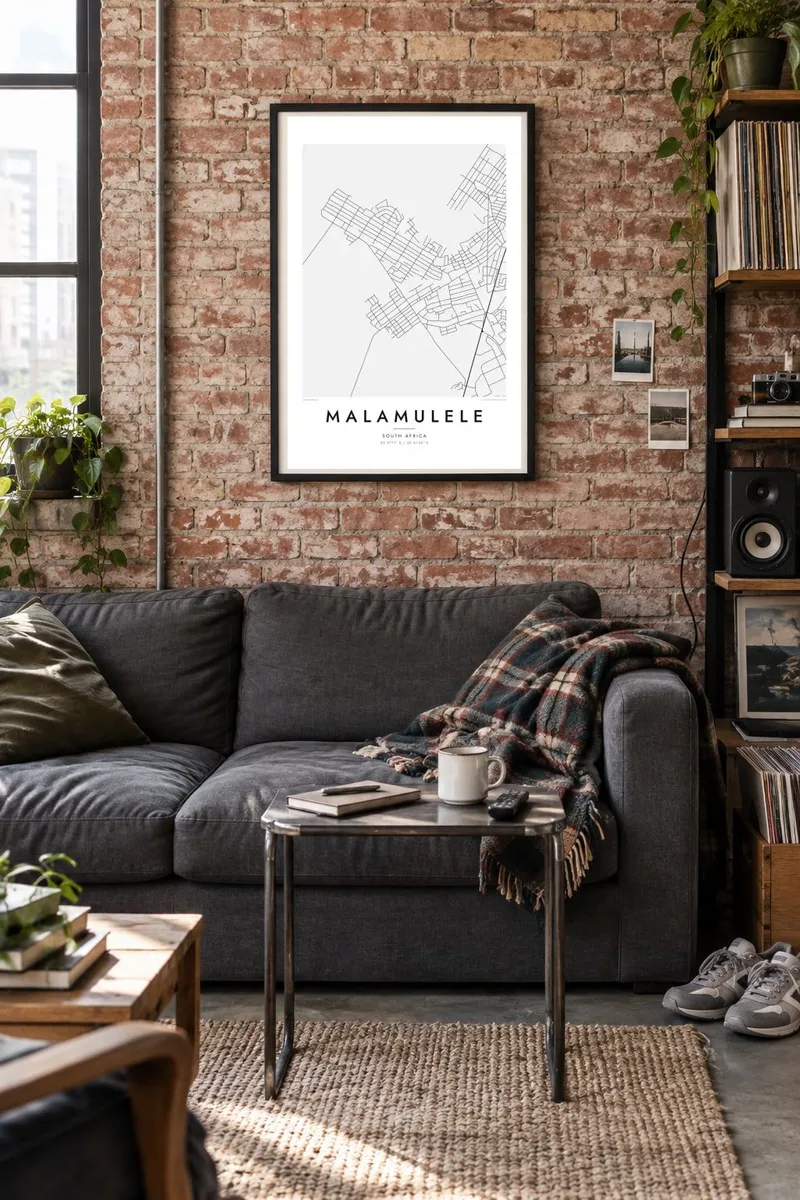
Malamulele lies in the far north-east of South Africa's Limpopo province, in lowveld country not far from the western boundary of Kruger National Park. From above it looks nothing like a tight grid. It is a loose, wide settlement where a central commercial area gives way to residential sections and then to villages scattered along the roads that cross the bushveld.
The town is a centre for the Xitsonga-speaking communities of the area. It is known for the local campaign that led to a municipality of its own: in 2016 it became part of the newly formed Collins Chabane Local Municipality. That civic role shows on the map in the roads, which lead to Malamulele from many directions.
A Malamulele map poster shows how that pattern holds together. Clusters of small plots, winding local roads and long regional routes fill the frame with fine texture. Dry riverbeds and open veld add gentle breaks between them. The result is a map of a place that grows outward rather than upward, and it still reads clearly from a distance.
Several routes meet at Malamulele and head off toward neighbouring villages and towns. On the poster they form a clear star pattern that anchors the whole design.
Around the centre, residential sections and nearby villages appear as patches of small plots and lanes. They spread the detail widely across the frame instead of packing it into one core.
Stretches of bush and farmland lie between the settlements and turn into calm white space. That space sets off the finer lines of the streets.
Fè l pou ou
Ajoute yon dat, yon non oswa pwòp fraz pa w, chanje estil, gwosè oswa oryantasyon.
Apèsi gratis la se nan rezolisyon ba avèk yon watèrmak. Enpresyon ak fichye HD yo jenere nan 300 DPI, jiska 7,200 × 10,800 px, san watèrmak.
Poukisa Malamulele
The map suits anyone with roots in Malamulele or the villages around it, and anyone who has passed through on the way to the northern part of Kruger. It records a place defined by its connections, where each road leads to somebody's home.
The title, subtitle and coordinates line can be personalised with a village name, a family surname or an important date. There are five styles to choose from: Classic black & white, Noir, Paper, Blueprint and Sand. Warmer tones such as Sand suit the lowveld setting well.
Kòmande afich Malamulele a| Gwosè enpresyon | Rezolisyon | Fichye |
|---|---|---|
| 30 × 40 cm11.8 × 15.7″ | 3,543 × 4,724 px | PNG · PDF |
| 29.7 × 42 cm (A3)11.7 × 16.5″ | 3,508 × 4,961 px | PNG · PDF |
| 42 × 59.4 cm (A2)16.5 × 23.4″ | 4,961 × 7,016 px | PNG · PDF |
| 45.7 × 61 cm18 × 24″ | 5,400 × 7,200 px | PNG · PDF |
| 50 × 70 cm19.7 × 27.6″ | 5,906 × 8,268 px | PNG · PDF |
| 61 × 91.4 cm24 × 36″ | 7,200 × 10,800 px | PNG · PDF |
Pou konpare, apèsi gratis la gen 900 px lajè, li gen filigràn epi li fèt pou ekran. Fichye HD yo gen jiska 8 fwa plis rezolisyon nan chak direksyon epi yo enprime pwòp nan gwosè postè konplè.
Chwazi yon style anlè paj la, epi chwazi Afich Enprime — yon gwosè epi, si w vle, yon kad — oswa Fichye Dijital HD. Peman an fèt nan yon sèl etap, epi paj kòmand ou a mete ajou kou peman an konfime.
Li enprime sou papye mat premium 200 gsm nan youn nan sis gwosè, soti nan 30 × 40 cm rive nan 24 × 36″. Afich enprime yo kòmanse nan $39, livrezon enkli.
Wi. Chwazi yon kad an bwa solid nan koulè nwa, blan, chenn natirèl oswa bwa fonse. Li vin ak yon vit ki pa kase epi li pare pou pandye. Afich ankadre yo kòmanse nan $99, livrezon enkli.
Livrezon gratis nan plis pase 60 peyi. Chak afich enprime pa patnè enprimeri ki pi pre w la nan plis pase 30 peyi, e anjeneral li rive nan 3 a 7 jou ouvrab. Ou ka suiv estati a ak swivi kolis la nan Kòmand mwen yo. Kèk peyi pran 2 a 5 semèn, e kote nou poko livre, sit la di w sa anvan w peye.
Voye nou yon foto nan 14 jou apre livrezon an epi nou ap reenprime li gratis oswa remèt ou lajan w.
Wi. Nan editè a sou paj sa a, chanje tit la, soutit la ak liy kowòdone yo pou nenpòt sa w vle, epi chwazi yon style ak yon gwosè. Kòmand enprime, ankadre ak dijital yo tout itilize egzakteman desen w lan.
Pou $9 ou jwenn fichye PNG 300 DPI ak PDF pare-pou-enprime nan tout sis gwosè yo, san watèrmak, pou enprime kote w vle. Pa sèten toujou? Telechaje yon apèsi gratis ak watèrmak anvan.
