100-metre avenues
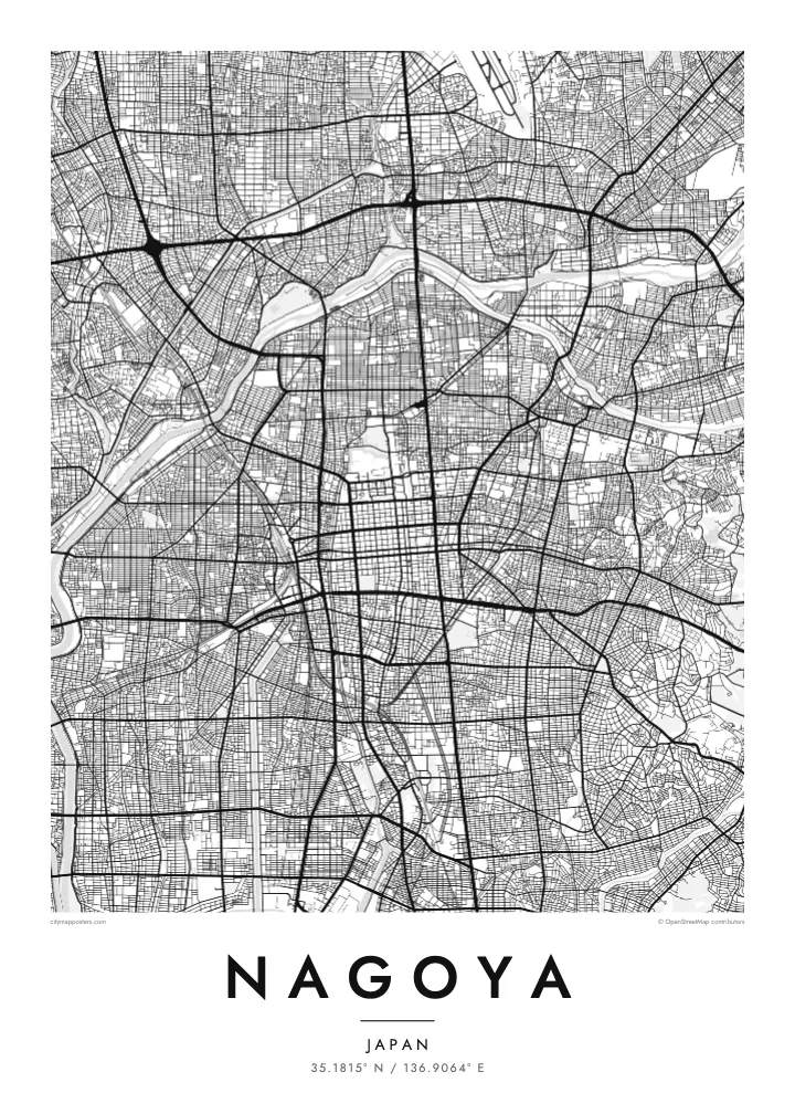
Hisaya-odori and Wakamiya-odori form a cross of unusually wide boulevards through the centre, lined with green space and clearly visible even at a small scale.
Postè kat minimalis · Japan
35.1815° N / 136.9064° E
A planned castle town grown into a vast grid, cut by wide boulevards and opening south onto Ise Bay.


Yon vil, senk atmosfè
Peze yon style pou wè li sou mi a. Chak style koute menm pri — enprime, ankadre oswa kòm fichye HD.
 Piksèl reyèl · fichye enpresyon 24 × 36″
Byen klè pou enprime
Sa a se yon zoom 100% sou vrè fichye enpresyon an. Chak afich — enprime, ankadre oswa telechaje — jenere sou sèvè nou yo nan 300 DPI, jiska 7,200 × 10,800 piksèl, konsa menm pi piti wout yo rete klè sou yon enpresyon 24 × 36″.
Sou mi a


Kat la
Nagoya was laid out in the early seventeenth century as a castle town under Tokugawa Ieyasu, and the order of that plan still shows. The centre is a clear grid of square blocks running south from Nagoya Castle, and the city has since extended the pattern across the flat Nobi Plain in every direction, filling the map with regular, closely spaced streets.
After wartime destruction, Nagoya was rebuilt with some of the widest avenues in Japan. Hisaya-odori and Wakamiya-odori, each about a hundred metres wide, cross the centre as broad bands with parks down the middle. The Hori River, dug to serve the castle, runs south to the port, and the Shonai River curves along the west before the city opens onto Ise Bay.
Nagoya is the capital of Aichi Prefecture and the centre of one of Japan's largest manufacturing regions, home to Toyota and much of the country's car industry. Atsuta Shrine, one of the most important Shinto sites in Japan, lies in the south of the city. A Nagoya map poster turns this ordered plan into a precise, graphic print.
Hisaya-odori and Wakamiya-odori form a cross of unusually wide boulevards through the centre, lined with green space and clearly visible even at a small scale.
The castle grounds and their moats sit at the northern edge of the centre, a large rectangular block where the historic grid begins.
A canal-like river dug in the early 1600s, it runs south from the castle area to the port, linking the old town with the bay.
Fè l pou ou
Ajoute yon dat, yon non oswa pwòp fraz pa w, chanje estil, gwosè oswa oryantasyon.
Apèsi gratis la se nan rezolisyon ba avèk yon watèrmak. Enpresyon ak fichye HD yo jenere nan 300 DPI, jiska 7,200 × 10,800 px, san watèrmak.
Poukisa Nagoya
Nagoya's orderly grid and broad avenues make a clean, architectural print, well suited to anyone who appreciates planning and structure. It also marks personal ties: a company posting in Aichi, a hometown, or a first apartment near Sakae or Osu.
Personalise the title, subtitle and coordinates, then choose from Classic black & white, Noir, Paper, Blueprint and Sand. Blueprint in particular suits the geometry of the city. Download HD files for $9 or order a matte print shipped from partners in more than 30 countries.
Kòmande afich Nagoya a| Gwosè enpresyon | Rezolisyon | Fichye |
|---|---|---|
| 30 × 40 cm (11.8 × 15.7″) | 3,543 × 4,724 px | PNG · PDF |
| 29.7 × 42 cm (A3, 11.7 × 16.5″) | 3,508 × 4,961 px | PNG · PDF |
| 42 × 59.4 cm (A2, 16.5 × 23.4″) | 4,961 × 7,016 px | PNG · PDF |
| 45.7 × 61 cm (18 × 24″) | 5,400 × 7,200 px | PNG · PDF |
| 50 × 70 cm (19.7 × 27.6″) | 5,906 × 8,268 px | PNG · PDF |
| 61 × 91.4 cm (24 × 36″) | 7,200 × 10,800 px | PNG · PDF |
Pou konpare, apèsi gratis la gen 900 px lajè, li gen filigràn epi li fèt pou ekran. Fichye HD yo gen jiska 8 fwa plis rezolisyon nan chak direksyon epi yo enprime pwòp nan gwosè postè konplè.
Chwazi yon style anlè paj la, epi chwazi Afich Enprime — yon gwosè epi, si w vle, yon kad — oswa Fichye Dijital HD. Peman an fèt nan yon sèl etap, epi paj kòmand ou a mete ajou kou peman an konfime.
Li enprime sou papye mat premium 200 gsm nan youn nan sis gwosè, soti nan 30 × 40 cm rive nan 24 × 36″. Afich enprime yo kòmanse nan $39, livrezon enkli.
Wi. Chwazi yon kad an bwa solid nan koulè nwa, blan, chenn natirèl oswa bwa fonse. Li vin ak yon vit ki pa kase epi li pare pou pandye. Afich ankadre yo kòmanse nan $99, livrezon enkli.
Livrezon an gratis nan tout mond lan. Se pi pwòch nan patnè enprimri nou yo nan plis pase 30 peyi ki enprime chak afich la, epi li anjeneral rive nan 3–7 jou ouvrab. Ou ka swiv estati ak swivi kolis la nan Kòmand mwen yo. Gen kèk peyi ki pran 2–5 semèn, e kote nou poko livre a, sit la di w anvan ou peye.
Voye nou yon foto nan 14 jou apre livrezon an epi nou ap reenprime li gratis oswa remèt ou lajan w.
Wi. Nan editè a sou paj sa a, chanje tit la, soutit la ak liy kowòdone yo pou nenpòt sa w vle, epi chwazi yon style ak yon gwosè. Kòmand enprime, ankadre ak dijital yo tout itilize egzakteman desen w lan.
Pou $9 ou jwenn fichye PNG 300 DPI ak PDF pare-pou-enprime nan tout sis gwosè yo, san watèrmak, pou enprime kote w vle. Pa sèten toujou? Telechaje yon apèsi gratis ak watèrmak anvan.
