Linear valley plan
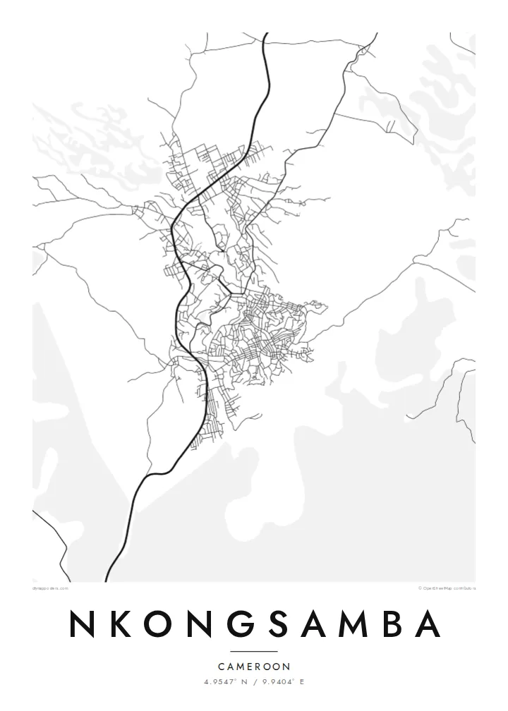
The town extends along its main road and valley, giving the map a long, stretched shape instead of a round centre.
Postè kat minimalis · Cameroon
4.9547° N / 9.9404° E
A highland town at the foot of Mount Manengouba, its streets climbing gently from a valley into green hills


Yon vil, senk atmosfè
Peze yon style pou wè li sou mi a. Chak style koute menm pri — enprime, ankadre oswa kòm fichye HD.
 Piksèl reyèl · fichye enpresyon 24 × 36″
Byen klè pou enprime
Sa a se yon zoom 100% sou vrè fichye enpresyon an. Chak afich — enprime, ankadre oswa telechaje — jenere sou sèvè nou yo nan 300 DPI, jiska 7,200 × 10,800 piksèl, konsa menm pi piti wout yo rete klè sou yon enpresyon 24 × 36″.
Sou mi a


Kat la
Nkongsamba lies in the uplands of Cameroon's Littoral region, north of Douala, near the base of Mount Manengouba. From above, the town stretches along the valley and main road, with streets branching up the slopes on either side. The surrounding terrain is hilly and heavily farmed, so the built area has soft, irregular edges rather than a clean outline.
The town grew as a centre for the coffee-growing country around it, and it was the northern terminus of a railway line built from Douala in the colonial era. That link to the coast helped make it one of the region's important market towns, a role shaped by the fertile volcanic soils of the area.
A Nkongsamba map poster reads as a town following its landscape. The main routes run along the valley, side streets rise in short branches, and the roads fade out into farmland toward the mountain. In black and white, the long, stretched form of the town becomes its signature: a line of streets drawn between hills.
The town extends along its main road and valley, giving the map a long, stretched shape instead of a round centre.
Mount Manengouba rises nearby, and the rising ground shapes where streets can go, leaving open spaces that hint at hills without any shading.
The line from Douala once ended here, and its route explains much of how the town grew along the valley toward the coast.
Fè l pou ou
Ajoute yon dat, yon non oswa pwòp fraz pa w, chanje estil, gwosè oswa oryantasyon.
Apèsi gratis la se nan rezolisyon ba avèk yon watèrmak. Enpresyon ak fichye HD yo jenere nan 300 DPI, jiska 7,200 × 10,800 px, san watèrmak.
Poukisa Nkongsamba
For people from Nkongsamba, or with family roots in the coffee country of the Littoral, a map of the town is a simple way to keep home in view. Its elongated shape makes a distinctive print that does not look like any other city.
You can personalise the title, subtitle and coordinates line, and choose among Classic black & white, Noir, Paper, Blueprint and Sand. Download the $9 HD files for your own printing, or order a matte poster shipped from a print partner near you.
Kòmande afich Nkongsamba a| Gwosè enpresyon | Rezolisyon | Fichye |
|---|---|---|
| 30 × 40 cm11.8 × 15.7″ | 3,543 × 4,724 px | PNG · PDF |
| 29.7 × 42 cm (A3)11.7 × 16.5″ | 3,508 × 4,961 px | PNG · PDF |
| 42 × 59.4 cm (A2)16.5 × 23.4″ | 4,961 × 7,016 px | PNG · PDF |
| 45.7 × 61 cm18 × 24″ | 5,400 × 7,200 px | PNG · PDF |
| 50 × 70 cm19.7 × 27.6″ | 5,906 × 8,268 px | PNG · PDF |
| 61 × 91.4 cm24 × 36″ | 7,200 × 10,800 px | PNG · PDF |
Pou konpare, apèsi gratis la gen 900 px lajè, li gen filigràn epi li fèt pou ekran. Fichye HD yo gen jiska 8 fwa plis rezolisyon nan chak direksyon epi yo enprime pwòp nan gwosè postè konplè.
Chwazi yon style anlè paj la, epi chwazi Afich Enprime — yon gwosè epi, si w vle, yon kad — oswa Fichye Dijital HD. Peman an fèt nan yon sèl etap, epi paj kòmand ou a mete ajou kou peman an konfime.
Li enprime sou papye mat premium 200 gsm nan youn nan sis gwosè, soti nan 30 × 40 cm rive nan 24 × 36″. Afich enprime yo kòmanse nan $39, livrezon enkli.
Wi. Chwazi yon kad an bwa solid nan koulè nwa, blan, chenn natirèl oswa bwa fonse. Li vin ak yon vit ki pa kase epi li pare pou pandye. Afich ankadre yo kòmanse nan $99, livrezon enkli.
Livrezon gratis nan plis pase 60 peyi. Chak afich enprime pa patnè enprimeri ki pi pre w la nan plis pase 30 peyi, e anjeneral li rive nan 3 a 7 jou ouvrab. Ou ka suiv estati a ak swivi kolis la nan Kòmand mwen yo. Kèk peyi pran 2 a 5 semèn, e kote nou poko livre, sit la di w sa anvan w peye.
Voye nou yon foto nan 14 jou apre livrezon an epi nou ap reenprime li gratis oswa remèt ou lajan w.
Wi. Nan editè a sou paj sa a, chanje tit la, soutit la ak liy kowòdone yo pou nenpòt sa w vle, epi chwazi yon style ak yon gwosè. Kòmand enprime, ankadre ak dijital yo tout itilize egzakteman desen w lan.
Pou $9 ou jwenn fichye PNG 300 DPI ak PDF pare-pou-enprime nan tout sis gwosè yo, san watèrmak, pou enprime kote w vle. Pa sèten toujou? Telechaje yon apèsi gratis ak watèrmak anvan.
