Stepped river terraces
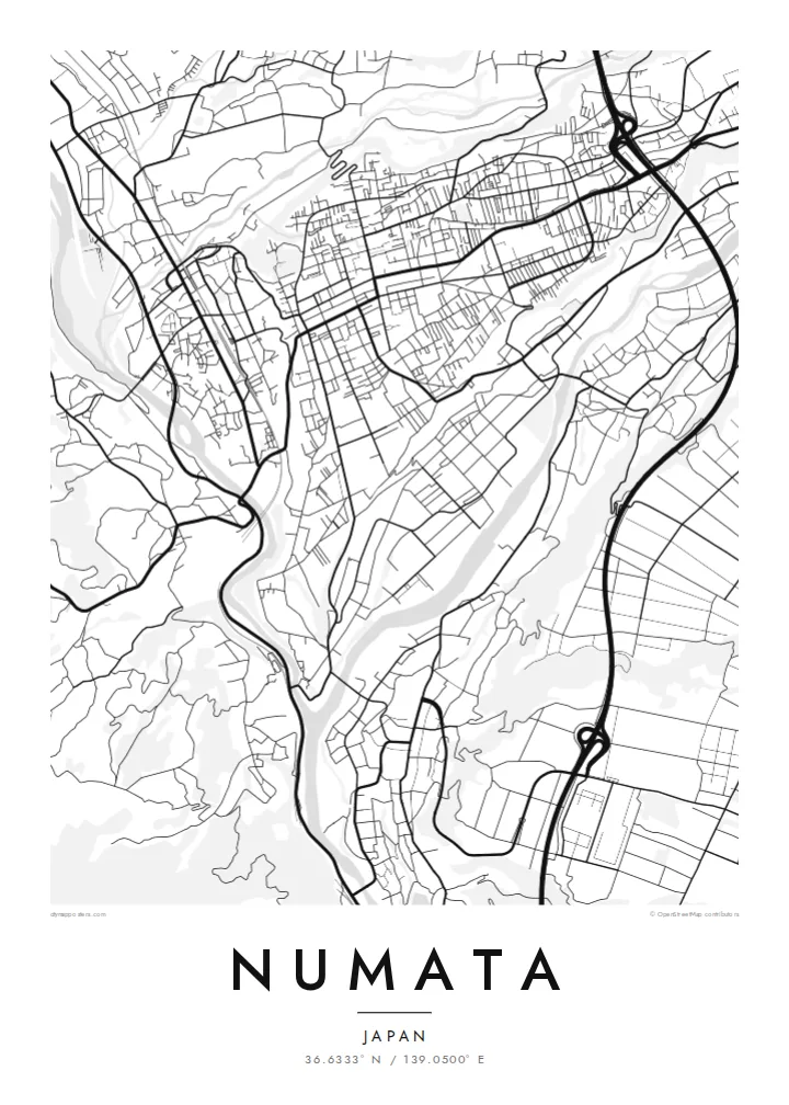
The centre sits on flat shelves cut by the Tone and Katashina rivers. On the map, the street grid stops sharply where the terraces fall toward the valleys.
Postè kat minimalis · Japan
36.6333° N / 139.0500° E
A town set on high river terraces above the Katashina and Tone rivers, with mountains closing in from every side


Yon vil, senk atmosfè
Peze yon style pou wè li sou mi a. Chak style koute menm pri — enprime, ankadre oswa kòm fichye HD.
 Piksèl reyèl · fichye enpresyon 24 × 36″
Byen klè pou enprime
Sa a se yon zoom 100% sou vrè fichye enpresyon an. Chak afich — enprime, ankadre oswa telechaje — jenere sou sèvè nou yo nan 300 DPI, jiska 7,200 × 10,800 piksèl, konsa menm pi piti wout yo rete klè sou yon enpresyon 24 × 36″.
Sou mi a


Kat la
Numata sits on a raised plateau in northern Gunma, and from above the reason is easy to see. The Tone and Katashina rivers have cut deep valleys around the town, leaving the centre on flat, stepped terraces. Streets spread across the top of this shelf, and the ground drops away at its edges toward the water.
These river terraces are among the best-known examples of the landform in Japan. They give the map a layered look, with the dense grid of the old castle town on the upper level and roads curving down the slopes to the river below. Beyond the valleys, forested mountains fill the rest of the frame.
Numata grew as a castle town under the Sanada clan, and the castle site is now a park at the edge of the terrace. The wider city reaches north into the mountains, where Fukiware Falls cuts through a rock gorge. A Numata map poster shows how closely the town follows the shape of its ground.
The centre sits on flat shelves cut by the Tone and Katashina rivers. On the map, the street grid stops sharply where the terraces fall toward the valleys.
The former Numata Castle site sits at the edge of the upper terrace, a green space looking out over the river valley and the older streets.
The Tone and Katashina meet near the town, and their valleys make two clear lines through the frame that the roads have to cross or follow.
Fè l pou ou
Ajoute yon dat, yon non oswa pwòp fraz pa w, chanje estil, gwosè oswa oryantasyon.
Apèsi gratis la se nan rezolisyon ba avèk yon watèrmak. Enpresyon ak fichye HD yo jenere nan 300 DPI, jiska 7,200 × 10,800 px, san watèrmak.
Poukisa Numata
Numata suits people who like a map with visible geology. The terraces and valleys turn a small town plan into something close to a relief study, and the pattern holds up in the quiet Paper or Sand styles as well as in Classic black and white.
You can change the title, add a subtitle such as a date or family name, and edit the coordinates line. The digital files cost $9 and cover six print sizes, or you can order a matte print, with a wooden frame if you like.
Kòmande afich Numata a| Gwosè enpresyon | Rezolisyon | Fichye |
|---|---|---|
| 30 × 40 cm (11.8 × 15.7″) | 3,543 × 4,724 px | PNG · PDF |
| 29.7 × 42 cm (A3, 11.7 × 16.5″) | 3,508 × 4,961 px | PNG · PDF |
| 42 × 59.4 cm (A2, 16.5 × 23.4″) | 4,961 × 7,016 px | PNG · PDF |
| 45.7 × 61 cm (18 × 24″) | 5,400 × 7,200 px | PNG · PDF |
| 50 × 70 cm (19.7 × 27.6″) | 5,906 × 8,268 px | PNG · PDF |
| 61 × 91.4 cm (24 × 36″) | 7,200 × 10,800 px | PNG · PDF |
Pou konpare, apèsi gratis la gen 900 px lajè, li gen filigràn epi li fèt pou ekran. Fichye HD yo gen jiska 8 fwa plis rezolisyon nan chak direksyon epi yo enprime pwòp nan gwosè postè konplè.
Chwazi yon style anlè paj la, epi chwazi Afich Enprime — yon gwosè epi, si w vle, yon kad — oswa Fichye Dijital HD. Peman an fèt nan yon sèl etap, epi paj kòmand ou a mete ajou kou peman an konfime.
Li enprime sou papye mat premium 200 gsm nan youn nan sis gwosè, soti nan 30 × 40 cm rive nan 24 × 36″. Afich enprime yo kòmanse nan {printFrom}, livrezon enkli.
Wi. Chwazi yon kad an bwa solid nan koulè nwa, blan, chenn natirèl oswa bwa fonse. Li vin ak yon vit ki pa kase epi li pare pou pandye. Afich ankadre yo kòmanse nan {framedFrom}, livrezon enkli.
Livrezon gratis toupatou nan mond lan. Chak afich enprime nan patnè enpresyon ki pi pre nan plis pase 30 peyi, e li rive jeneralman nan 3–7 jou ouvrab. Ou ka swiv estati ak suivi anba My Orders.
Voye nou yon foto nan 14 jou apre livrezon an epi nou ap reenprime li gratis oswa remèt ou lajan w.
Wi. Nan editè a sou paj sa a, chanje tit la, soutit la ak liy kowòdone yo pou nenpòt sa w vle, epi chwazi yon style ak yon gwosè. Kòmand enprime, ankadre ak dijital yo tout itilize egzakteman desen w lan.
Pou $9 ou jwenn fichye PNG 300 DPI ak PDF pare-pou-enprime nan tout sis gwosè yo, san watèrmak, pou enprime kote w vle. Pa sèten toujou? Telechaje yon apèsi gratis ak watèrmak anvan.
