Subic Bay
The deep, sheltered bay forms the western edge of the map, its coastline curving around the city and the former base, with piers and harbour structures along the shore.
Postè kat minimalis · Philippines
14.8292° N / 120.2828° E
A city pressed between the Zambales mountains and Subic Bay, its compact grid facing the former naval base across a narrow waterway.


Yon vil, senk atmosfè
Peze yon style pou wè li sou mi a. Chak style koute menm pri — enprime, ankadre oswa kòm fichye HD.
 Piksèl reyèl · fichye enpresyon 24 × 36″
Byen klè pou enprime
Sa a se yon zoom 100% sou vrè fichye enpresyon an. Chak afich — enprime, ankadre oswa telechaje — jenere sou sèvè nou yo nan 300 DPI, jiska 7,200 × 10,800 piksèl, konsa menm pi piti wout yo rete klè sou yon enpresyon 24 × 36″.
Sou mi a


Kat la
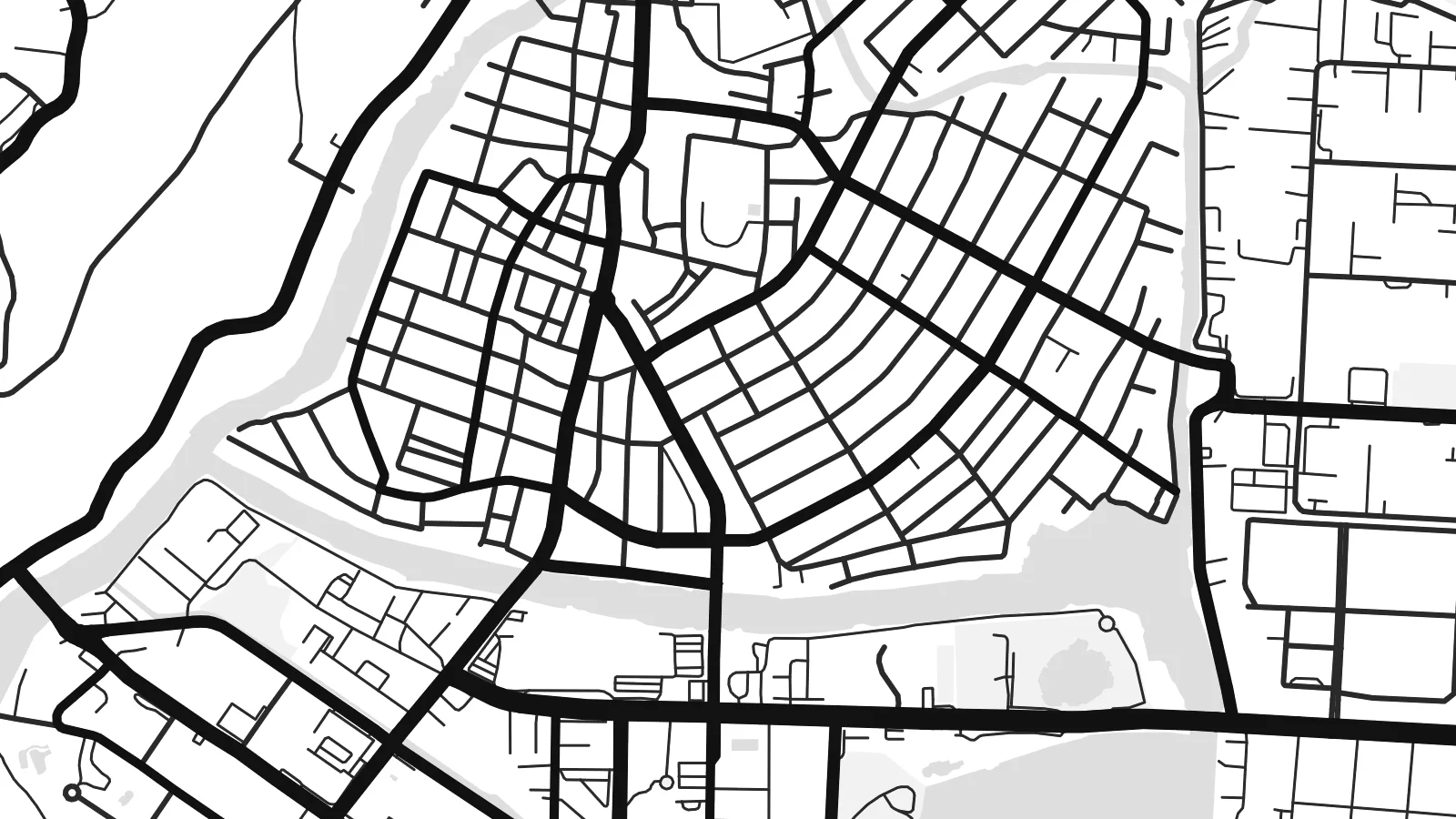
Olongapo occupies a narrow strip of flat land at the head of Subic Bay, with forested hills of the Zambales range rising close behind. The downtown streets form a tight, regular grid squeezed between the slopes and the shore, and newer neighbourhoods climb into the valleys wherever the terrain allows. On the map, green hills press in from almost every side.
For much of the twentieth century the city's life was tied to the United States Naval Base Subic Bay, one of the largest American military installations abroad. When the base closed in 1992, its land was converted into the Subic Bay Freeport Zone, with a port, an airport and industrial areas. A small waterway and the main gate still mark the line between base and city.
The Olongapo map poster shows the two halves side by side: the dense civilian grid on one side, the spacious layout of the former base on the other, with its long waterfront and roads winding into the hills. It is an unusual portrait of how military history shapes a city's form, even decades after the base itself has gone.
The deep, sheltered bay forms the western edge of the map, its coastline curving around the city and the former base, with piers and harbour structures along the shore.
Between the hills and the water, central Olongapo is laid out in a compact grid of short blocks, one of the densest parts of the map.
The former naval base spreads across a large area beside the city, with broad roads, open spaces and waterfront facilities giving it a very different texture.
Fè l pou ou
Ajoute yon dat, yon non oswa pwòp fraz pa w, chanje estil, gwosè oswa oryantasyon.
Apèsi gratis la se nan rezolisyon ba avèk yon watèrmak. Enpresyon ak fichye HD yo jenere nan 300 DPI, jiska 7,200 × 10,800 px, san watèrmak.
Poukisa Olongapo
Olongapo is remembered by many, including former service members, Filipino families and people who have worked in the freeport. The map brings together hills, bay and city in a composition that makes sense to all of them.
Add a title, a subtitle with a year or unit name, and adjust the coordinates line. Choose among five styles; Blueprint suits the naval history well. A free watermarked preview is available before buying the $9 HD files.
Kòmande afich Olongapo a| Gwosè enpresyon | Rezolisyon | Fichye |
|---|---|---|
| 30 × 40 cm11.8 × 15.7″ | 3,543 × 4,724 px | PNG · PDF |
| 29.7 × 42 cm (A3)11.7 × 16.5″ | 3,508 × 4,961 px | PNG · PDF |
| 42 × 59.4 cm (A2)16.5 × 23.4″ | 4,961 × 7,016 px | PNG · PDF |
| 45.7 × 61 cm18 × 24″ | 5,400 × 7,200 px | PNG · PDF |
| 50 × 70 cm19.7 × 27.6″ | 5,906 × 8,268 px | PNG · PDF |
| 61 × 91.4 cm24 × 36″ | 7,200 × 10,800 px | PNG · PDF |
Pou konpare, apèsi gratis la gen 900 px lajè, li gen filigràn epi li fèt pou ekran. Fichye HD yo gen jiska 8 fwa plis rezolisyon nan chak direksyon epi yo enprime pwòp nan gwosè postè konplè.
Chwazi yon style anlè paj la, epi chwazi Afich Enprime — yon gwosè epi, si w vle, yon kad — oswa Fichye Dijital HD. Peman an fèt nan yon sèl etap, epi paj kòmand ou a mete ajou kou peman an konfime.
Li enprime sou papye mat premium 200 gsm nan youn nan sis gwosè, soti nan 30 × 40 cm rive nan 24 × 36″. Afich enprime yo kòmanse nan $39, livrezon enkli.
Wi. Chwazi yon kad an bwa solid nan koulè nwa, blan, chenn natirèl oswa bwa fonse. Li vin ak yon vit ki pa kase epi li pare pou pandye. Afich ankadre yo kòmanse nan $99, livrezon enkli.
Livrezon gratis nan plis pase 60 peyi. Chak afich enprime pa patnè enprimeri ki pi pre w la nan plis pase 30 peyi, e anjeneral li rive nan 3 a 7 jou ouvrab. Ou ka suiv estati a ak swivi kolis la nan Kòmand mwen yo. Kèk peyi pran 2 a 5 semèn, e kote nou poko livre, sit la di w sa anvan w peye.
Voye nou yon foto nan 14 jou apre livrezon an epi nou ap reenprime li gratis oswa remèt ou lajan w.
Wi. Nan editè a sou paj sa a, chanje tit la, soutit la ak liy kowòdone yo pou nenpòt sa w vle, epi chwazi yon style ak yon gwosè. Kòmand enprime, ankadre ak dijital yo tout itilize egzakteman desen w lan.
Pou $9 ou jwenn fichye PNG 300 DPI ak PDF pare-pou-enprime nan tout sis gwosè yo, san watèrmak, pou enprime kote w vle. Pa sèten toujou? Telechaje yon apèsi gratis ak watèrmak anvan.
