The crater harbour
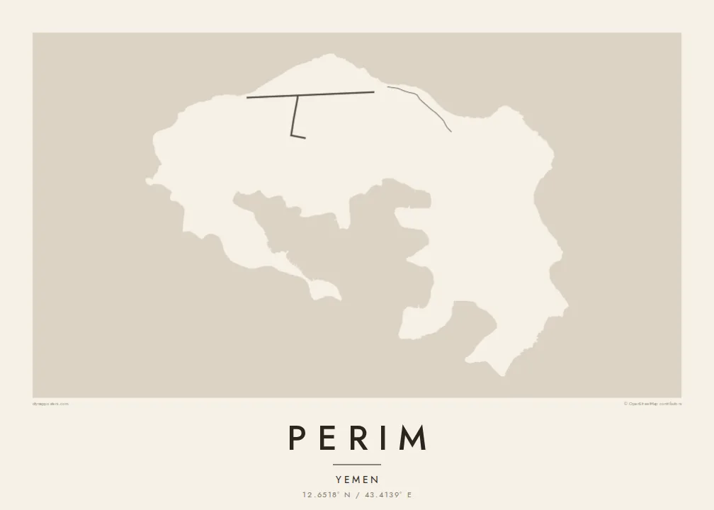
The island's core is a sheltered bay enclosed by curving arms of land, the flooded heart of an old volcano. It gives Perim its unmistakable horseshoe outline on the map.
Postè kat minimalis · Yemen
12.6518° N / 43.4139° E
A small volcanic horseshoe in the Bab-el-Mandeb strait, curled around a sheltered natural harbour.




Yon vil, senk atmosfè
Peze yon style pou wè li sou mi a. Chak style koute menm pri — enprime, ankadre oswa kòm fichye HD.
 Piksèl reyèl · fichye enpresyon 24 × 36″
Byen klè pou enprime
Sa a se yon zoom 100% sou vrè fichye enpresyon an. Chak afich — enprime, ankadre oswa telechaje — jenere sou sèvè nou yo nan 300 DPI, jiska 7,200 × 10,800 piksèl, konsa menm pi piti wout yo rete klè sou yon enpresyon 24 × 36″.
Sou mi a


Kat la
Perim is a small island in the Bab-el-Mandeb, the strait that joins the Red Sea to the Gulf of Aden. It lies close to the Yemeni coast, in the narrow channel between Arabia and Africa. Its shape is the first thing you notice. The island is the remains of a volcanic crater, curled into a rough horseshoe around a deep, enclosed bay.
That natural harbour and the island's position on one of the world's busiest sea lanes gave Perim an outsized role in the past. In the late nineteenth and early twentieth centuries, the British used it as a coaling station for ships travelling between the Suez Canal and the Indian Ocean. Today it is sparsely inhabited, and it is known in Arabic as Mayun.
A Perim map poster is almost entirely about the coastline. The curved arms of the island wrap around the inner bay, and there is only a light scatter of lines on the land itself. Open water frames the island on all sides. The result is a spare, graphic shape that is easy to recognise at any size.
The island's core is a sheltered bay enclosed by curving arms of land, the flooded heart of an old volcano. It gives Perim its unmistakable horseshoe outline on the map.
Perim sits in the Bab-el-Mandeb, between the Arabian Peninsula and the Horn of Africa. At a wider framing, the poster shows the island guarding the narrow passage.
There are very few roads or buildings on the island. That leaves the land mostly blank, so the outline and inner harbour carry the entire composition.
Fè l pou ou
Ajoute yon dat, yon non oswa pwòp fraz pa w, chanje estil, gwosè oswa oryantasyon.
Apèsi gratis la se nan rezolisyon ba avèk yon watèrmak. Enpresyon ak fichye HD yo jenere nan 300 DPI, jiska 7,200 × 10,800 px, san watèrmak.
Poukisa Perim
Perim appeals to people drawn to maritime history, shipping routes and unusual geography. Its horseshoe shape is striking on its own, even for those who have never been there. It suits a study or office wall as a clean, almost abstract form with a real story behind it.
Add a title of your choosing, a subtitle and your own coordinates line, then pick from Classic black & white, Noir, Paper, Blueprint or Sand. The $9 digital download includes six sizes at 300 DPI with no watermark. Printed posters ship from partners in more than 30 countries.
Kòmande afich Perim a| Gwosè enpresyon | Rezolisyon | Fichye |
|---|---|---|
| 30 × 40 cm (11.8 × 15.7″) | 3,543 × 4,724 px | PNG · PDF |
| 29.7 × 42 cm (A3, 11.7 × 16.5″) | 3,508 × 4,961 px | PNG · PDF |
| 42 × 59.4 cm (A2, 16.5 × 23.4″) | 4,961 × 7,016 px | PNG · PDF |
| 45.7 × 61 cm (18 × 24″) | 5,400 × 7,200 px | PNG · PDF |
| 50 × 70 cm (19.7 × 27.6″) | 5,906 × 8,268 px | PNG · PDF |
| 61 × 91.4 cm (24 × 36″) | 7,200 × 10,800 px | PNG · PDF |
Pou konpare, apèsi gratis la gen 900 px lajè, li gen filigràn epi li fèt pou ekran. Fichye HD yo gen jiska 8 fwa plis rezolisyon nan chak direksyon epi yo enprime pwòp nan gwosè postè konplè.
Chwazi yon style anlè paj la, epi chwazi Afich Enprime — yon gwosè epi, si w vle, yon kad — oswa Fichye Dijital HD. Peman an fèt nan yon sèl etap, epi paj kòmand ou a mete ajou kou peman an konfime.
Li enprime sou papye mat premium 200 gsm nan youn nan sis gwosè, soti nan 30 × 40 cm rive nan 24 × 36″. Afich enprime yo kòmanse nan {printFrom}, livrezon enkli.
Wi. Chwazi yon kad an bwa solid nan koulè nwa, blan, chenn natirèl oswa bwa fonse. Li vin ak yon vit ki pa kase epi li pare pou pandye. Afich ankadre yo kòmanse nan {framedFrom}, livrezon enkli.
Livrezon an gratis nan tout mond lan. Se pi pwòch nan patnè enprimri nou yo nan plis pase 30 peyi ki enprime chak afich la, epi li anjeneral rive nan 3–7 jou ouvrab. Ou ka swiv estati ak swivi kolis la nan Kòmand mwen yo. Gen kèk peyi ki pran 2–5 semèn, e kote nou poko livre a, sit la di w anvan ou peye.
Voye nou yon foto nan 14 jou apre livrezon an epi nou ap reenprime li gratis oswa remèt ou lajan w.
Wi. Nan editè a sou paj sa a, chanje tit la, soutit la ak liy kowòdone yo pou nenpòt sa w vle, epi chwazi yon style ak yon gwosè. Kòmand enprime, ankadre ak dijital yo tout itilize egzakteman desen w lan.
Pou $9 ou jwenn fichye PNG 300 DPI ak PDF pare-pou-enprime nan tout sis gwosè yo, san watèrmak, pou enprime kote w vle. Pa sèten toujou? Telechaje yon apèsi gratis ak watèrmak anvan.
