Lahar-shaped riverbeds
The channels draining from the Pinatubo area run through the municipality as wide, braided corridors, left behind by the volcanic sediment that moved down them after the 1991 eruption.
Postè kat minimalis · Philippines
15.0711° N / 120.5423° E
A Pampanga town spreading west from the plain toward the foothills, crossed by wide, pale lahar-scarred riverbeds.


Yon vil, senk atmosfè
Peze yon style pou wè li sou mi a. Chak style koute menm pri — enprime, ankadre oswa kòm fichye HD.
 Piksèl reyèl · fichye enpresyon 24 × 36″
Byen klè pou enprime
Sa a se yon zoom 100% sou vrè fichye enpresyon an. Chak afich — enprime, ankadre oswa telechaje — jenere sou sèvè nou yo nan 300 DPI, jiska 7,200 × 10,800 piksèl, konsa menm pi piti wout yo rete klè sou yon enpresyon 24 × 36″.
Sou mi a


Kat la
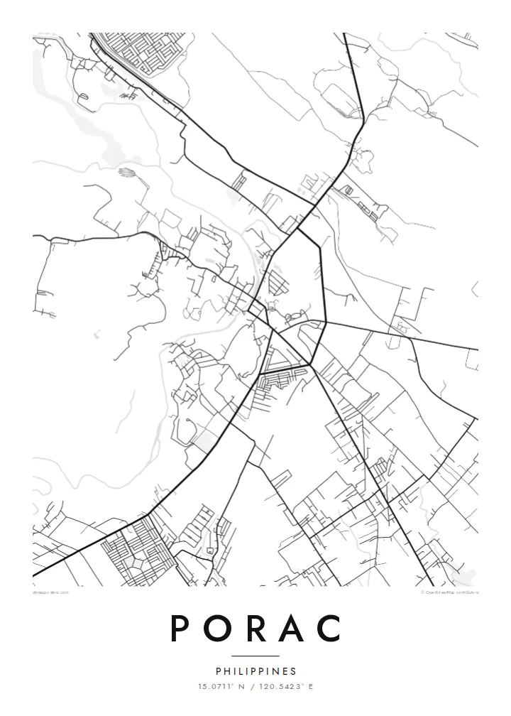
Porac lies on the western edge of the Central Luzon plain, where flat rice land starts to rise toward the Zambales Mountains. From above, the town centre is a compact cluster of streets, while barangays spread outward along roads, the lines between them filled with fields. To the west the land becomes rougher and the street pattern thins out.
The town's recent history is written on its rivers. After Mount Pinatubo erupted in 1991, lahar flows moved down the channels that drain the volcano's slopes and buried large areas of Porac under volcanic sediment. On a map, the Porac River and nearby waterways show up as unusually wide, braided corridors, much broader than the water they usually carry.
A Porac map poster captures a place that rebuilt on new ground. The regular grid of the centre, the scattered villages and the broad riverbeds together describe a town between plain and mountain. In monochrome the sand channels read as pale bands running across the fields. The result is a record of change as much as of streets.
The channels draining from the Pinatubo area run through the municipality as wide, braided corridors, left behind by the volcanic sediment that moved down them after the 1991 eruption.
The poblacion forms a small, orderly block of streets, the densest part of the map and the point from which roads spread out to the surrounding barangays.
West of the centre, settlement thins and the roads start to wind. The map shows the change from flat Pampanga farmland to the uplands below the Zambales range.
Fè l pou ou
Ajoute yon dat, yon non oswa pwòp fraz pa w, chanje estil, gwosè oswa oryantasyon.
Apèsi gratis la se nan rezolisyon ba avèk yon watèrmak. Enpresyon ak fichye HD yo jenere nan 300 DPI, jiska 7,200 × 10,800 px, san watèrmak.
Poukisa Porac
For families from Porac, and those who have moved away, this map carries the town's story of loss and rebuilding. It works as a quiet reminder of home, and the braided riverbeds make an unusual composition that visitors ask about.
Add a barangay name, a family name or an important date to the title and subtitle, and adjust the coordinates line. Pick one of five styles, from Classic black & white to Sand. Order it as a matte print, framed or unframed, or download the files for $9.
Kòmande afich Porac a| Gwosè enpresyon | Rezolisyon | Fichye |
|---|---|---|
| 30 × 40 cm11.8 × 15.7″ | 3,543 × 4,724 px | PNG · PDF |
| 29.7 × 42 cm (A3)11.7 × 16.5″ | 3,508 × 4,961 px | PNG · PDF |
| 42 × 59.4 cm (A2)16.5 × 23.4″ | 4,961 × 7,016 px | PNG · PDF |
| 45.7 × 61 cm18 × 24″ | 5,400 × 7,200 px | PNG · PDF |
| 50 × 70 cm19.7 × 27.6″ | 5,906 × 8,268 px | PNG · PDF |
| 61 × 91.4 cm24 × 36″ | 7,200 × 10,800 px | PNG · PDF |
Pou konpare, apèsi gratis la gen 900 px lajè, li gen filigràn epi li fèt pou ekran. Fichye HD yo gen jiska 8 fwa plis rezolisyon nan chak direksyon epi yo enprime pwòp nan gwosè postè konplè.
Chwazi yon style anlè paj la, epi chwazi Afich Enprime — yon gwosè epi, si w vle, yon kad — oswa Fichye Dijital HD. Peman an fèt nan yon sèl etap, epi paj kòmand ou a mete ajou kou peman an konfime.
Li enprime sou papye mat premium 200 gsm nan youn nan sis gwosè, soti nan 30 × 40 cm rive nan 24 × 36″. Afich enprime yo kòmanse nan $39, livrezon enkli.
Wi. Chwazi yon kad an bwa solid nan koulè nwa, blan, chenn natirèl oswa bwa fonse. Li vin ak yon vit ki pa kase epi li pare pou pandye. Afich ankadre yo kòmanse nan $99, livrezon enkli.
Livrezon gratis nan plis pase 60 peyi. Chak afich enprime pa patnè enprimeri ki pi pre w la nan plis pase 30 peyi, e anjeneral li rive nan 3 a 7 jou ouvrab. Ou ka suiv estati a ak swivi kolis la nan Kòmand mwen yo. Kèk peyi pran 2 a 5 semèn, e kote nou poko livre, sit la di w sa anvan w peye.
Voye nou yon foto nan 14 jou apre livrezon an epi nou ap reenprime li gratis oswa remèt ou lajan w.
Wi. Nan editè a sou paj sa a, chanje tit la, soutit la ak liy kowòdone yo pou nenpòt sa w vle, epi chwazi yon style ak yon gwosè. Kòmand enprime, ankadre ak dijital yo tout itilize egzakteman desen w lan.
Pou $9 ou jwenn fichye PNG 300 DPI ak PDF pare-pou-enprime nan tout sis gwosè yo, san watèrmak, pou enprime kote w vle. Pa sèten toujou? Telechaje yon apèsi gratis ak watèrmak anvan.
