Neighbourhood clusters
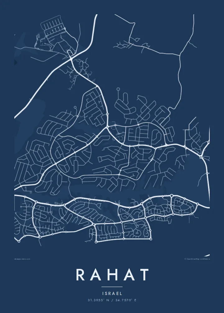
The city is organised into separate neighbourhoods, often numbered. On the map they appear as distinct groups of streets linked by main roads.
Postè kat minimalis · Israel
31.3955° N / 34.7570° E
A planned Negev town of numbered neighbourhoods laid out in distinct clusters across the desert plain north of Beersheba.



Yon vil, senk atmosfè
Peze yon style pou wè li sou mi a. Chak style koute menm pri — enprime, ankadre oswa kòm fichye HD.
 Piksèl reyèl · fichye enpresyon 24 × 36″
Byen klè pou enprime
Sa a se yon zoom 100% sou vrè fichye enpresyon an. Chak afich — enprime, ankadre oswa telechaje — jenere sou sèvè nou yo nan 300 DPI, jiska 7,200 × 10,800 piksèl, konsa menm pi piti wout yo rete klè sou yon enpresyon 24 × 36″.
Sou mi a


Kat la
Rahat lies in the northern Negev, a short distance north of Beersheba. It is the largest Bedouin city in Israel and was established as a planned town in the early 1970s. It received city status in 1994. Its layout reflects that planning: the town is divided into separate neighbourhoods, many identified by number, each forming its own cluster of streets.
From above, Rahat looks like a group of distinct residential units connected by main roads, with open ground between some of them. Around the town, the Negev landscape is dry and open, crossed by roads, wadis and agricultural plots. The contrast between the organised neighbourhood clusters and the surrounding land is the defining feature of the map.
A Rahat map poster captures a city that grew quickly from a planned beginning into a significant urban centre in southern Israel. Printed in black and white, the neighbourhood pattern becomes a striking modular composition. For residents and families connected to Rahat, each cluster represents a specific place and a specific set of people.
The city is organised into separate neighbourhoods, often numbered. On the map they appear as distinct groups of streets linked by main roads.
Rahat was founded as a planned town in the 1970s, and its structured layout shows clearly compared with older, more organic settlements.
Open, arid land surrounds the city, crossed by roads and dry watercourses, which gives the map generous empty space around its edges.
Fè l pou ou
Ajoute yon dat, yon non oswa pwòp fraz pa w, chanje estil, gwosè oswa oryantasyon.
Apèsi gratis la se nan rezolisyon ba avèk yon watèrmak. Enpresyon ak fichye HD yo jenere nan 300 DPI, jiska 7,200 × 10,800 px, san watèrmak.
Poukisa Rahat
For families from Rahat and the wider Negev Bedouin community, this map is a portrait of home drawn at the scale of neighbourhoods. Its modular pattern also makes it a strong, distinctive graphic piece.
Set a title, a subtitle and the coordinates line, and choose from five styles. Sand suits the desert setting especially well. HD files cost $9 for six sizes, and printed posters on matte paper can be ordered with or without a frame.
Kòmande afich Rahat a| Gwosè enpresyon | Rezolisyon | Fichye |
|---|---|---|
| 30 × 40 cm (11.8 × 15.7″) | 3,543 × 4,724 px | PNG · PDF |
| 29.7 × 42 cm (A3, 11.7 × 16.5″) | 3,508 × 4,961 px | PNG · PDF |
| 42 × 59.4 cm (A2, 16.5 × 23.4″) | 4,961 × 7,016 px | PNG · PDF |
| 45.7 × 61 cm (18 × 24″) | 5,400 × 7,200 px | PNG · PDF |
| 50 × 70 cm (19.7 × 27.6″) | 5,906 × 8,268 px | PNG · PDF |
| 61 × 91.4 cm (24 × 36″) | 7,200 × 10,800 px | PNG · PDF |
Pou konpare, apèsi gratis la gen 900 px lajè, li gen filigràn epi li fèt pou ekran. Fichye HD yo gen jiska 8 fwa plis rezolisyon nan chak direksyon epi yo enprime pwòp nan gwosè postè konplè.
Chwazi yon style anlè paj la, epi chwazi Afich Enprime — yon gwosè epi, si w vle, yon kad — oswa Fichye Dijital HD. Peman an fèt nan yon sèl etap, epi paj kòmand ou a mete ajou kou peman an konfime.
Li enprime sou papye mat premium 200 gsm nan youn nan sis gwosè, soti nan 30 × 40 cm rive nan 24 × 36″. Afich enprime yo kòmanse nan $39, livrezon enkli.
Wi. Chwazi yon kad an bwa solid nan koulè nwa, blan, chenn natirèl oswa bwa fonse. Li vin ak yon vit ki pa kase epi li pare pou pandye. Afich ankadre yo kòmanse nan $99, livrezon enkli.
Livrezon an gratis nan tout mond lan. Se pi pwòch nan patnè enprimri nou yo nan plis pase 30 peyi ki enprime chak afich la, epi li anjeneral rive nan 3–7 jou ouvrab. Ou ka swiv estati ak swivi kolis la nan Kòmand mwen yo. Gen kèk peyi ki pran 2–5 semèn, e kote nou poko livre a, sit la di w anvan ou peye.
Voye nou yon foto nan 14 jou apre livrezon an epi nou ap reenprime li gratis oswa remèt ou lajan w.
Wi. Nan editè a sou paj sa a, chanje tit la, soutit la ak liy kowòdone yo pou nenpòt sa w vle, epi chwazi yon style ak yon gwosè. Kòmand enprime, ankadre ak dijital yo tout itilize egzakteman desen w lan.
Pou $9 ou jwenn fichye PNG 300 DPI ak PDF pare-pou-enprime nan tout sis gwosè yo, san watèrmak, pou enprime kote w vle. Pa sèten toujou? Telechaje yon apèsi gratis ak watèrmak anvan.
