Rivière des Marsouins
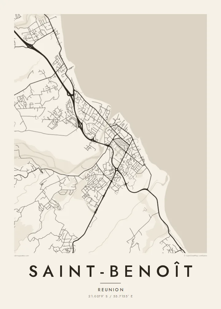
The river reaches the ocean beside the town, its mouth cutting a clear gap in the coastline on the map.
Postè kat minimalis · Réunion
21.0379° S / 55.7155° E
A town on Réunion's wet eastern coast, set between the Indian Ocean, a river mouth and the road climbing to the high plains




Yon vil, senk atmosfè
Peze yon style pou wè li sou mi a. Chak style koute menm pri — enprime, ankadre oswa kòm fichye HD.
 Piksèl reyèl · fichye enpresyon 24 × 36″
Byen klè pou enprime
Sa a se yon zoom 100% sou vrè fichye enpresyon an. Chak afich — enprime, ankadre oswa telechaje — jenere sou sèvè nou yo nan 300 DPI, jiska 7,200 × 10,800 piksèl, konsa menm pi piti wout yo rete klè sou yon enpresyon 24 × 36″.
Sou mi a


Kat la
Saint-Benoît is on the eastern, windward side of Réunion, where the island gets the most rain. On a map the town fills a strip of land between the Indian Ocean and the green slopes behind it. The Rivière des Marsouins reaches the sea at the town's edge, and the coastal road runs through, linking Saint-Benoît with the other towns along the east coast.
The town is the main centre of eastern Réunion and a sub-prefecture. It is also where the Route des Plaines begins, the road that climbs through the island's interior to the Plaine-des-Palmistes and on across to the west. Sugar cane grows over much of the surrounding land, and the rivers draining the wet slopes are a constant feature of the landscape.
A Saint-Benoît map poster brings together the coastline, the river mouth and the roads heading uphill. The ocean gives the print a broad, calm edge, the town's streets gather near it and long lines lead inland toward the mountains. It is a strong portrait of Réunion's east, and a natural pair for a print of the whole island.
The river reaches the ocean beside the town, its mouth cutting a clear gap in the coastline on the map.
The Indian Ocean shore runs along the town's seaward edge, a long, clean line that frames the whole composition.
The Route des Plaines starts here and climbs inland in wide curves, one of the most recognisable roads on Réunion.
Fè l pou ou
Ajoute yon dat, yon non oswa pwòp fraz pa w, chanje estil, gwosè oswa oryantasyon.
Apèsi gratis la se nan rezolisyon ba avèk yon watèrmak. Enpresyon ak fichye HD yo jenere nan 300 DPI, jiska 7,200 × 10,800 px, san watèrmak.
Poukisa Saint-Benoît
Saint-Benoît is a home town for many Réunionnais living in mainland France and beyond, and a map of its coast and streets is a quiet way to stay connected. It also makes a lovely keepsake for anyone who has stayed on the east coast.
Change the title, subtitle and coordinates line to include a name, a neighbourhood or an important date. Choose from Classic black and white, Noir, Paper, Blueprint and Sand, and download the $9 HD files or order a matte printed poster, with or without a wooden frame.
Kòmande afich Saint-Benoît a| Gwosè enpresyon | Rezolisyon | Fichye |
|---|---|---|
| 30 × 40 cm (11.8 × 15.7″) | 3,543 × 4,724 px | PNG · PDF |
| 29.7 × 42 cm (A3, 11.7 × 16.5″) | 3,508 × 4,961 px | PNG · PDF |
| 42 × 59.4 cm (A2, 16.5 × 23.4″) | 4,961 × 7,016 px | PNG · PDF |
| 45.7 × 61 cm (18 × 24″) | 5,400 × 7,200 px | PNG · PDF |
| 50 × 70 cm (19.7 × 27.6″) | 5,906 × 8,268 px | PNG · PDF |
| 61 × 91.4 cm (24 × 36″) | 7,200 × 10,800 px | PNG · PDF |
Pou konpare, apèsi gratis la gen 900 px lajè, li gen filigràn epi li fèt pou ekran. Fichye HD yo gen jiska 8 fwa plis rezolisyon nan chak direksyon epi yo enprime pwòp nan gwosè postè konplè.
Chwazi yon style anlè paj la, epi chwazi Afich Enprime — yon gwosè epi, si w vle, yon kad — oswa Fichye Dijital HD. Peman an fèt nan yon sèl etap, epi paj kòmand ou a mete ajou kou peman an konfime.
Li enprime sou papye mat premium 200 gsm nan youn nan sis gwosè, soti nan 30 × 40 cm rive nan 24 × 36″. Afich enprime yo kòmanse nan {printFrom}, livrezon enkli.
Wi. Chwazi yon kad an bwa solid nan koulè nwa, blan, chenn natirèl oswa bwa fonse. Li vin ak yon vit ki pa kase epi li pare pou pandye. Afich ankadre yo kòmanse nan {framedFrom}, livrezon enkli.
Livrezon an gratis nan tout mond lan. Se pi pwòch nan patnè enprimri nou yo nan plis pase 30 peyi ki enprime chak afich la, epi li anjeneral rive nan 3–7 jou ouvrab. Ou ka swiv estati ak swivi kolis la nan Kòmand mwen yo. Gen kèk peyi ki pran 2–5 semèn, e kote nou poko livre a, sit la di w anvan ou peye.
Voye nou yon foto nan 14 jou apre livrezon an epi nou ap reenprime li gratis oswa remèt ou lajan w.
Wi. Nan editè a sou paj sa a, chanje tit la, soutit la ak liy kowòdone yo pou nenpòt sa w vle, epi chwazi yon style ak yon gwosè. Kòmand enprime, ankadre ak dijital yo tout itilize egzakteman desen w lan.
Pou $9 ou jwenn fichye PNG 300 DPI ak PDF pare-pou-enprime nan tout sis gwosè yo, san watèrmak, pou enprime kote w vle. Pa sèten toujou? Telechaje yon apèsi gratis ak watèrmak anvan.
