Sanmachi Suji
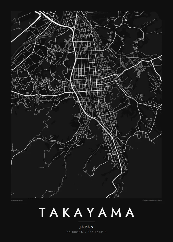
Parallel lanes of preserved merchant houses form the heart of the old town, a fine, regular grid that stands out clearly against the newer streets around it.
Postè kat minimalis · Japan
36.1333° N / 137.2500° E
A mountain town in the Hida highlands, its preserved merchant lanes laid in a tight grid beside the Miyagawa River.



Yon vil, senk atmosfè
Peze yon style pou wè li sou mi a. Chak style koute menm pri — enprime, ankadre oswa kòm fichye HD.
 Piksèl reyèl · fichye enpresyon 24 × 36″
Byen klè pou enprime
Sa a se yon zoom 100% sou vrè fichye enpresyon an. Chak afich — enprime, ankadre oswa telechaje — jenere sou sèvè nou yo nan 300 DPI, jiska 7,200 × 10,800 piksèl, konsa menm pi piti wout yo rete klè sou yon enpresyon 24 × 36″.
Sou mi a


Kat la
Takayama lies in a basin of the Hida highlands in Gifu Prefecture, surrounded by the peaks of the Japanese Alps. The Miyagawa River runs north through the town, and the old centre sits on its east bank. From above, the historic streets form a compact grid of narrow lanes, bordered by forested hills rising toward the old castle site.
The Sanmachi Suji district preserves rows of Edo-period merchant houses, sake breweries and shops along a few parallel streets. Nearby, the Takayama Jinya, a former government office of the shogunate, occupies a large walled compound. Morning markets are held along the Miyagawa and in front of the Jinya. A Takayama map poster places all of these within a few blocks of each other.
The town is famous for the Takayama Festival, held in spring and autumn, when elaborately decorated floats are drawn through the streets. Since municipal mergers in 2005, Takayama has been Japan's largest municipality by area, stretching deep into the mountains. The town itself remains small, walkable and closely bound to its river and hills.
Parallel lanes of preserved merchant houses form the heart of the old town, a fine, regular grid that stands out clearly against the newer streets around it.
The river runs north through the centre, crossed by a series of short bridges. Its banks host one of the town's morning markets, and it divides old and new Takayama.
East of the old town, the wooded hill where Takayama Castle once stood is now Shiroyama Park, a soft green mass that frames the tight streets below.
Fè l pou ou
Ajoute yon dat, yon non oswa pwòp fraz pa w, chanje estil, gwosè oswa oryantasyon.
Apèsi gratis la se nan rezolisyon ba avèk yon watèrmak. Enpresyon ak fichye HD yo jenere nan 300 DPI, jiska 7,200 × 10,800 px, san watèrmak.
Poukisa Takayama
Takayama is a place people remember precisely: the lanes of Sanmachi, the red bridges, the festival floats. A map of the old town makes a calm, detailed print for anyone who has walked there, and it sits well alongside prints of Kyoto or Kanazawa.
Personalise the title and subtitle, perhaps in Japanese or with the date of your visit, and adjust the coordinates line. Choose from Classic black and white, Noir, Paper, Blueprint and Sand. Paper suits the historic streets especially well.
Kòmande afich Takayama a| Gwosè enpresyon | Rezolisyon | Fichye |
|---|---|---|
| 30 × 40 cm11.8 × 15.7″ | 3,543 × 4,724 px | PNG · PDF |
| 29.7 × 42 cm (A3)11.7 × 16.5″ | 3,508 × 4,961 px | PNG · PDF |
| 42 × 59.4 cm (A2)16.5 × 23.4″ | 4,961 × 7,016 px | PNG · PDF |
| 45.7 × 61 cm18 × 24″ | 5,400 × 7,200 px | PNG · PDF |
| 50 × 70 cm19.7 × 27.6″ | 5,906 × 8,268 px | PNG · PDF |
| 61 × 91.4 cm24 × 36″ | 7,200 × 10,800 px | PNG · PDF |
Pou konpare, apèsi gratis la gen 900 px lajè, li gen filigràn epi li fèt pou ekran. Fichye HD yo gen jiska 8 fwa plis rezolisyon nan chak direksyon epi yo enprime pwòp nan gwosè postè konplè.
Chwazi yon style anlè paj la, epi chwazi Afich Enprime — yon gwosè epi, si w vle, yon kad — oswa Fichye Dijital HD. Peman an fèt nan yon sèl etap, epi paj kòmand ou a mete ajou kou peman an konfime.
Li enprime sou papye mat premium 200 gsm nan youn nan sis gwosè, soti nan 30 × 40 cm rive nan 24 × 36″. Afich enprime yo kòmanse nan $39, livrezon enkli.
Wi. Chwazi yon kad an bwa solid nan koulè nwa, blan, chenn natirèl oswa bwa fonse. Li vin ak yon vit ki pa kase epi li pare pou pandye. Afich ankadre yo kòmanse nan $99, livrezon enkli.
Livrezon gratis nan plis pase 60 peyi. Chak afich enprime pa patnè enprimeri ki pi pre w la nan plis pase 30 peyi, e anjeneral li rive nan 3 a 7 jou ouvrab. Ou ka suiv estati a ak swivi kolis la nan Kòmand mwen yo. Kèk peyi pran 2 a 5 semèn, e kote nou poko livre, sit la di w sa anvan w peye.
Voye nou yon foto nan 14 jou apre livrezon an epi nou ap reenprime li gratis oswa remèt ou lajan w.
Wi. Nan editè a sou paj sa a, chanje tit la, soutit la ak liy kowòdone yo pou nenpòt sa w vle, epi chwazi yon style ak yon gwosè. Kòmand enprime, ankadre ak dijital yo tout itilize egzakteman desen w lan.
Pou $9 ou jwenn fichye PNG 300 DPI ak PDF pare-pou-enprime nan tout sis gwosè yo, san watèrmak, pou enprime kote w vle. Pa sèten toujou? Telechaje yon apèsi gratis ak watèrmak anvan.
