Paddy patterns
Around the built-up areas, rice fields form a regular grid of small plots. They give the map the finely divided texture typical of the Nara Basin.
Postè kat minimalis · Japan
34.5542° N / 135.7930° E
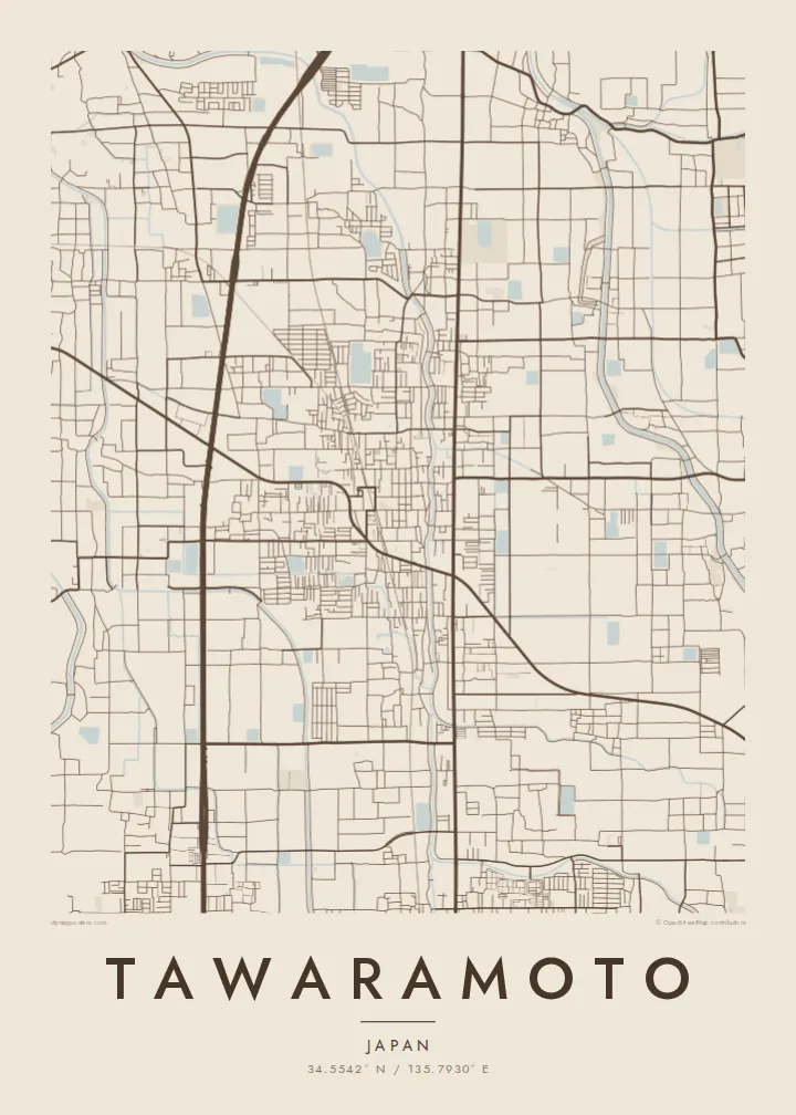
A flat town in the Nara Basin, where rice paddies, two rail lines and small village clusters form a quiet patchwork.


Yon vil, senk atmosfè
Peze yon style pou wè li sou mi a. Chak style koute menm pri — enprime, ankadre oswa kòm fichye HD.
 Piksèl reyèl · fichye enpresyon 24 × 36″
Byen klè pou enprime
Sa a se yon zoom 100% sou vrè fichye enpresyon an. Chak afich — enprime, ankadre oswa telechaje — jenere sou sèvè nou yo nan 300 DPI, jiska 7,200 × 10,800 piksèl, konsa menm pi piti wout yo rete klè sou yon enpresyon 24 × 36″.
Sou mi a


Kat la
Tawaramoto lies in the middle of the Nara Basin, on level ground, with the mountains that ring the basin in the distance. The town is flat, and its map mixes residential clusters, narrow lanes and rice fields laid out in neat rectangular plots. Small rivers and irrigation channels cross the land, most of them in straight lines.
Two railway lines pass through the town, and their stations form small centres of denser streets. Tawaramoto is also home to the Karako-Kagi site, one of the best-known archaeological sites of Japan's Yayoi period, where a reconstructed tower now stands. A Tawaramoto map poster shows this blend of an old settlement pattern and a modern town.
In monochrome, field boundaries and the grid of lanes make a fine, even texture across the sheet. The clustered villages and the long lines of the railways break it up. The result is subtle and balanced, a map that rewards close looking and suits a calm, uncluttered room.
Around the built-up areas, rice fields form a regular grid of small plots. They give the map the finely divided texture typical of the Nara Basin.
Two railway lines cross the town, each with its own station area. Their straight tracks divide the fields and link Tawaramoto with other parts of the basin.
The Yayoi-period archaeological site forms an open area among the fields. This green space, with its reconstructed tower, marks one of the region's oldest known settlements.
Fè l pou ou
Ajoute yon dat, yon non oswa pwòp fraz pa w, chanje estil, gwosè oswa oryantasyon.
Apèsi gratis la se nan rezolisyon ba avèk yon watèrmak. Enpresyon ak fichye HD yo jenere nan 300 DPI, jiska 7,200 × 10,800 px, san watèrmak.
Poukisa Tawaramoto
Tawaramoto suits people who like quiet, orderly maps: former residents, visitors to the Nara region, or anyone interested in Japan's early history. Add your own title and subtitle, perhaps a family name or the dates of a stay, and keep or edit the coordinates line.
Choose Classic black & white, Noir, Paper, Blueprint or Sand. The free preview shows a 900 px watermarked version. The $9 purchase includes six sizes, among them A3 and A2, as 300 DPI PNG and print-ready PDF, and matte printed posters come with an optional wooden frame.
Kòmande afich Tawaramoto a| Gwosè enpresyon | Rezolisyon | Fichye |
|---|---|---|
| 30 × 40 cm11.8 × 15.7″ | 3,543 × 4,724 px | PNG · PDF |
| 29.7 × 42 cm (A3)11.7 × 16.5″ | 3,508 × 4,961 px | PNG · PDF |
| 42 × 59.4 cm (A2)16.5 × 23.4″ | 4,961 × 7,016 px | PNG · PDF |
| 45.7 × 61 cm18 × 24″ | 5,400 × 7,200 px | PNG · PDF |
| 50 × 70 cm19.7 × 27.6″ | 5,906 × 8,268 px | PNG · PDF |
| 61 × 91.4 cm24 × 36″ | 7,200 × 10,800 px | PNG · PDF |
Pou konpare, apèsi gratis la gen 900 px lajè, li gen filigràn epi li fèt pou ekran. Fichye HD yo gen jiska 8 fwa plis rezolisyon nan chak direksyon epi yo enprime pwòp nan gwosè postè konplè.
Chwazi yon style anlè paj la, epi chwazi Afich Enprime — yon gwosè epi, si w vle, yon kad — oswa Fichye Dijital HD. Peman an fèt nan yon sèl etap, epi paj kòmand ou a mete ajou kou peman an konfime.
Li enprime sou papye mat premium 200 gsm nan youn nan sis gwosè, soti nan 30 × 40 cm rive nan 24 × 36″. Afich enprime yo kòmanse nan $39, livrezon enkli.
Wi. Chwazi yon kad an bwa solid nan koulè nwa, blan, chenn natirèl oswa bwa fonse. Li vin ak yon vit ki pa kase epi li pare pou pandye. Afich ankadre yo kòmanse nan $99, livrezon enkli.
Livrezon gratis nan plis pase 60 peyi. Chak afich enprime pa patnè enprimeri ki pi pre w la nan plis pase 30 peyi, e anjeneral li rive nan 3 a 7 jou ouvrab. Ou ka suiv estati a ak swivi kolis la nan Kòmand mwen yo. Kèk peyi pran 2 a 5 semèn, e kote nou poko livre, sit la di w sa anvan w peye.
Voye nou yon foto nan 14 jou apre livrezon an epi nou ap reenprime li gratis oswa remèt ou lajan w.
Wi. Nan editè a sou paj sa a, chanje tit la, soutit la ak liy kowòdone yo pou nenpòt sa w vle, epi chwazi yon style ak yon gwosè. Kòmand enprime, ankadre ak dijital yo tout itilize egzakteman desen w lan.
Pou $9 ou jwenn fichye PNG 300 DPI ak PDF pare-pou-enprime nan tout sis gwosè yo, san watèrmak, pou enprime kote w vle. Pa sèten toujou? Telechaje yon apèsi gratis ak watèrmak anvan.
