Toronto Islands
A group of low, connected islands lies just offshore, enclosing the inner harbour. On the map they form a soft, curved edge between the city and the open lake.
Postè kat minimalis · Canada
43.7064° N / 79.3986° W
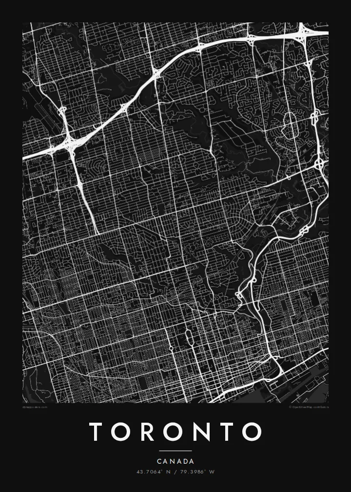
A lakeside grid cut by deep green ravines, with a chain of islands sheltering the harbour



Yon vil, senk atmosfè
Peze yon style pou wè li sou mi a. Chak style koute menm pri — enprime, ankadre oswa kòm fichye HD.
 Piksèl reyèl · fichye enpresyon 24 × 36″
Byen klè pou enprime
Sa a se yon zoom 100% sou vrè fichye enpresyon an. Chak afich — enprime, ankadre oswa telechaje — jenere sou sèvè nou yo nan 300 DPI, jiska 7,200 × 10,800 piksèl, konsa menm pi piti wout yo rete klè sou yon enpresyon 24 × 36″.
Sou mi a


Kat la
Toronto spreads along the northern shore of Lake Ontario. From above, the city is dominated by a long, regular grid. Major streets run north from the lake and cross avenues running east–west. Yonge Street, one of the city's main axes, runs north from the waterfront through the centre.
The grid is interrupted by a network of ravines. The Don Valley and the Humber River cut deep, winding green corridors through the city, carrying rivers, parks and trails. On the map they appear as long irregular strips that break up the straight lines of streets.
Offshore, the Toronto Islands form a chain of low land that shelters the inner harbour. The Gardiner Expressway and rail corridor run along the waterfront, with the CN Tower rising near the shore. A Toronto map poster shows how the lake, the grid and the ravines fit together into one clear shape.
A group of low, connected islands lies just offshore, enclosing the inner harbour. On the map they form a soft, curved edge between the city and the open lake.
The Don and Humber valleys, plus smaller ravines, cut deep green corridors through the city. They create long, irregular gaps in the street grid.
Yonge Street runs north from the lakefront through downtown and beyond. It forms a central line in Toronto's grid, with neighbourhoods arranged on both sides.
Fè l pou ou
Ajoute yon dat, yon non oswa pwòp fraz pa w, chanje estil, gwosè oswa oryantasyon.
Apèsi gratis la se nan rezolisyon ba avèk yon watèrmak. Enpresyon ak fichye HD yo jenere nan 300 DPI, jiska 7,200 × 10,800 px, san watèrmak.
Poukisa Toronto
Toronto is a city many people move to for study or work and then call home. A map of the lake, the islands and the ravines captures the Toronto they know in a clean, simple form.
You can personalise the title, subtitle and coordinates, for example with your neighbourhood or a special date, and choose Classic black & white, Noir, Paper, Blueprint or Sand. Get it as a digital file or printed poster.
Kòmande afich Toronto a| Gwosè enpresyon | Rezolisyon | Fichye |
|---|---|---|
| 30 × 40 cm (11.8 × 15.7″) | 3,543 × 4,724 px | PNG · PDF |
| 29.7 × 42 cm (A3, 11.7 × 16.5″) | 3,508 × 4,961 px | PNG · PDF |
| 42 × 59.4 cm (A2, 16.5 × 23.4″) | 4,961 × 7,016 px | PNG · PDF |
| 45.7 × 61 cm (18 × 24″) | 5,400 × 7,200 px | PNG · PDF |
| 50 × 70 cm (19.7 × 27.6″) | 5,906 × 8,268 px | PNG · PDF |
| 61 × 91.4 cm (24 × 36″) | 7,200 × 10,800 px | PNG · PDF |
Pou konpare, apèsi gratis la gen 900 px lajè, li gen filigràn epi li fèt pou ekran. Fichye HD yo gen jiska 8 fwa plis rezolisyon nan chak direksyon epi yo enprime pwòp nan gwosè postè konplè.
Chwazi yon style anlè paj la, epi chwazi Afich Enprime — yon gwosè epi, si w vle, yon kad — oswa Fichye Dijital HD. Peman an fèt nan yon sèl etap, epi paj kòmand ou a mete ajou kou peman an konfime.
Li enprime sou papye mat premium 200 gsm nan youn nan sis gwosè, soti nan 30 × 40 cm rive nan 24 × 36″. Afich enprime yo kòmanse nan $39, livrezon enkli.
Wi. Chwazi yon kad an bwa solid nan koulè nwa, blan, chenn natirèl oswa bwa fonse. Li vin ak yon vit ki pa kase epi li pare pou pandye. Afich ankadre yo kòmanse nan $99, livrezon enkli.
Livrezon an gratis nan tout mond lan. Se pi pwòch nan patnè enprimri nou yo nan plis pase 30 peyi ki enprime chak afich la, epi li anjeneral rive nan 3–7 jou ouvrab. Ou ka swiv estati ak swivi kolis la nan Kòmand mwen yo. Gen kèk peyi ki pran 2–5 semèn, e kote nou poko livre a, sit la di w anvan ou peye.
Voye nou yon foto nan 14 jou apre livrezon an epi nou ap reenprime li gratis oswa remèt ou lajan w.
Wi. Nan editè a sou paj sa a, chanje tit la, soutit la ak liy kowòdone yo pou nenpòt sa w vle, epi chwazi yon style ak yon gwosè. Kòmand enprime, ankadre ak dijital yo tout itilize egzakteman desen w lan.
Pou $9 ou jwenn fichye PNG 300 DPI ak PDF pare-pou-enprime nan tout sis gwosè yo, san watèrmak, pou enprime kote w vle. Pa sèten toujou? Telechaje yon apèsi gratis ak watèrmak anvan.
