Interstate junction
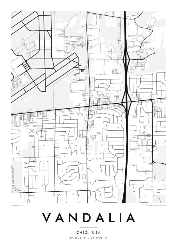
I-70 and I-75 meet near Vandalia, and the interchange loops show up clearly from above. They frame the city with the widest and boldest lines on the print.
Postè kat minimalis · United States
39.8906° N / 84.1988° W
An Ohio crossroads city north of Dayton, where interstates, the National Road and airport runways meet in a suburban grid


Yon vil, senk atmosfè
Peze yon style pou wè li sou mi a. Chak style koute menm pri — enprime, ankadre oswa kòm fichye HD.
 Piksèl reyèl · fichye enpresyon 24 × 36″
Byen klè pou enprime
Sa a se yon zoom 100% sou vrè fichye enpresyon an. Chak afich — enprime, ankadre oswa telechaje — jenere sou sèvè nou yo nan 300 DPI, jiska 7,200 × 10,800 piksèl, konsa menm pi piti wout yo rete klè sou yon enpresyon 24 × 36″.
Sou mi a


Kat la
Vandalia lies just north of Dayton, Ohio, at a point where major routes come together. Interstate 75 runs north–south along its eastern side, Interstate 70 runs east–west through the area, and the historic National Road, now US 40, passes through the city. The local slogan, Crossroads of America, describes the map quite literally.
Dayton International Airport sits immediately to the west, and its runways form long, crossing lines at the edge of the city. Between the highways, Vandalia's residential streets follow a mostly regular grid with some curving subdivisions. Parks, schools and a compact centre along the old National Road break it up. Farmland still reaches the outer edges.
A Vandalia map poster shows a place defined by movement: interchanges, arterial roads and runways surrounding a quiet, ordinary suburb. In black and white, the heavy highway lines, the fine residential streets and the geometric airfield make one of the more graphic compositions among small Ohio cities.
I-70 and I-75 meet near Vandalia, and the interchange loops show up clearly from above. They frame the city with the widest and boldest lines on the print.
US 40, the historic National Road, runs through Vandalia. It was one of the first major federally built roads in the United States and still forms a central axis of the city.
Dayton International Airport lies just west of the city. Its runways and taxiways create a large geometric shape at the edge of the map.
Fè l pou ou
Ajoute yon dat, yon non oswa pwòp fraz pa w, chanje estil, gwosè oswa oryantasyon.
Apèsi gratis la se nan rezolisyon ba avèk yon watèrmak. Enpresyon ak fichye HD yo jenere nan 300 DPI, jiska 7,200 × 10,800 px, san watèrmak.
Poukisa Vandalia
A map of Vandalia suits people from the Dayton area, aviation enthusiasts and anyone whose life has passed through this crossroads. It shows a familiar place with more structure and character than people usually expect.
Title it with your street, family or high school class, add a date, and keep the coordinates. Choose from Classic black & white, Noir, Paper, Blueprint or Sand. Order it printed on matte paper, with or without a wooden frame.
Kòmande afich Vandalia a| Gwosè enpresyon | Rezolisyon | Fichye |
|---|---|---|
| 30 × 40 cm11.8 × 15.7″ | 3,543 × 4,724 px | PNG · PDF |
| 29.7 × 42 cm (A3)11.7 × 16.5″ | 3,508 × 4,961 px | PNG · PDF |
| 42 × 59.4 cm (A2)16.5 × 23.4″ | 4,961 × 7,016 px | PNG · PDF |
| 45.7 × 61 cm18 × 24″ | 5,400 × 7,200 px | PNG · PDF |
| 50 × 70 cm19.7 × 27.6″ | 5,906 × 8,268 px | PNG · PDF |
| 61 × 91.4 cm24 × 36″ | 7,200 × 10,800 px | PNG · PDF |
Pou konpare, apèsi gratis la gen 900 px lajè, li gen filigràn epi li fèt pou ekran. Fichye HD yo gen jiska 8 fwa plis rezolisyon nan chak direksyon epi yo enprime pwòp nan gwosè postè konplè.
Chwazi yon style anlè paj la, epi chwazi Afich Enprime — yon gwosè epi, si w vle, yon kad — oswa Fichye Dijital HD. Peman an fèt nan yon sèl etap, epi paj kòmand ou a mete ajou kou peman an konfime.
Li enprime sou papye mat premium 200 gsm nan youn nan sis gwosè, soti nan 30 × 40 cm rive nan 24 × 36″. Afich enprime yo kòmanse nan $39, livrezon enkli.
Wi. Chwazi yon kad an bwa solid nan koulè nwa, blan, chenn natirèl oswa bwa fonse. Li vin ak yon vit ki pa kase epi li pare pou pandye. Afich ankadre yo kòmanse nan $99, livrezon enkli.
Livrezon gratis nan plis pase 60 peyi. Chak afich enprime pa patnè enprimeri ki pi pre w la nan plis pase 30 peyi, e anjeneral li rive nan 3 a 7 jou ouvrab. Ou ka suiv estati a ak swivi kolis la nan Kòmand mwen yo. Kèk peyi pran 2 a 5 semèn, e kote nou poko livre, sit la di w sa anvan w peye.
Voye nou yon foto nan 14 jou apre livrezon an epi nou ap reenprime li gratis oswa remèt ou lajan w.
Wi. Nan editè a sou paj sa a, chanje tit la, soutit la ak liy kowòdone yo pou nenpòt sa w vle, epi chwazi yon style ak yon gwosè. Kòmand enprime, ankadre ak dijital yo tout itilize egzakteman desen w lan.
Pou $9 ou jwenn fichye PNG 300 DPI ak PDF pare-pou-enprime nan tout sis gwosè yo, san watèrmak, pou enprime kote w vle. Pa sèten toujou? Telechaje yon apèsi gratis ak watèrmak anvan.
