Airport runways
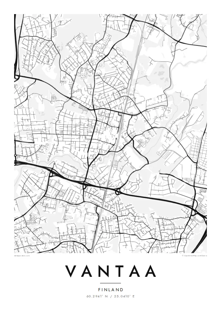
Helsinki Airport's crossing runways are the strongest geometric element in Vantaa, long clean strokes that anchor the centre of the map and contrast with the organic forms of the forests around them.
Postè kat minimalis · Finland
60.2941° N / 25.0410° E
Suburban centres, forests and a major airport spread across the river valley just north of Helsinki


Yon vil, senk atmosfè
Peze yon style pou wè li sou mi a. Chak style koute menm pri — enprime, ankadre oswa kòm fichye HD.
 Piksèl reyèl · fichye enpresyon 24 × 36″
Byen klè pou enprime
Sa a se yon zoom 100% sou vrè fichye enpresyon an. Chak afich — enprime, ankadre oswa telechaje — jenere sou sèvè nou yo nan 300 DPI, jiska 7,200 × 10,800 piksèl, konsa menm pi piti wout yo rete klè sou yon enpresyon 24 × 36″.
Sou mi a


Kat la
Vantaa has no single historic core. Instead the map shows several distinct centres, such as Tikkurila, Myyrmäki and Korso, each a cluster of apartment blocks, rail stations and shopping streets, separated by forests, fields and river valleys. It became a town in the early 1970s, formed from a rural municipality that had grown quickly as Helsinki expanded northward.
The largest single shape on the map is Helsinki Airport, whose runways cut long straight lines through the middle of the city and around which the Aviapolis business district has grown. Ring III, the outer ring road of the capital region, crosses Vantaa from west to east, while the Vantaa River winds south toward Helsinki through a green valley.
Vantaa is also home to Heureka, the Finnish Science Centre in Tikkurila. A Vantaa map poster suits the city's layered pattern: rail lines radiating out of Helsinki and the Ring Rail loop that dips beneath the airport, curving suburban streets, and large patches of forest that keep the neighbourhoods apart and give the composition room to breathe.
Helsinki Airport's crossing runways are the strongest geometric element in Vantaa, long clean strokes that anchor the centre of the map and contrast with the organic forms of the forests around them.
The river that gives the city its name meanders through farmland and parkland toward Helsinki, drawing a soft, looping line through the south and west of the city.
The outer ring road sweeps across Vantaa with large interchanges, a strong line that ties together the city's scattered centres, business parks and industrial areas.
Fè l pou ou
Ajoute yon dat, yon non oswa pwòp fraz pa w, chanje estil, gwosè oswa oryantasyon.
Apèsi gratis la se nan rezolisyon ba avèk yon watèrmak. Enpresyon ak fichye HD yo jenere nan 300 DPI, jiska 7,200 × 10,800 px, san watèrmak.
Poukisa Vantaa
Vantaa is where many people in the capital region actually live, commute and first arrive in Finland. A map of it recalls a first home, a neighbourhood near the rail line, or the airport where a new chapter began.
Add your own title, subtitle and coordinates, for example the name of a district and the year you moved in. Choose among five styles: Classic black and white keeps the forests crisp, while Blueprint suits the runway geometry.
Kòmande afich Vantaa a| Gwosè enpresyon | Rezolisyon | Fichye |
|---|---|---|
| 30 × 40 cm (11.8 × 15.7″) | 3,543 × 4,724 px | PNG · PDF |
| 29.7 × 42 cm (A3, 11.7 × 16.5″) | 3,508 × 4,961 px | PNG · PDF |
| 42 × 59.4 cm (A2, 16.5 × 23.4″) | 4,961 × 7,016 px | PNG · PDF |
| 45.7 × 61 cm (18 × 24″) | 5,400 × 7,200 px | PNG · PDF |
| 50 × 70 cm (19.7 × 27.6″) | 5,906 × 8,268 px | PNG · PDF |
| 61 × 91.4 cm (24 × 36″) | 7,200 × 10,800 px | PNG · PDF |
Pou konpare, apèsi gratis la gen 900 px lajè, li gen filigràn epi li fèt pou ekran. Fichye HD yo gen jiska 8 fwa plis rezolisyon nan chak direksyon epi yo enprime pwòp nan gwosè postè konplè.
Chwazi yon style anlè paj la, epi chwazi Afich Enprime — yon gwosè epi, si w vle, yon kad — oswa Fichye Dijital HD. Peman an fèt nan yon sèl etap, epi paj kòmand ou a mete ajou kou peman an konfime.
Li enprime sou papye mat premium 200 gsm nan youn nan sis gwosè, soti nan 30 × 40 cm rive nan 24 × 36″. Afich enprime yo kòmanse nan {printFrom}, livrezon enkli.
Wi. Chwazi yon kad an bwa solid nan koulè nwa, blan, chenn natirèl oswa bwa fonse. Li vin ak yon vit ki pa kase epi li pare pou pandye. Afich ankadre yo kòmanse nan {framedFrom}, livrezon enkli.
Livrezon gratis toupatou nan mond lan. Chak afich enprime nan patnè enpresyon ki pi pre nan plis pase 30 peyi, e li rive jeneralman nan 3–7 jou ouvrab. Ou ka swiv estati ak suivi anba My Orders.
Voye nou yon foto nan 14 jou apre livrezon an epi nou ap reenprime li gratis oswa remèt ou lajan w.
Wi. Nan editè a sou paj sa a, chanje tit la, soutit la ak liy kowòdone yo pou nenpòt sa w vle, epi chwazi yon style ak yon gwosè. Kòmand enprime, ankadre ak dijital yo tout itilize egzakteman desen w lan.
Pou $9 ou jwenn fichye PNG 300 DPI ak PDF pare-pou-enprime nan tout sis gwosè yo, san watèrmak, pou enprime kote w vle. Pa sèten toujou? Telechaje yon apèsi gratis ak watèrmak anvan.
