Whanganui River
The river enters in broad loops and flows past the centre to the sea. Its wide, curving course gives the poster a strong natural line against the straight streets on either side.
Postè kat minimalis · New Zealand
39.9333° S / 175.0500° E
A river city on New Zealand's west coast, gathered around the last broad bends of the Whanganui before the Tasman Sea.



Yon vil, senk atmosfè
Peze yon style pou wè li sou mi a. Chak style koute menm pri — enprime, ankadre oswa kòm fichye HD.
 Piksèl reyèl · fichye enpresyon 24 × 36″
Byen klè pou enprime
Sa a se yon zoom 100% sou vrè fichye enpresyon an. Chak afich — enprime, ankadre oswa telechaje — jenere sou sèvè nou yo nan 300 DPI, jiska 7,200 × 10,800 piksèl, konsa menm pi piti wout yo rete klè sou yon enpresyon 24 × 36″.
Sou mi a


Kat la
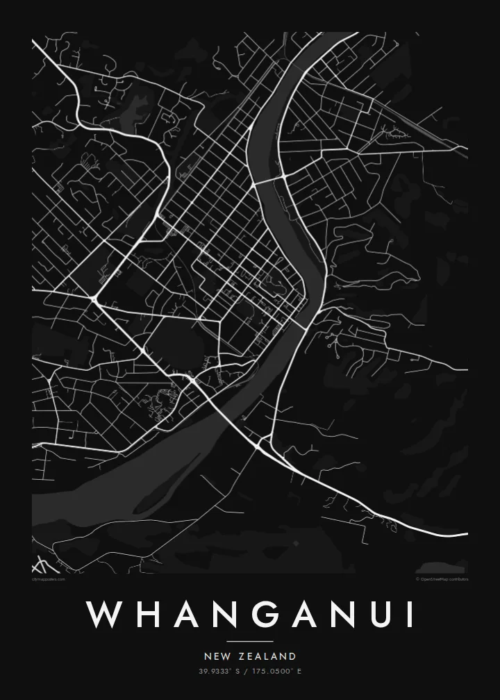
Whanganui sits near the mouth of the Whanganui River on the southwest coast of the North Island. The river is the centre of the map: it sweeps in from the north in wide bends, passes the city centre and runs out to the Tasman Sea a few kilometres downstream. Streets spread across both banks, with the main commercial grid on the western side.
Several bridges link the two halves of the city, and on the eastern bank the ground rises sharply to Durie Hill, reached by a tunnel and an elevator opened in 1919. In 2017 the Whanganui River became the first river in the world to be recognised as a legal person, a status tied to its importance to local iwi. A Whanganui map poster puts that river at the heart of the design.
Away from the river, the city opens into a regular grid of suburbs, parks and reserves, with the coastline and dunes to the southwest. The centre keeps many Victorian and Edwardian buildings, though on the map it is the structure that matters: long straight streets meeting the soft curves of the water.
The river enters in broad loops and flows past the centre to the sea. Its wide, curving course gives the poster a strong natural line against the straight streets on either side.
On the eastern bank, the land climbs steeply. Streets there follow the contours, and the hill's elevator, built into the slope, links it to the river flats below.
Near the coast, the river meets the Tasman Sea between sandy shores and stone moles. Including the mouth in the frame adds a clean coastal edge to the composition.
Fè l pou ou
Ajoute yon dat, yon non oswa pwòp fraz pa w, chanje estil, gwosè oswa oryantasyon.
Apèsi gratis la se nan rezolisyon ba avèk yon watèrmak. Enpresyon ak fichye HD yo jenere nan 300 DPI, jiska 7,200 × 10,800 px, san watèrmak.
Poukisa Whanganui
Whanganui matters to people who grew up by the river, rowed on it or travelled its length by canoe. A map of the city keeps that bond in view with a simple, honest image of streets and water.
Choose a title in English or te reo Māori, add a subtitle such as a date, and edit the coordinates line if you wish. Five styles are available, from Classic black & white to Blueprint. Order a matte print or download the $9 HD files.
Kòmande afich Whanganui a| Gwosè enpresyon | Rezolisyon | Fichye |
|---|---|---|
| 30 × 40 cm11.8 × 15.7″ | 3,543 × 4,724 px | PNG · PDF |
| 29.7 × 42 cm (A3)11.7 × 16.5″ | 3,508 × 4,961 px | PNG · PDF |
| 42 × 59.4 cm (A2)16.5 × 23.4″ | 4,961 × 7,016 px | PNG · PDF |
| 45.7 × 61 cm18 × 24″ | 5,400 × 7,200 px | PNG · PDF |
| 50 × 70 cm19.7 × 27.6″ | 5,906 × 8,268 px | PNG · PDF |
| 61 × 91.4 cm24 × 36″ | 7,200 × 10,800 px | PNG · PDF |
Pou konpare, apèsi gratis la gen 900 px lajè, li gen filigràn epi li fèt pou ekran. Fichye HD yo gen jiska 8 fwa plis rezolisyon nan chak direksyon epi yo enprime pwòp nan gwosè postè konplè.
Chwazi yon style anlè paj la, epi chwazi Afich Enprime — yon gwosè epi, si w vle, yon kad — oswa Fichye Dijital HD. Peman an fèt nan yon sèl etap, epi paj kòmand ou a mete ajou kou peman an konfime.
Li enprime sou papye mat premium 200 gsm nan youn nan sis gwosè, soti nan 30 × 40 cm rive nan 24 × 36″. Afich enprime yo kòmanse nan $39, livrezon enkli.
Wi. Chwazi yon kad an bwa solid nan koulè nwa, blan, chenn natirèl oswa bwa fonse. Li vin ak yon vit ki pa kase epi li pare pou pandye. Afich ankadre yo kòmanse nan $99, livrezon enkli.
Livrezon gratis nan plis pase 60 peyi. Chak afich enprime pa patnè enprimeri ki pi pre w la nan plis pase 30 peyi, e anjeneral li rive nan 3 a 7 jou ouvrab. Ou ka suiv estati a ak swivi kolis la nan Kòmand mwen yo. Kèk peyi pran 2 a 5 semèn, e kote nou poko livre, sit la di w sa anvan w peye.
Voye nou yon foto nan 14 jou apre livrezon an epi nou ap reenprime li gratis oswa remèt ou lajan w.
Wi. Nan editè a sou paj sa a, chanje tit la, soutit la ak liy kowòdone yo pou nenpòt sa w vle, epi chwazi yon style ak yon gwosè. Kòmand enprime, ankadre ak dijital yo tout itilize egzakteman desen w lan.
Pou $9 ou jwenn fichye PNG 300 DPI ak PDF pare-pou-enprime nan tout sis gwosè yo, san watèrmak, pou enprime kote w vle. Pa sèten toujou? Telechaje yon apèsi gratis ak watèrmak anvan.
