Rounded outline
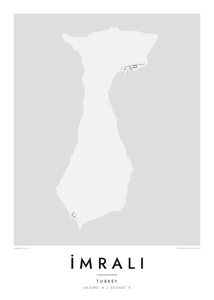
The island's coast is smooth and only lightly indented. The map shows a compact, soft-edged form surrounded by a wide stretch of open water.
Poster minimalista con mappa · Turchia
40.5382° N / 28.5352° E
A compact, hilly island in the southern Sea of Marmara, with a smooth coastline and few marked features.


Una città, cinque atmosfere
Tocca uno stile per vederlo a parete. Ogni stile costa lo stesso — stampato, incorniciato o in file HD.
 Pixel reali · file di stampa 24 × 36″
Nitido in stampa
Questo è un ritaglio al 100% del vero file di stampa. Ogni poster — stampato, incorniciato o scaricato — viene renderizzato sui nostri server a 300 DPI, fino a 7,200 × 10,800 pixel, così anche le strade più piccole restano nitide su una stampa 24 × 36″.
Sulla parete


La mappa
İmralı lies in the southern Sea of Marmara, near the mouth of the Gulf of Gemlik and within sight of the Bursa coastline. On a map it is a small, rounded island with a gently curving outline and a hilly interior. It has almost no marked roads or settlements. Its shape is simple, closer to a pebble than to the jagged islands of the Aegean.
The island has served as a prison since the 1930s, and access has long been limited to the authorities. Since 1999 it has held Abdullah Öcalan, which has made the name widely known in Turkey and abroad. The island therefore stays largely closed to visitors, and maps show few details of its interior.
From the Marmara coast it sits low on the horizon between the mainland and open water. An İmralı map poster treats the island purely as geography: a clean outline in the sea, with the surrounding coast and water giving scale to a place better known by name than by sight.
The island's coast is smooth and only lightly indented. The map shows a compact, soft-edged form surrounded by a wide stretch of open water.
The island lies near the mouth of the Gulf of Gemlik, between the southern coast and the open sea, which frames it clearly on the page.
Access is restricted and there has been little development, so the interior carries few roads or buildings. The hills alone define the map.
Personalizzalo
Aggiungi una data, un nome o una frase tua, cambia stile, formato o orientamento.
L'anteprima gratuita è a bassa risoluzione e con filigrana. Stampe e file HD vengono renderizzati a 300 DPI, fino a 7,200 × 10,800 px, senza filigrana.
Perché İmralı
Some people want the island for its place in modern Turkish history, others simply for its shape in the Marmara. Either way the print is restrained and neutral, a piece of geography rather than a statement on the wall.
Change the title and subtitle to suit your purpose, keep the coordinates line, and pick from five styles, such as Classic black & white or Paper. The free watermarked preview lets you check the framing before you choose files or a print.
Ordina il poster İmralı| Formato di stampa | Risoluzione | File |
|---|---|---|
| 30 × 40 cm (11.8 × 15.7″) | 3,543 × 4,724 px | PNG · PDF |
| 29.7 × 42 cm (A3, 11.7 × 16.5″) | 3,508 × 4,961 px | PNG · PDF |
| 42 × 59.4 cm (A2, 16.5 × 23.4″) | 4,961 × 7,016 px | PNG · PDF |
| 45.7 × 61 cm (18 × 24″) | 5,400 × 7,200 px | PNG · PDF |
| 50 × 70 cm (19.7 × 27.6″) | 5,906 × 8,268 px | PNG · PDF |
| 61 × 91.4 cm (24 × 36″) | 7,200 × 10,800 px | PNG · PDF |
Per confronto, l'anteprima gratuita è larga 900 px, ha la filigrana ed è pensata per gli schermi. I file HD hanno fino a 8 volte la risoluzione in ogni direzione e si stampano in modo nitido nel formato poster completo.
Scegli uno stile in cima alla pagina, poi seleziona Poster Stampato — una misura e, se vuoi, una cornice — oppure File Digitali HD. Il checkout richiede un solo passaggio e la pagina del tuo ordine si aggiorna non appena il pagamento va a buon fine.
Viene stampato su carta opaca premium da 200 gsm in una di sei misure, da 30 × 40 cm a 24 × 36″. I poster stampati partono da {printFrom}, spedizione inclusa.
Sì. Scegli una cornice in legno massello nera, bianca, in rovere naturale o legno scuro. Include un vetro infrangibile ed è pronta da appendere. I poster incorniciati partono da {framedFrom}, spedizione inclusa.
La spedizione è gratuita in tutto il mondo. Ogni poster viene stampato dal partner di stampa più vicino tra i nostri, in oltre 30 paesi, e di solito arriva in 3–7 giorni lavorativi. Puoi seguire stato e tracking in I Miei Ordini.
Inviaci una foto entro 14 giorni dalla consegna e lo ristamperemo gratuitamente o ti rimborseremo.
Sì. Nell'editor di questa pagina puoi modificare il titolo, il sottotitolo e la riga delle coordinate come preferisci, e scegliere stile e misura. Gli ordini stampati, incorniciati e digitali usano esattamente il tuo design.
Per $9 ricevi file PNG a 300 DPI e PDF pronti per la stampa in tutte e sei le misure, senza filigrana, da stampare ovunque. Non sei ancora sicuro? Scarica prima un'anteprima gratuita con filigrana.
