Hills in town
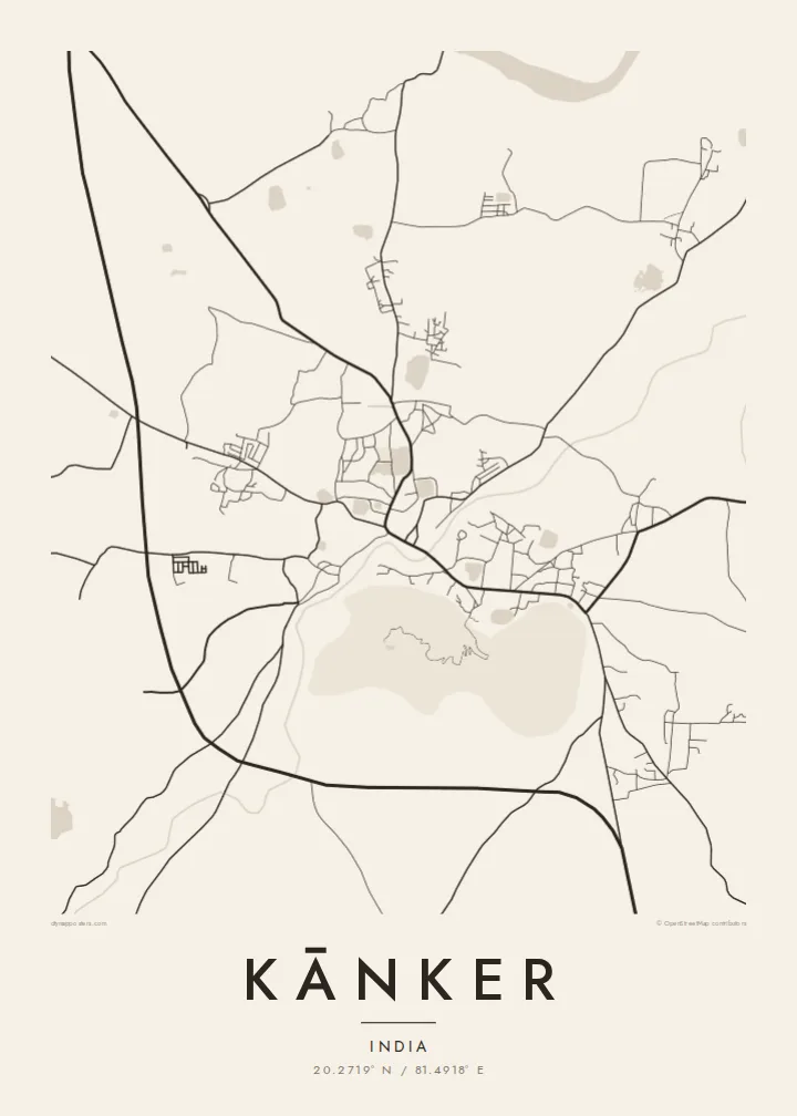
Rocky, forested hills rise around and within the town. The streets curve around them, leaving empty areas that give the map a distinctive, sculpted look.
Poster minimalista con mappa · India
20.2719° N / 81.4918° E
A district town in Chhattisgarh set among rocky hills, with the Doodh River curving past its compact centre.




Una città, cinque atmosfere
Tocca uno stile per vederlo a parete. Ogni stile costa lo stesso — stampato, incorniciato o in file HD.
 Pixel reali · file di stampa 24 × 36″
Nitido in stampa
Questo è un ritaglio al 100% del vero file di stampa. Ogni poster — stampato, incorniciato o scaricato — viene renderizzato sui nostri server a 300 DPI, fino a 7,200 × 10,800 pixel, così anche le strade più piccole restano nitide su una stampa 24 × 36″.
Sulla parete


La mappa
Kānker is the headquarters of Kanker district in northern Chhattisgarh, at the gateway to the Bastar region. It was once the seat of a small princely state, and the town grew around its old centre, close to the Doodh River, a small stream that curves along the edge of town before joining larger rivers further on.
What sets Kānker apart on a map is its setting: rocky, wooded hills rise directly around the town and even between its neighbourhoods, so the streets bend around them rather than running straight. The national highway linking Raipur with Jagdalpur passes through the town and forms its main axis, with newer districts growing along it.
A Kānker map poster turns this interplay between hills and streets into a strong graphic image. The dense centre, the river's curve and the highway give the print structure, while the empty spaces of the hills create natural pauses. It is an unusual townscape, shaped as much by the land as by planning.
Rocky, forested hills rise around and within the town. The streets curve around them, leaving empty areas that give the map a distinctive, sculpted look.
A small river winds along the edge of the town. Its curving line adds a soft, natural element to the composition and marks the older side of Kānker.
The national highway between Raipur and Jagdalpur runs through the town. It forms a clear axis across the poster, with newer neighbourhoods growing along it.
Personalizzalo
Aggiungi una data, un nome o una frase tua, cambia stile, formato o orientamento.
L'anteprima gratuita è a bassa risoluzione e con filigrana. Stampe e file HD vengono renderizzati a 300 DPI, fino a 7,200 × 10,800 px, senza filigrana.
Perché Kānker
For people from Kānker living in Raipur, elsewhere in India or abroad, a map of the town brings back the hills, the river and the familiar roads in a simple, lasting form.
You can personalise the title and subtitle, add a date or a family name, and choose one of five styles. Paper gives a soft, warm finish, while Classic black & white keeps every line sharp.
Ordina il poster Kānker| Formato di stampa | Risoluzione | File |
|---|---|---|
| 30 × 40 cm (11.8 × 15.7″) | 3,543 × 4,724 px | PNG · PDF |
| 29.7 × 42 cm (A3, 11.7 × 16.5″) | 3,508 × 4,961 px | PNG · PDF |
| 42 × 59.4 cm (A2, 16.5 × 23.4″) | 4,961 × 7,016 px | PNG · PDF |
| 45.7 × 61 cm (18 × 24″) | 5,400 × 7,200 px | PNG · PDF |
| 50 × 70 cm (19.7 × 27.6″) | 5,906 × 8,268 px | PNG · PDF |
| 61 × 91.4 cm (24 × 36″) | 7,200 × 10,800 px | PNG · PDF |
Per confronto, l'anteprima gratuita è larga 900 px, ha la filigrana ed è pensata per gli schermi. I file HD hanno fino a 8 volte la risoluzione in ogni direzione e si stampano in modo nitido nel formato poster completo.
Scegli uno stile in cima alla pagina, poi seleziona Poster Stampato — una misura e, se vuoi, una cornice — oppure File Digitali HD. Il checkout richiede un solo passaggio e la pagina del tuo ordine si aggiorna non appena il pagamento va a buon fine.
Viene stampato su carta opaca premium da 200 gsm in una di sei misure, da 30 × 40 cm a 24 × 36″. I poster stampati partono da {printFrom}, spedizione inclusa.
Sì. Scegli una cornice in legno massello nera, bianca, in rovere naturale o legno scuro. Include un vetro infrangibile ed è pronta da appendere. I poster incorniciati partono da {framedFrom}, spedizione inclusa.
La spedizione è gratuita in tutto il mondo. Ogni poster viene stampato dal partner di stampa a noi più vicino tra quelli presenti in oltre 30 paesi e di solito arriva in 3–7 giorni lavorativi. Puoi seguire lo stato e il tracking in I miei ordini. Per alcuni paesi servono 2–5 settimane e, dove non spediamo ancora, il sito te lo dice prima del pagamento.
Inviaci una foto entro 14 giorni dalla consegna e lo ristamperemo gratuitamente o ti rimborseremo.
Sì. Nell'editor di questa pagina puoi modificare il titolo, il sottotitolo e la riga delle coordinate come preferisci, e scegliere stile e misura. Gli ordini stampati, incorniciati e digitali usano esattamente il tuo design.
Per $9 ricevi file PNG a 300 DPI e PDF pronti per la stampa in tutte e sei le misure, senza filigrana, da stampare ovunque. Non sei ancora sicuro? Scarica prima un'anteprima gratuita con filigrana.
Nelle vicinanze
