Village centres
Several former villages make up the municipality. Each appears on the map as a small, distinct cluster around its own church and square.
Poster minimalista con mappa · Belgio
50.9663° N / 3.9859° E
A Flemish municipality of linked villages, with a railway line crossing gently rolling farmland between Aalst and Ghent.


Una città, cinque atmosfere
Tocca uno stile per vederlo a parete. Ogni stile costa lo stesso — stampato, incorniciato o in file HD.
 Pixel reali · file di stampa 24 × 36″
Nitido in stampa
Questo è un ritaglio al 100% del vero file di stampa. Ogni poster — stampato, incorniciato o scaricato — viene renderizzato sui nostri server a 300 DPI, fino a 7,200 × 10,800 pixel, così anche le strade più piccole restano nitide su una stampa 24 × 36″.
Sulla parete


La mappa
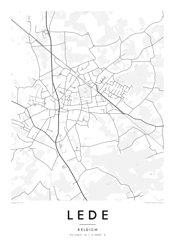
Lede is in East Flanders, Belgium, just west of Aalst and on the way toward Ghent. Like many Flemish municipalities, it is made up of several former villages joined together administratively. Each keeps its own church and small centre, and the map shows these separate clusters rather than one large town.
The railway between Brussels and Ghent passes through the municipality. It forms one of the few long straight lines on the map. Elsewhere the roads follow older routes between villages, and many houses line those roads, a pattern common in Flanders. Between them, farmland and small woods cover the gently rolling ground.
A Lede map poster shows this pattern clearly: several village centres, ribbons of houses along the roads, and fields filling the gaps. It is a quiet and detailed composition. Anyone from one of the villages will find their own street and church, and the whole looks balanced on the wall.
Several former villages make up the municipality. Each appears on the map as a small, distinct cluster around its own church and square.
The Brussels–Ghent railway crosses the area in a long, straight line. It stands out clearly against the softer, winding pattern of the local roads.
Houses line the roads between villages instead of forming compact blocks. On the poster, these roads look like threads connecting the settlements.
Personalizzalo
Aggiungi una data, un nome o una frase tua, cambia stile, formato o orientamento.
L'anteprima gratuita è a bassa risoluzione e con filigrana. Stampe e file HD vengono renderizzati a 300 DPI, fino a 7,200 × 10,800 px, senza filigrana.
Perché Lede
This map suits anyone who grew up in Lede or one of its villages, or who commutes from here to Ghent, Aalst or Brussels. It shows home at the scale of daily life, from the station to the church square to the fields.
You can personalise the title, subtitle and coordinates line in Dutch or any other language. There are five styles: Classic black & white, Noir, Paper, Blueprint and Sand. Classic black & white suits the fine Flemish road pattern best.
Ordina il poster Lede| Formato di stampa | Risoluzione | File |
|---|---|---|
| 30 × 40 cm (11.8 × 15.7″) | 3,543 × 4,724 px | PNG · PDF |
| 29.7 × 42 cm (A3, 11.7 × 16.5″) | 3,508 × 4,961 px | PNG · PDF |
| 42 × 59.4 cm (A2, 16.5 × 23.4″) | 4,961 × 7,016 px | PNG · PDF |
| 45.7 × 61 cm (18 × 24″) | 5,400 × 7,200 px | PNG · PDF |
| 50 × 70 cm (19.7 × 27.6″) | 5,906 × 8,268 px | PNG · PDF |
| 61 × 91.4 cm (24 × 36″) | 7,200 × 10,800 px | PNG · PDF |
Per confronto, l'anteprima gratuita è larga 900 px, ha la filigrana ed è pensata per gli schermi. I file HD hanno fino a 8 volte la risoluzione in ogni direzione e si stampano in modo nitido nel formato poster completo.
Scegli uno stile in cima alla pagina, poi seleziona Poster Stampato — una misura e, se vuoi, una cornice — oppure File Digitali HD. Il checkout richiede un solo passaggio e la pagina del tuo ordine si aggiorna non appena il pagamento va a buon fine.
Viene stampato su carta opaca premium da 200 gsm in una di sei misure, da 30 × 40 cm a 24 × 36″. I poster stampati partono da {printFrom}, spedizione inclusa.
Sì. Scegli una cornice in legno massello nera, bianca, in rovere naturale o legno scuro. Include un vetro infrangibile ed è pronta da appendere. I poster incorniciati partono da {framedFrom}, spedizione inclusa.
La spedizione è gratuita in tutto il mondo. Ogni poster viene stampato dal partner di stampa a noi più vicino tra quelli presenti in oltre 30 paesi e di solito arriva in 3–7 giorni lavorativi. Puoi seguire lo stato e il tracking in I miei ordini. Per alcuni paesi servono 2–5 settimane e, dove non spediamo ancora, il sito te lo dice prima del pagamento.
Inviaci una foto entro 14 giorni dalla consegna e lo ristamperemo gratuitamente o ti rimborseremo.
Sì. Nell'editor di questa pagina puoi modificare il titolo, il sottotitolo e la riga delle coordinate come preferisci, e scegliere stile e misura. Gli ordini stampati, incorniciati e digitali usano esattamente il tuo design.
Per $9 ricevi file PNG a 300 DPI e PDF pronti per la stampa in tutte e sei le misure, senza filigrana, da stampare ovunque. Non sei ancora sicuro? Scarica prima un'anteprima gratuita con filigrana.
Nelle vicinanze
