Scattered hamlets
Houses gather in small groups across the slopes, not in one centre. The map shows many little clusters linked by lanes, each hamlet with its own name.
Poster minimalista con mappa · Francia
45.8608° N / 6.3700° E
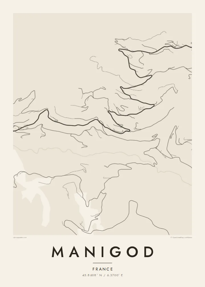
A scatter of hamlets on steep slopes above a green valley in the Aravis, with roads climbing to two passes.




Una città, cinque atmosfere
Tocca uno stile per vederlo a parete. Ogni stile costa lo stesso — stampato, incorniciato o in file HD.
 Pixel reali · file di stampa 24 × 36″
Nitido in stampa
Questo è un ritaglio al 100% del vero file di stampa. Ogni poster — stampato, incorniciato o scaricato — viene renderizzato sui nostri server a 300 DPI, fino a 7,200 × 10,800 pixel, così anche le strade più piccole restano nitide su una stampa 24 × 36″.
Sulla parete


La mappa
Manigod is less a village than a network of hamlets spread across the slopes of the Aravis massif in Haute-Savoie. The small centre with its church sits above the valley, and chalets and farms are dotted over the hillsides around it. On a map, winding lanes link them together and climb toward the Col de la Croix Fry and the Col de Merdassier.
The ski area at the passes connects with La Clusaz, which makes Manigod a quieter way into a larger domain. The commune lies in reblochon country, and farming still shapes much of the landscape. Pastures and hay meadows fill the ground between the hamlets, and the Fier begins its course in these mountains.
A Manigod map poster is all about dispersion. There is no dense grid, only threads of road and track tying together many small groups of houses, with streams running down to the valley floor. It is a picture of mountain farming life more than of a resort, and it looks especially good in a minimal, open style.
Houses gather in small groups across the slopes, not in one centre. The map shows many little clusters linked by lanes, each hamlet with its own name.
The road climbs to this pass between Manigod and La Clusaz. Its chalets and lift bases make it one of the few denser spots on the map.
The Fier flows through the valley below the village toward Thônes. It is the line that collects the streams coming down from the hamlets on either side.
Personalizzalo
Aggiungi una data, un nome o una frase tua, cambia stile, formato o orientamento.
L'anteprima gratuita è a bassa risoluzione e con filigrana. Stampe e file HD vengono renderizzati a 300 DPI, fino a 7,200 × 10,800 px, senza filigrana.
Perché Manigod
Manigod suits people who prefer the quieter side of the Aravis, whether that means a family chalet on a hillside or a farm stay in summer. Its scattered shape makes a map with plenty of space, one that feels close to the place itself.
Choose the title, subtitle and coordinates, then one of five styles: Classic black & white, Noir, Paper, Blueprint or Sand. A free watermarked preview shows the result first. HD files or printed matte posters follow when you are ready.
Ordina il poster Manigod| Formato di stampa | Risoluzione | File |
|---|---|---|
| 30 × 40 cm (11.8 × 15.7″) | 3,543 × 4,724 px | PNG · PDF |
| 29.7 × 42 cm (A3, 11.7 × 16.5″) | 3,508 × 4,961 px | PNG · PDF |
| 42 × 59.4 cm (A2, 16.5 × 23.4″) | 4,961 × 7,016 px | PNG · PDF |
| 45.7 × 61 cm (18 × 24″) | 5,400 × 7,200 px | PNG · PDF |
| 50 × 70 cm (19.7 × 27.6″) | 5,906 × 8,268 px | PNG · PDF |
| 61 × 91.4 cm (24 × 36″) | 7,200 × 10,800 px | PNG · PDF |
Per confronto, l'anteprima gratuita è larga 900 px, ha la filigrana ed è pensata per gli schermi. I file HD hanno fino a 8 volte la risoluzione in ogni direzione e si stampano in modo nitido nel formato poster completo.
Scegli uno stile in cima alla pagina, poi seleziona Poster Stampato — una misura e, se vuoi, una cornice — oppure File Digitali HD. Il checkout richiede un solo passaggio e la pagina del tuo ordine si aggiorna non appena il pagamento va a buon fine.
Viene stampato su carta opaca premium da 200 gsm in una di sei misure, da 30 × 40 cm a 24 × 36″. I poster stampati partono da {printFrom}, spedizione inclusa.
Sì. Scegli una cornice in legno massello nera, bianca, in rovere naturale o legno scuro. Include un vetro infrangibile ed è pronta da appendere. I poster incorniciati partono da {framedFrom}, spedizione inclusa.
La spedizione è gratuita in tutto il mondo. Ogni poster viene stampato dal partner di stampa più vicino tra i nostri, in oltre 30 paesi, e di solito arriva in 3–7 giorni lavorativi. Puoi seguire stato e tracking in I Miei Ordini.
Inviaci una foto entro 14 giorni dalla consegna e lo ristamperemo gratuitamente o ti rimborseremo.
Sì. Nell'editor di questa pagina puoi modificare il titolo, il sottotitolo e la riga delle coordinate come preferisci, e scegliere stile e misura. Gli ordini stampati, incorniciati e digitali usano esattamente il tuo design.
Per $9 ricevi file PNG a 300 DPI e PDF pronti per la stampa in tutte e sei le misure, senza filigrana, da stampare ovunque. Non sei ancora sicuro? Scarica prima un'anteprima gratuita con filigrana.
Nelle vicinanze
