Colonial grid
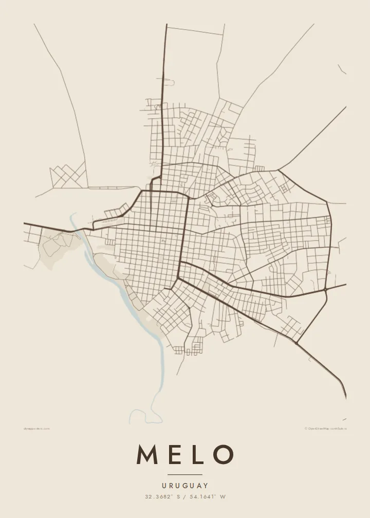
Square blocks and straight streets cover the city in a regular pattern, arranged around central plazas in the manner of many Uruguayan towns.
Poster minimalista con mappa · Uruguay
32.3682° S / 54.1641° W
A regular colonial grid in the rolling grasslands of northeast Uruguay, bordered by a winding stream


Una città, cinque atmosfere
Tocca uno stile per vederlo a parete. Ogni stile costa lo stesso — stampato, incorniciato o in file HD.
 Pixel reali · file di stampa 24 × 36″
Nitido in stampa
Questo è un ritaglio al 100% del vero file di stampa. Ogni poster — stampato, incorniciato o scaricato — viene renderizzato sui nostri server a 300 DPI, fino a 7,200 × 10,800 pixel, così anche le strade più piccole restano nitide su una stampa 24 × 36″.
Sulla parete


La mappa
Melo is the capital of Cerro Largo department in northeastern Uruguay, not far from the border with Brazil. Founded in the late eighteenth century, it follows the regular grid common to towns of the region: square blocks arranged around central plazas, with straight streets running out toward the edges of the city.
The Arroyo Conventos winds along the town, and its curving course breaks the otherwise strict geometry of the street plan. Beyond the built-up area, the map opens onto the gently rolling grasslands of the Uruguayan interior, cattle country crossed by roads leading toward the border and toward Montevideo far to the south.
A Melo map poster is a clear portrait of a planned town on open land. In black and white the grid reads as a precise pattern of squares, the stream adds a single soft curve, and the pale countryside around it gives the composition room. It is orderly and restful, much like the region itself.
Square blocks and straight streets cover the city in a regular pattern, arranged around central plazas in the manner of many Uruguayan towns.
The stream curves along the town, a natural line that softens the grid and provides open, green space along its banks.
Beyond the city the map opens onto rolling pasture, crossed by a few long roads heading toward Brazil and the rest of Uruguay.
Personalizzalo
Aggiungi una data, un nome o una frase tua, cambia stile, formato o orientamento.
L'anteprima gratuita è a bassa risoluzione e con filigrana. Stampe e file HD vengono renderizzati a 300 DPI, fino a 7,200 × 10,800 px, senza filigrana.
Perché Melo
A map of Melo is a fitting piece for people from Cerro Largo, for families with roots in the northeast and for anyone who enjoys the precision of a planned town. The grid makes a crisp, graphic image.
You can edit the title, subtitle and coordinates line and choose from five styles, including Paper and Noir. HD files cost $9 in six print sizes, and printed posters come on matte paper with an optional wooden frame.
Ordina il poster Melo| Formato di stampa | Risoluzione | File |
|---|---|---|
| 30 × 40 cm (11.8 × 15.7″) | 3,543 × 4,724 px | PNG · PDF |
| 29.7 × 42 cm (A3, 11.7 × 16.5″) | 3,508 × 4,961 px | PNG · PDF |
| 42 × 59.4 cm (A2, 16.5 × 23.4″) | 4,961 × 7,016 px | PNG · PDF |
| 45.7 × 61 cm (18 × 24″) | 5,400 × 7,200 px | PNG · PDF |
| 50 × 70 cm (19.7 × 27.6″) | 5,906 × 8,268 px | PNG · PDF |
| 61 × 91.4 cm (24 × 36″) | 7,200 × 10,800 px | PNG · PDF |
Per confronto, l'anteprima gratuita è larga 900 px, ha la filigrana ed è pensata per gli schermi. I file HD hanno fino a 8 volte la risoluzione in ogni direzione e si stampano in modo nitido nel formato poster completo.
Scegli uno stile in cima alla pagina, poi seleziona Poster Stampato — una misura e, se vuoi, una cornice — oppure File Digitali HD. Il checkout richiede un solo passaggio e la pagina del tuo ordine si aggiorna non appena il pagamento va a buon fine.
Viene stampato su carta opaca premium da 200 gsm in una di sei misure, da 30 × 40 cm a 24 × 36″. I poster stampati partono da {printFrom}, spedizione inclusa.
Sì. Scegli una cornice in legno massello nera, bianca, in rovere naturale o legno scuro. Include un vetro infrangibile ed è pronta da appendere. I poster incorniciati partono da {framedFrom}, spedizione inclusa.
La spedizione è gratuita in tutto il mondo. Ogni poster viene stampato dal partner di stampa più vicino tra i nostri, in oltre 30 paesi, e di solito arriva in 3–7 giorni lavorativi. Puoi seguire stato e tracking in I Miei Ordini.
Inviaci una foto entro 14 giorni dalla consegna e lo ristamperemo gratuitamente o ti rimborseremo.
Sì. Nell'editor di questa pagina puoi modificare il titolo, il sottotitolo e la riga delle coordinate come preferisci, e scegliere stile e misura. Gli ordini stampati, incorniciati e digitali usano esattamente il tuo design.
Per $9 ricevi file PNG a 300 DPI e PDF pronti per la stampa in tutte e sei le misure, senza filigrana, da stampare ovunque. Non sei ancora sicuro? Scarica prima un'anteprima gratuita con filigrana.
