Bayfront town
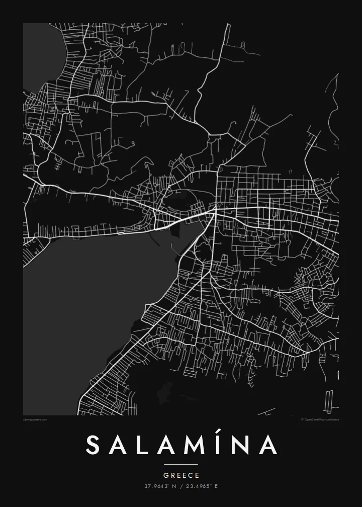
The town wraps around a sheltered bay. Its dense streets meet the water along a clearly defined curve.
Poster minimalista con mappa · Grecia
37.9643° N / 23.4965° E
The main town of Salamis island, spread along a sheltered bay, facing the waters where one of antiquity's great naval battles was fought



Una città, cinque atmosfere
Tocca uno stile per vederlo a parete. Ogni stile costa lo stesso — stampato, incorniciato o in file HD.
 Pixel reali · file di stampa 24 × 36″
Nitido in stampa
Questo è un ritaglio al 100% del vero file di stampa. Ogni poster — stampato, incorniciato o scaricato — viene renderizzato sui nostri server a 300 DPI, fino a 7,200 × 10,800 pixel, così anche le strade più piccole restano nitide su una stampa 24 × 36″.
Sulla parete


La mappa
Salamína is the chief town of Salamis, the largest island in the Saronic Gulf, a short ferry ride from Piraeus. From above, the town curves around a sheltered bay. Its dense streets run back from the waterfront toward the rocky, lightly built hills of the interior, and the island's irregular coastline bends and folds around it.
The island's name is best known from the Battle of Salamis in 480 BC. In that battle the Greek fleet defeated the Persian navy in the narrow strait between Salamis and the mainland. Today the island is closely tied to the Athens area, with frequent ferries and many summer homes.
A Salamína map poster pairs a busy town with a complex shoreline. The streets fill the lower ground around the bay. The coast forms a sharp, detailed edge, and the surrounding sea leaves wide pale areas that give the composition a strong maritime character.
The town wraps around a sheltered bay. Its dense streets meet the water along a clearly defined curve.
Headlands, coves and inlets make the island's outline complicated and detailed. They give the poster a strong, recognisable edge.
Open sea and the narrow straits toward the mainland surround the island. They give the map a calm, spacious frame.
Personalizzalo
Aggiungi una data, un nome o una frase tua, cambia stile, formato o orientamento.
L'anteprima gratuita è a bassa risoluzione e con filigrana. Stampe e file HD vengono renderizzati a 300 DPI, fino a 7,200 × 10,800 px, senza filigrana.
Perché Salamína
Salamína appeals to islanders, to Athenians who spend summers there and to anyone who knows the story of the ancient battle. A map of its bay and coastline is both personal and historically resonant.
You can personalise the title, subtitle and coordinates line, for example with the Greek name or a summer year. Choose one of five styles: Classic black & white, Noir, Paper, Blueprint or Sand.
Ordina il poster Salamína| Formato di stampa | Risoluzione | File |
|---|---|---|
| 30 × 40 cm (11.8 × 15.7″) | 3,543 × 4,724 px | PNG · PDF |
| 29.7 × 42 cm (A3, 11.7 × 16.5″) | 3,508 × 4,961 px | PNG · PDF |
| 42 × 59.4 cm (A2, 16.5 × 23.4″) | 4,961 × 7,016 px | PNG · PDF |
| 45.7 × 61 cm (18 × 24″) | 5,400 × 7,200 px | PNG · PDF |
| 50 × 70 cm (19.7 × 27.6″) | 5,906 × 8,268 px | PNG · PDF |
| 61 × 91.4 cm (24 × 36″) | 7,200 × 10,800 px | PNG · PDF |
Per confronto, l'anteprima gratuita è larga 900 px, ha la filigrana ed è pensata per gli schermi. I file HD hanno fino a 8 volte la risoluzione in ogni direzione e si stampano in modo nitido nel formato poster completo.
Scegli uno stile in cima alla pagina, poi seleziona Poster Stampato — una misura e, se vuoi, una cornice — oppure File Digitali HD. Il checkout richiede un solo passaggio e la pagina del tuo ordine si aggiorna non appena il pagamento va a buon fine.
Viene stampato su carta opaca premium da 200 gsm in una di sei misure, da 30 × 40 cm a 24 × 36″. I poster stampati partono da {printFrom}, spedizione inclusa.
Sì. Scegli una cornice in legno massello nera, bianca, in rovere naturale o legno scuro. Include un vetro infrangibile ed è pronta da appendere. I poster incorniciati partono da {framedFrom}, spedizione inclusa.
La spedizione è gratuita in tutto il mondo. Ogni poster viene stampato dal partner di stampa a noi più vicino tra quelli presenti in oltre 30 paesi e di solito arriva in 3–7 giorni lavorativi. Puoi seguire lo stato e il tracking in I miei ordini. Per alcuni paesi servono 2–5 settimane e, dove non spediamo ancora, il sito te lo dice prima del pagamento.
Inviaci una foto entro 14 giorni dalla consegna e lo ristamperemo gratuitamente o ti rimborseremo.
Sì. Nell'editor di questa pagina puoi modificare il titolo, il sottotitolo e la riga delle coordinate come preferisci, e scegliere stile e misura. Gli ordini stampati, incorniciati e digitali usano esattamente il tuo design.
Per $9 ricevi file PNG a 300 DPI e PDF pronti per la stampa in tutte e sei le misure, senza filigrana, da stampare ovunque. Non sei ancora sicuro? Scarica prima un'anteprima gratuita con filigrana.
Nelle vicinanze
