Mediterranean shore
The coastline runs in a long, nearly straight line along the western edge of the city. On the poster it forms a clean boundary, with the coastal road following just behind it.
Tabula geographica minimalis · Palestinian Territories
31.5016° N / 34.4667° E
A dense coastal city on the Mediterranean, with streets running between the old town and a long, straight shoreline.


Una urbs, quinque animi
Tange formam ut eam in pariete videas. Omnis forma eodem pretio constat — typis impressa, compagine inclusa, vel ut fasciculi HD.
 Pixelli veri · fasciculus impressionis 24 × 36″
Ad imprimendum acuta
Haec est particula 100% fasciculi impressionis veri. Omnis tabula — typis impressa, compagine inclusa, vel demissa — in servis nostris ad 300 DPI conficitur, usque ad 7,200 × 10,800 pixellos, ut etiam angustissimae viae in impressione 24 × 36″ nitidae maneant.
In pariete


Tabula
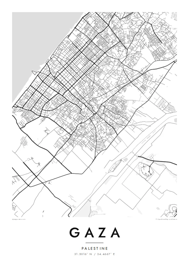
Gaza lies on a flat strip of coast facing the Mediterranean. From above, the plan runs inland from the shoreline. A coastal road follows the sea, neighbourhoods such as Rimal sit close to the water, and the older quarters around the historic centre lie further east. Main roads cross the city on a broadly north–south line and tie it to the rest of the Gaza Strip.
Gaza is among the oldest continuously inhabited cities in the region. For thousands of years it was a port and a trading stop on the routes between Egypt and the Levant. The Great Omari Mosque, long the centre of the old city, was among the historic buildings badly damaged in the war that began in 2023, along with much of the city's housing and streets.
A Gaza map poster records the city as a pattern of streets, blocks and coastline, drawn from open map data. It does not claim to show the city as it stands today. Instead it keeps the layout that generations have known, with the lines of neighbourhoods, markets and the sea road, in a quiet and plain form.
The coastline runs in a long, nearly straight line along the western edge of the city. On the poster it forms a clean boundary, with the coastal road following just behind it.
East of the newer seaside districts, the historic centre has a tighter, irregular pattern of lanes. This is the oldest part of the plan and the area around the Great Omari Mosque.
Long roads run the length of the Gaza Strip and pass through the city. They give the map its strong vertical lines between the sea and the eastern neighbourhoods.
Tuam fac
Adde diem, nomen vel versum tuum; muta stilum, magnitudinem vel directionem.
Specimen gratuitum resolutionis humilis est cum nota aquatica. Impressiones et fasciculi HD ad 300 DPI conficiuntur, usque ad 7,200 × 10,800 px, sine nota aquatica.
Cur Gaza
For many Palestinians and their families abroad, a map of Gaza keeps a place present: a street, a neighbourhood or a home that may no longer stand. The poster holds that memory in a calm and respectful form.
You can write your own title and subtitle, such as a family name, a neighbourhood or a date, and adjust the coordinates line. Choose from five styles, Classic black & white, Noir, Paper, Blueprint or Sand, as a $9 digital download or a printed poster.
Eme tabulam Gaza| Magnitudo impressionis | Resolutio | Fasciculi |
|---|---|---|
| 30 × 40 cm11.8 × 15.7″ | 3,543 × 4,724 px | PNG · PDF |
| 29.7 × 42 cm (A3)11.7 × 16.5″ | 3,508 × 4,961 px | PNG · PDF |
| 42 × 59.4 cm (A2)16.5 × 23.4″ | 4,961 × 7,016 px | PNG · PDF |
| 45.7 × 61 cm18 × 24″ | 5,400 × 7,200 px | PNG · PDF |
| 50 × 70 cm19.7 × 27.6″ | 5,906 × 8,268 px | PNG · PDF |
| 61 × 91.4 cm24 × 36″ | 7,200 × 10,800 px | PNG · PDF |
Comparationis causa, specimen gratuitum 900 px latum est, signo aquatico notatum et ad spectandum in quadris lucidis destinatum. Fasciculi HD usque ad octiens maiorem resolutionem in utramque partem habent et tota tabulae magnitudine pure imprimuntur.
Elige formam in summa pagina, deinde selige Tabulam Typis Impressam — magnitudinem et, si vis, compagem — vel Fasciculos Digitales HD. Emptio uno gradu conficitur, et pagina emptionis tuae statim renovatur ubi primum solutio confecta est.
In charta opaca praestanti 200 gsm typis imprimitur, una ex sex magnitudinibus, a 30 × 40 cm usque ad 24 × 36″. Tabulae typis impressae incipiunt a $39, missione inclusa.
Ita. Elige compagem ex solido ligno, colore nigro, albo, quercu naturali vel ligno obscuro. Vitro infrangibili instructa venit et ad suspendendum parata est. Tabulae compagine inclusae incipiunt a $99, missione inclusa.
Missio gratuita est in plus quam 60 terras. Quodque poster ab proximo ex sociis nostris typographicis in plus quam 30 terris imprimitur et plerumque intra 3–7 dies negotiales advenit. Statum et vestigium sub «Mea mandata» sequi potes. Quaedam terrae 2–5 hebdomades requirunt, et ubi nondum mittimus, situs te ante solutionem monet.
Mitte nobis imaginem intra 14 dies post missionem acceptam, et eam gratis iterum imprimemus vel pecuniam tibi reddemus.
Ita. In instrumento huius paginae, titulum, subtitulum et lineam coordinatarum ad libitum muta, et formam ac magnitudinem elige. Emptiones typis impressae, compagine inclusae et digitales omnes exacte figuram tuam adhibent.
Pro $9 accipis fasciculos PNG 300 DPI et PDF ad imprimendum paratos in omnibus sex magnitudinibus, sine nota aquatica, ut ubique imprimere possis. Nondum certus es? Prius specimen gratuitum cum nota aquatica demitte.
