Converging country roads
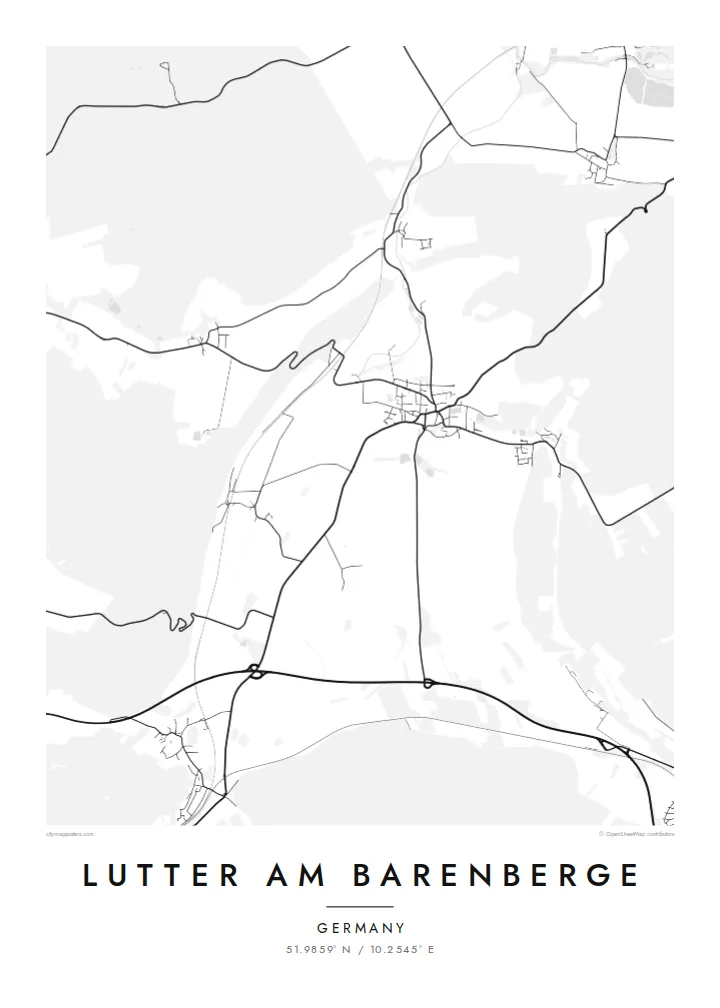
Several local roads meet in the village centre, giving the map a clear focal point from which lines radiate out across the surrounding farmland toward neighbouring villages.
Tabula geographica minimalis · Germany
51.9859° N / 10.2545° E
A small village core where country roads meet, framed by open fields and wooded higher ground on the northern edge of the Harz.


Una urbs, quinque animi
Tange formam ut eam in pariete videas. Omnis forma eodem pretio constat — typis impressa, compagine inclusa, vel ut fasciculi HD.
 Pixelli veri · fasciculus impressionis 24 × 36″
Ad imprimendum acuta
Haec est particula 100% fasciculi impressionis veri. Omnis tabula — typis impressa, compagine inclusa, vel demissa — in servis nostris ad 300 DPI conficitur, usque ad 7,200 × 10,800 pixellos, ut etiam angustissimae viae in impressione 24 × 36″ nitidae maneant.
In pariete


Tabula
Lutter am Barenberge sits in the rolling country north of the Harz, in the district of Goslar in Lower Saxony. On a map the village reads as a compact cluster of streets where several roads converge, with farmland spreading out in broad, irregular parcels and patches of woodland rising toward the higher ground. The name itself points to a nearby hill, the Barenberg, a reminder that the landscape here is shaped by gentle relief rather than flat plain.
The place entered European history in August 1626, when the Battle of Lutter was fought nearby during the Thirty Years' War. Imperial and Catholic League troops under Tilly defeated the army of King Christian IV of Denmark, a defeat that sharply weakened the Danish role in the war. Little of that drama shows on paper today. What remains visible is the quiet agricultural pattern that surrounded the battlefield then and still does now.
Since 2021 Lutter has belonged to the town of Langelsheim, yet it keeps its own distinct outline. A Lutter am Barenberge map poster captures that outline in fine lines: the village streets at the centre, the lanes and field tracks running outward, and the softer texture of forest at the margins. It is a small place, and the poster treats it with the same care as any large city.
Several local roads meet in the village centre, giving the map a clear focal point from which lines radiate out across the surrounding farmland toward neighbouring villages.
Large agricultural parcels surround the built-up area, and their boundaries and tracks form a loose geometric background that contrasts with the denser streets of the village.
Wooded higher ground lies within reach of the village, and the Barenberg that gives Lutter its name hints at the rising terrain that eventually becomes the Harz to the south.
Tuam fac
Adde diem, nomen vel versum tuum; muta stilum, magnitudinem vel directionem.
Specimen gratuitum resolutionis humilis est cum nota aquatica. Impressiones et fasciculi HD ad 300 DPI conficiuntur, usque ad 7,200 × 10,800 px, sine nota aquatica.
Cur Lutter am Barenberge
For people with family roots in the Goslar district, or for anyone interested in the Thirty Years' War, this map is a quiet way to keep a specific place in view. It is less about spectacle than about recognising the lanes you know, drawn with clarity and restraint.
You can set your own title and subtitle, add a date such as a wedding or a move, and adjust the coordinates line. Choose between Classic black & white, Noir, Paper, Blueprint and Sand, then download HD files for $9 or order a printed poster.
Eme tabulam Lutter am Barenberge| Magnitudo impressionis | Resolutio | Fasciculi |
|---|---|---|
| 30 × 40 cm11.8 × 15.7″ | 3,543 × 4,724 px | PNG · PDF |
| 29.7 × 42 cm (A3)11.7 × 16.5″ | 3,508 × 4,961 px | PNG · PDF |
| 42 × 59.4 cm (A2)16.5 × 23.4″ | 4,961 × 7,016 px | PNG · PDF |
| 45.7 × 61 cm18 × 24″ | 5,400 × 7,200 px | PNG · PDF |
| 50 × 70 cm19.7 × 27.6″ | 5,906 × 8,268 px | PNG · PDF |
| 61 × 91.4 cm24 × 36″ | 7,200 × 10,800 px | PNG · PDF |
Comparationis causa, specimen gratuitum 900 px latum est, signo aquatico notatum et ad spectandum in quadris lucidis destinatum. Fasciculi HD usque ad octiens maiorem resolutionem in utramque partem habent et tota tabulae magnitudine pure imprimuntur.
Elige formam in summa pagina, deinde selige Tabulam Typis Impressam — magnitudinem et, si vis, compagem — vel Fasciculos Digitales HD. Emptio uno gradu conficitur, et pagina emptionis tuae statim renovatur ubi primum solutio confecta est.
In charta opaca praestanti 200 gsm typis imprimitur, una ex sex magnitudinibus, a 30 × 40 cm usque ad 24 × 36″. Tabulae typis impressae incipiunt a $39, missione inclusa.
Ita. Elige compagem ex solido ligno, colore nigro, albo, quercu naturali vel ligno obscuro. Vitro infrangibili instructa venit et ad suspendendum parata est. Tabulae compagine inclusae incipiunt a $99, missione inclusa.
Missio gratuita est in plus quam 60 terras. Quodque poster ab proximo ex sociis nostris typographicis in plus quam 30 terris imprimitur et plerumque intra 3–7 dies negotiales advenit. Statum et vestigium sub «Mea mandata» sequi potes. Quaedam terrae 2–5 hebdomades requirunt, et ubi nondum mittimus, situs te ante solutionem monet.
Mitte nobis imaginem intra 14 dies post missionem acceptam, et eam gratis iterum imprimemus vel pecuniam tibi reddemus.
Ita. In instrumento huius paginae, titulum, subtitulum et lineam coordinatarum ad libitum muta, et formam ac magnitudinem elige. Emptiones typis impressae, compagine inclusae et digitales omnes exacte figuram tuam adhibent.
Pro $9 accipis fasciculos PNG 300 DPI et PDF ad imprimendum paratos in omnibus sex magnitudinibus, sine nota aquatica, ut ubique imprimere possis. Nondum certus es? Prius specimen gratuitum cum nota aquatica demitte.
