The river confluence
The Saigon and Đồng Nai rivers merge here to form the Nhà Bè river. Two broad channels become one in a wide bend that dominates the upper part of the map.
Tabula geographica minimalis · Vietnam
10.6967° N / 106.7403° E
Low, water-laced ground on Ho Chi Minh City's southern edge, where great rivers meet and turn toward the sea


Una urbs, quinque animi
Tange formam ut eam in pariete videas. Omnis forma eodem pretio constat — typis impressa, compagine inclusa, vel ut fasciculi HD.
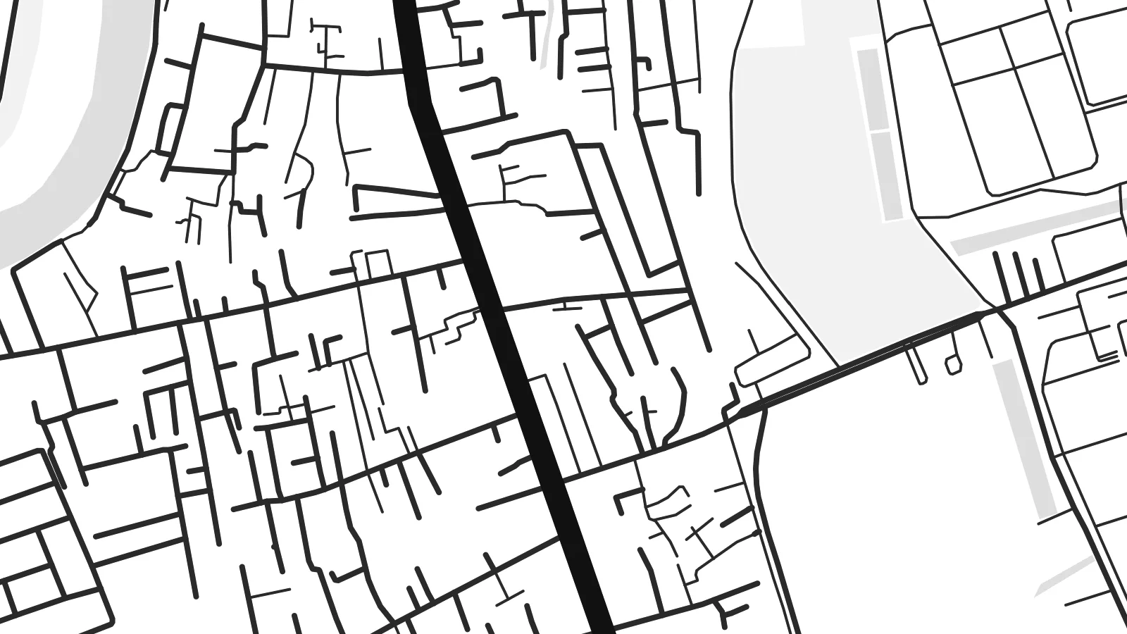 Pixelli veri · fasciculus impressionis 24 × 36″
Ad imprimendum acuta
Haec est particula 100% fasciculi impressionis veri. Omnis tabula — typis impressa, compagine inclusa, vel demissa — in servis nostris ad 300 DPI conficitur, usque ad 7,200 × 10,800 pixellos, ut etiam angustissimae viae in impressione 24 × 36″ nitidae maneant.
In pariete


Tabula
Nhà Bè lies at the southern edge of Ho Chi Minh City, and from above it looks more like water than land. Here the Saigon and Đồng Nai rivers join to form the Nhà Bè river. Just south, the wide channels of the Soài Rạp and Lòng Tàu begin their run toward the coast. The settled areas follow the embankments and main roads, and between them lie fingers of low, flat ground cut by creeks.
The street pattern is loose and practical. There is no old grid or walled core. Instead you see long roads running parallel to the riverbanks, short lanes branching off toward the water, and blocks of warehouses and industrial land toward the south. Small canals and tidal creeks weave through everything. On a Nhà Bè map poster they appear as fine, irregular threads between the heavier outlines of the main rivers.
The river confluence has long made this a place of shipping and trade. Vessels bound for the city's ports pass through these channels, and the area's industry still leans toward the water. On a monochrome print, the district's fragmented land and broad river bends make an unusual composition. It feels closer to a delta chart than to a city plan, which is exactly its character.
The Saigon and Đồng Nai rivers merge here to form the Nhà Bè river. Two broad channels become one in a wide bend that dominates the upper part of the map.
A dense web of small creeks and canals crosses the low ground between the main rivers. It produces a fine, hand-drawn texture that sets Nhà Bè apart from the denser inner districts.
To the south, the waterways open toward the Soài Rạp and the coast. Their long, widening lines carry the eye out of the frame and hint at the delta beyond.
Tuam fac
Adde diem, nomen vel versum tuum; muta stilum, magnitudinem vel directionem.
Specimen gratuitum resolutionis humilis est cum nota aquatica. Impressiones et fasciculi HD ad 300 DPI conficiuntur, usque ad 7,200 × 10,800 px, sine nota aquatica.
Cur Nhà Bè
This map suits anyone who has lived, worked or grown up along Saigon's southern rivers, or anyone who likes maps where water leads the composition. The irregular shapes feel calm on a wall and pair well with plain interiors and natural materials.
You can personalise the title and subtitle, including Vietnamese diacritics, and use the coordinates line for a date or a home address. Five styles are available: Classic black & white, Noir, Paper, Blueprint and Sand. Noir makes the channels glow, and Sand gives the delta a warmer tone.
Eme tabulam Nhà Bè| Magnitudo impressionis | Resolutio | Fasciculi |
|---|---|---|
| 30 × 40 cm11.8 × 15.7″ | 3,543 × 4,724 px | PNG · PDF |
| 29.7 × 42 cm (A3)11.7 × 16.5″ | 3,508 × 4,961 px | PNG · PDF |
| 42 × 59.4 cm (A2)16.5 × 23.4″ | 4,961 × 7,016 px | PNG · PDF |
| 45.7 × 61 cm18 × 24″ | 5,400 × 7,200 px | PNG · PDF |
| 50 × 70 cm19.7 × 27.6″ | 5,906 × 8,268 px | PNG · PDF |
| 61 × 91.4 cm24 × 36″ | 7,200 × 10,800 px | PNG · PDF |
Comparationis causa, specimen gratuitum 900 px latum est, signo aquatico notatum et ad spectandum in quadris lucidis destinatum. Fasciculi HD usque ad octiens maiorem resolutionem in utramque partem habent et tota tabulae magnitudine pure imprimuntur.
Elige formam in summa pagina, deinde selige Tabulam Typis Impressam — magnitudinem et, si vis, compagem — vel Fasciculos Digitales HD. Emptio uno gradu conficitur, et pagina emptionis tuae statim renovatur ubi primum solutio confecta est.
In charta opaca praestanti 200 gsm typis imprimitur, una ex sex magnitudinibus, a 30 × 40 cm usque ad 24 × 36″. Tabulae typis impressae incipiunt a $39, missione inclusa.
Ita. Elige compagem ex solido ligno, colore nigro, albo, quercu naturali vel ligno obscuro. Vitro infrangibili instructa venit et ad suspendendum parata est. Tabulae compagine inclusae incipiunt a $99, missione inclusa.
Missio gratuita est in plus quam 60 terras. Quodque poster ab proximo ex sociis nostris typographicis in plus quam 30 terris imprimitur et plerumque intra 3–7 dies negotiales advenit. Statum et vestigium sub «Mea mandata» sequi potes. Quaedam terrae 2–5 hebdomades requirunt, et ubi nondum mittimus, situs te ante solutionem monet.
Mitte nobis imaginem intra 14 dies post missionem acceptam, et eam gratis iterum imprimemus vel pecuniam tibi reddemus.
Ita. In instrumento huius paginae, titulum, subtitulum et lineam coordinatarum ad libitum muta, et formam ac magnitudinem elige. Emptiones typis impressae, compagine inclusae et digitales omnes exacte figuram tuam adhibent.
Pro $9 accipis fasciculos PNG 300 DPI et PDF ad imprimendum paratos in omnibus sex magnitudinibus, sine nota aquatica, ut ubique imprimere possis. Nondum certus es? Prius specimen gratuitum cum nota aquatica demitte.
