Radiating roads
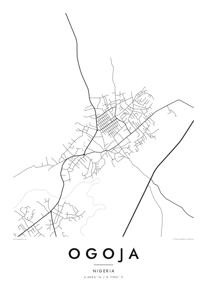
Main routes leave the centre in several directions toward neighbouring towns. They form the backbone of the poster and give the composition a clear, star-like structure.
Tabula geographica minimalis · Nigeria
6.6584° N / 8.7992° E
A regional town in northern Cross River State, its roads radiating outward through green, gently rolling country.


Una urbs, quinque animi
Tange formam ut eam in pariete videas. Omnis forma eodem pretio constat — typis impressa, compagine inclusa, vel ut fasciculi HD.
 Pixelli veri · fasciculus impressionis 24 × 36″
Ad imprimendum acuta
Haec est particula 100% fasciculi impressionis veri. Omnis tabula — typis impressa, compagine inclusa, vel demissa — in servis nostris ad 300 DPI conficitur, usque ad 7,200 × 10,800 pixellos, ut etiam angustissimae viae in impressione 24 × 36″ nitidae maneant.
In pariete


Tabula
Ogoja is a town in the northern part of Cross River State in southeastern Nigeria, and the headquarters of the local government area of the same name. It serves as a market and administrative centre for the surrounding farming communities, and it has long been a point where roads from different parts of the region meet.
From above, the town reads as a central core of streets from which main roads lead out in several directions, with housing thinning into farmland and patches of vegetation as they go. The layout is informal rather than planned, with lanes that follow the ground and connect clusters of compounds, schools and churches. Ogoja is also the seat of a Catholic diocese.
An Ogoja map poster captures this network in a clean, restrained way. Without the colours of a satellite image, the map shows only the lines of movement: the main roads, the side streets and the small paths that link neighbourhoods. The result is an honest portrait of how the town fits together and extends into the countryside.
Main routes leave the centre in several directions toward neighbouring towns. They form the backbone of the poster and give the composition a clear, star-like structure.
Between the main roads, lanes curve and branch following the land. This irregular pattern contrasts with planned grids and gives the map a hand-drawn feel.
At the edges, the streets thin out gradually into farmland. The soft boundary shows how closely the town is tied to the surrounding villages and fields.
Tuam fac
Adde diem, nomen vel versum tuum; muta stilum, magnitudinem vel directionem.
Specimen gratuitum resolutionis humilis est cum nota aquatica. Impressiones et fasciculi HD ad 300 DPI conficiuntur, usque ad 7,200 × 10,800 px, sine nota aquatica.
Cur Ogoja
For people from Ogoja living elsewhere in Nigeria or abroad, a map of the town is a simple, dignified reminder of home, of family compounds and familiar roads, without the need for a photograph.
You can write your own title, add a family name or a date to the subtitle, and choose among Classic black & white, Noir, Paper, Blueprint and Sand. Noir looks especially strong on a light wall.
Eme tabulam Ogoja| Magnitudo impressionis | Resolutio | Fasciculi |
|---|---|---|
| 30 × 40 cm11.8 × 15.7″ | 3,543 × 4,724 px | PNG · PDF |
| 29.7 × 42 cm (A3)11.7 × 16.5″ | 3,508 × 4,961 px | PNG · PDF |
| 42 × 59.4 cm (A2)16.5 × 23.4″ | 4,961 × 7,016 px | PNG · PDF |
| 45.7 × 61 cm18 × 24″ | 5,400 × 7,200 px | PNG · PDF |
| 50 × 70 cm19.7 × 27.6″ | 5,906 × 8,268 px | PNG · PDF |
| 61 × 91.4 cm24 × 36″ | 7,200 × 10,800 px | PNG · PDF |
Comparationis causa, specimen gratuitum 900 px latum est, signo aquatico notatum et ad spectandum in quadris lucidis destinatum. Fasciculi HD usque ad octiens maiorem resolutionem in utramque partem habent et tota tabulae magnitudine pure imprimuntur.
Elige formam in summa pagina, deinde selige Tabulam Typis Impressam — magnitudinem et, si vis, compagem — vel Fasciculos Digitales HD. Emptio uno gradu conficitur, et pagina emptionis tuae statim renovatur ubi primum solutio confecta est.
In charta opaca praestanti 200 gsm typis imprimitur, una ex sex magnitudinibus, a 30 × 40 cm usque ad 24 × 36″. Tabulae typis impressae incipiunt a $39, missione inclusa.
Ita. Elige compagem ex solido ligno, colore nigro, albo, quercu naturali vel ligno obscuro. Vitro infrangibili instructa venit et ad suspendendum parata est. Tabulae compagine inclusae incipiunt a $99, missione inclusa.
Missio gratuita est in plus quam 60 terras. Quodque poster ab proximo ex sociis nostris typographicis in plus quam 30 terris imprimitur et plerumque intra 3–7 dies negotiales advenit. Statum et vestigium sub «Mea mandata» sequi potes. Quaedam terrae 2–5 hebdomades requirunt, et ubi nondum mittimus, situs te ante solutionem monet.
Mitte nobis imaginem intra 14 dies post missionem acceptam, et eam gratis iterum imprimemus vel pecuniam tibi reddemus.
Ita. In instrumento huius paginae, titulum, subtitulum et lineam coordinatarum ad libitum muta, et formam ac magnitudinem elige. Emptiones typis impressae, compagine inclusae et digitales omnes exacte figuram tuam adhibent.
Pro $9 accipis fasciculos PNG 300 DPI et PDF ad imprimendum paratos in omnibus sex magnitudinibus, sine nota aquatica, ut ubique imprimere possis. Nondum certus es? Prius specimen gratuitum cum nota aquatica demitte.
