Katsura River valley
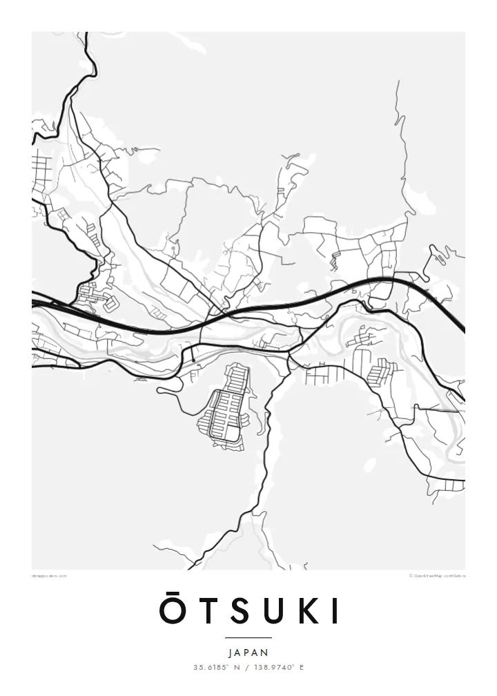
The river winds through the narrow valley, and almost every road and railway follows it. That creates the long, bundled shape at the centre of the map.
Tabula geographica minimalis · Japan
35.6185° N / 138.9740° E
A narrow mountain valley town where river, railway and expressway squeeze together below steep forested slopes


Una urbs, quinque animi
Tange formam ut eam in pariete videas. Omnis forma eodem pretio constat — typis impressa, compagine inclusa, vel ut fasciculi HD.
 Pixelli veri · fasciculus impressionis 24 × 36″
Ad imprimendum acuta
Haec est particula 100% fasciculi impressionis veri. Omnis tabula — typis impressa, compagine inclusa, vel demissa — in servis nostris ad 300 DPI conficitur, usque ad 7,200 × 10,800 pixellos, ut etiam angustissimae viae in impressione 24 × 36″ nitidae maneant.
In pariete


Tabula
Ōtsuki lies in eastern Yamanashi, in a deep valley surrounded by steep, wooded mountains. From above the town is long and narrow. The Katsura River, the JR Chūō Main Line and the Chūō Expressway all follow the valley floor, with homes and small streets fitted into whatever flat land remains between them.
Ōtsuki is a junction on the route to Mount Fuji. The Fujikyū line branches south from Ōtsuki Station toward Fujiyoshida and Kawaguchiko, so many travellers change trains here. Just east of the centre is the Saruhashi, the Monkey Bridge, a wooden cantilever bridge over a gorge, often counted among Japan's three unusual bridges.
An Ōtsuki map poster shows the town squeezed into its setting. The river and transport lines form strong parallel curves, and the mountains appear as broad empty areas crossed by only a few winding roads. It is a clear record of how a Japanese valley town is shaped by its terrain, and it suits both residents and Fuji travellers.
The river winds through the narrow valley, and almost every road and railway follows it. That creates the long, bundled shape at the centre of the map.
The Monkey Bridge spans a narrow gorge east of the centre. This wooden cantilever bridge is one of the best-known historic structures in the region.
At Ōtsuki Station the Fujikyū line leaves the Chūō Main Line and heads south toward Mount Fuji, giving the map a branching rail line.
Tuam fac
Adde diem, nomen vel versum tuum; muta stilum, magnitudinem vel directionem.
Specimen gratuitum resolutionis humilis est cum nota aquatica. Impressiones et fasciculi HD ad 300 DPI conficiuntur, usque ad 7,200 × 10,800 px, sine nota aquatica.
Cur Ōtsuki
Many people pass through Ōtsuki on the way to Fuji, and some stay long enough to know its valley well. The map captures that transit role and the dramatic setting, and the empty mountain areas make it a very graphic print.
Change the title and subtitle, including Japanese text if you prefer, and add a date or adjust the coordinates line. The five styles are Classic black and white, Noir, Paper, Blueprint and Sand. Noir works well with the narrow valley.
Eme tabulam Ōtsuki| Magnitudo impressionis | Resolutio | Fasciculi |
|---|---|---|
| 30 × 40 cm (11.8 × 15.7″) | 3,543 × 4,724 px | PNG · PDF |
| 29.7 × 42 cm (A3, 11.7 × 16.5″) | 3,508 × 4,961 px | PNG · PDF |
| 42 × 59.4 cm (A2, 16.5 × 23.4″) | 4,961 × 7,016 px | PNG · PDF |
| 45.7 × 61 cm (18 × 24″) | 5,400 × 7,200 px | PNG · PDF |
| 50 × 70 cm (19.7 × 27.6″) | 5,906 × 8,268 px | PNG · PDF |
| 61 × 91.4 cm (24 × 36″) | 7,200 × 10,800 px | PNG · PDF |
Comparationis causa, specimen gratuitum 900 px latum est, signo aquatico notatum et ad spectandum in quadris lucidis destinatum. Fasciculi HD usque ad octiens maiorem resolutionem in utramque partem habent et tota tabulae magnitudine pure imprimuntur.
Elige formam in summa pagina, deinde selige Tabulam Typis Impressam — magnitudinem et, si vis, compagem — vel Fasciculos Digitales HD. Emptio uno gradu conficitur, et pagina emptionis tuae statim renovatur ubi primum solutio confecta est.
In charta opaca praestanti 200 gsm typis imprimitur, una ex sex magnitudinibus, a 30 × 40 cm usque ad 24 × 36″. Tabulae typis impressae incipiunt a {printFrom}, missione inclusa.
Ita. Elige compagem ex solido ligno, colore nigro, albo, quercu naturali vel ligno obscuro. Vitro infrangibili instructa venit et ad suspendendum parata est. Tabulae compagine inclusae incipiunt a {framedFrom}, missione inclusa.
Missio ubique terrarum gratuita est. Quodque propositum a socio typographico nostro proximo, in plus quam 30 terris, imprimitur et plerumque intra 3–7 dies negotiales advenit. Condicionem et vestigium in sectione «Mea mandata» sequi potes. In paucis terris 2–5 hebdomades requiruntur, et ubi nondum mittimus, situs te ante solutionem monet.
Mitte nobis imaginem intra 14 dies post missionem acceptam, et eam gratis iterum imprimemus vel pecuniam tibi reddemus.
Ita. In instrumento huius paginae, titulum, subtitulum et lineam coordinatarum ad libitum muta, et formam ac magnitudinem elige. Emptiones typis impressae, compagine inclusae et digitales omnes exacte figuram tuam adhibent.
Pro $9 accipis fasciculos PNG 300 DPI et PDF ad imprimendum paratos in omnibus sex magnitudinibus, sine nota aquatica, ut ubique imprimere possis. Nondum certus es? Prius specimen gratuitum cum nota aquatica demitte.
