Road to the Iseran
The valley road continues past the village toward the Col de l'Iseran, one of the highest paved road passes in the Alps, closed in winter and giving the map a clear upstream direction.
Tabula geographica minimalis · France
45.4496° N / 6.9787° E
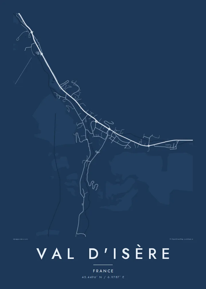
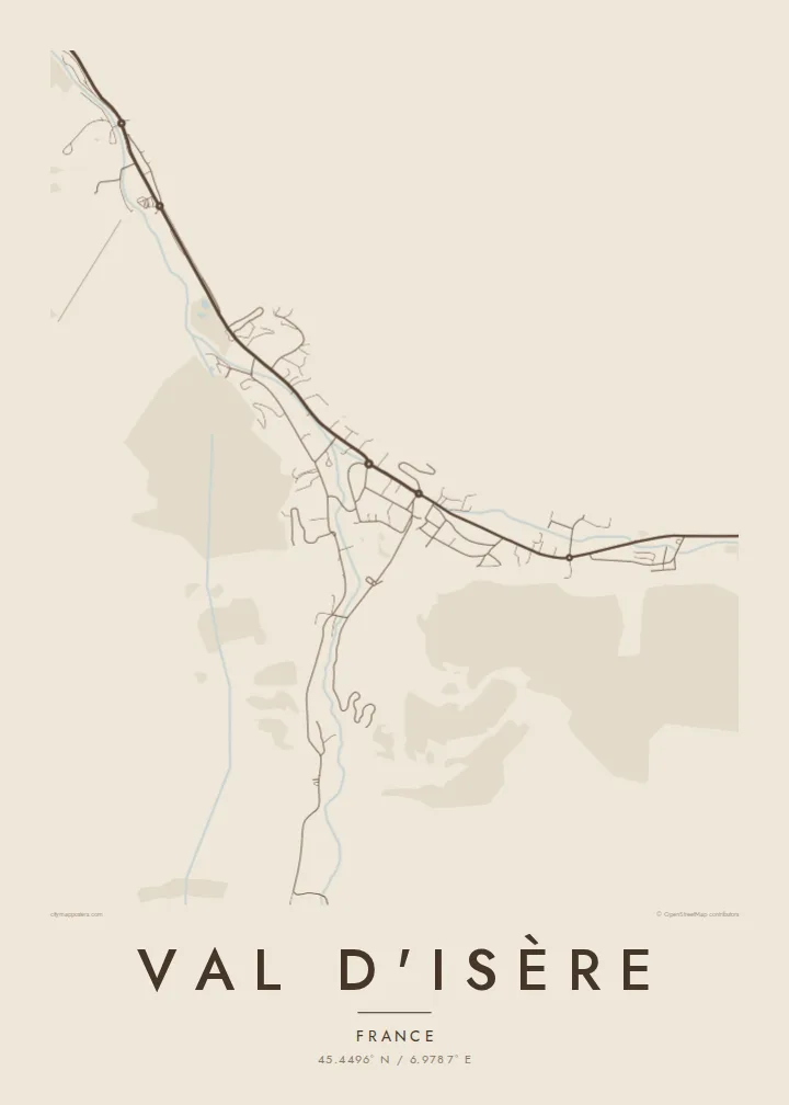
A single valley road climbing the upper Isère, with the village, its outlying hamlets and wide slopes on both sides.


Una urbs, quinque animi
Tange formam ut eam in pariete videas. Omnis forma eodem pretio constat — typis impressa, compagine inclusa, vel ut fasciculi HD.
 Pixelli veri · fasciculus impressionis 24 × 36″
Ad imprimendum acuta
Haec est particula 100% fasciculi impressionis veri. Omnis tabula — typis impressa, compagine inclusa, vel demissa — in servis nostris ad 300 DPI conficitur, usque ad 7,200 × 10,800 pixellos, ut etiam angustissimae viae in impressione 24 × 36″ nitidae maneant.
In pariete


Tabula
Val d'Isère lies near the head of the Tarentaise valley in Savoie, and its map is built around one road. The D902 enters from downstream, passes the hamlet of La Daille, runs through the village centre and continues upstream past Le Fornet toward the Col de l'Iseran. Chalets, lift stations and car parks line this route, with the Isère river running alongside.
The resort shares the Espace Killy ski area with Tignes, named after Jean-Claude Killy, who grew up in Val d'Isère and won three alpine gold medals at the 1968 Olympics. The Face de Bellevarde above the village hosted the men's downhill at the 1992 Albertville Games, and the Critérium de la Première Neige World Cup race is held here early in the season.
A Val d'Isère map poster shows a resort in its simplest form: one road, one river and a string of settlements tucked into a high valley. Around the centre, a small church and a network of lanes give the village its core, while the empty ground on either side stands in for the slopes of Bellevarde and Solaise.
The valley road continues past the village toward the Col de l'Iseran, one of the highest paved road passes in the Alps, closed in winter and giving the map a clear upstream direction.
The two hamlets mark either end of the resort, La Daille downstream with its lift base and Le Fornet upstream, each a small cluster of buildings along the road.
The two mountains rising directly from the village carry the main lift-served slopes; on the map they appear as open ground above the streets, framing the centre on two sides.
Tuam fac
Adde diem, nomen vel versum tuum; muta stilum, magnitudinem vel directionem.
Specimen gratuitum resolutionis humilis est cum nota aquatica. Impressiones et fasciculi HD ad 300 DPI conficiuntur, usque ad 7,200 × 10,800 px, sine nota aquatica.
Cur Val d'Isère
Val d'Isère is the kind of resort people return to year after year, and a map is a fitting keepsake for that habit. Its linear shape reads clearly even at a small print size, and it looks at home in a chalet or a city flat alike.
Set a title and subtitle, add a coordinates line for your chalet or favourite run, and pick one of five styles: Classic black & white, Noir, Paper, Blueprint or Sand. Buy the HD files for $9, or have it printed on matte paper and shipped with an optional wooden frame.
Eme tabulam Val d'Isère| Magnitudo impressionis | Resolutio | Fasciculi |
|---|---|---|
| 30 × 40 cm11.8 × 15.7″ | 3,543 × 4,724 px | PNG · PDF |
| 29.7 × 42 cm (A3)11.7 × 16.5″ | 3,508 × 4,961 px | PNG · PDF |
| 42 × 59.4 cm (A2)16.5 × 23.4″ | 4,961 × 7,016 px | PNG · PDF |
| 45.7 × 61 cm18 × 24″ | 5,400 × 7,200 px | PNG · PDF |
| 50 × 70 cm19.7 × 27.6″ | 5,906 × 8,268 px | PNG · PDF |
| 61 × 91.4 cm24 × 36″ | 7,200 × 10,800 px | PNG · PDF |
Comparationis causa, specimen gratuitum 900 px latum est, signo aquatico notatum et ad spectandum in quadris lucidis destinatum. Fasciculi HD usque ad octiens maiorem resolutionem in utramque partem habent et tota tabulae magnitudine pure imprimuntur.
Elige formam in summa pagina, deinde selige Tabulam Typis Impressam — magnitudinem et, si vis, compagem — vel Fasciculos Digitales HD. Emptio uno gradu conficitur, et pagina emptionis tuae statim renovatur ubi primum solutio confecta est.
In charta opaca praestanti 200 gsm typis imprimitur, una ex sex magnitudinibus, a 30 × 40 cm usque ad 24 × 36″. Tabulae typis impressae incipiunt a $39, missione inclusa.
Ita. Elige compagem ex solido ligno, colore nigro, albo, quercu naturali vel ligno obscuro. Vitro infrangibili instructa venit et ad suspendendum parata est. Tabulae compagine inclusae incipiunt a $99, missione inclusa.
Missio gratuita est in plus quam 60 terras. Quodque poster ab proximo ex sociis nostris typographicis in plus quam 30 terris imprimitur et plerumque intra 3–7 dies negotiales advenit. Statum et vestigium sub «Mea mandata» sequi potes. Quaedam terrae 2–5 hebdomades requirunt, et ubi nondum mittimus, situs te ante solutionem monet.
Mitte nobis imaginem intra 14 dies post missionem acceptam, et eam gratis iterum imprimemus vel pecuniam tibi reddemus.
Ita. In instrumento huius paginae, titulum, subtitulum et lineam coordinatarum ad libitum muta, et formam ac magnitudinem elige. Emptiones typis impressae, compagine inclusae et digitales omnes exacte figuram tuam adhibent.
Pro $9 accipis fasciculos PNG 300 DPI et PDF ad imprimendum paratos in omnibus sex magnitudinibus, sine nota aquatica, ut ubique imprimere possis. Nondum certus es? Prius specimen gratuitum cum nota aquatica demitte.
