Polar Bear Pass
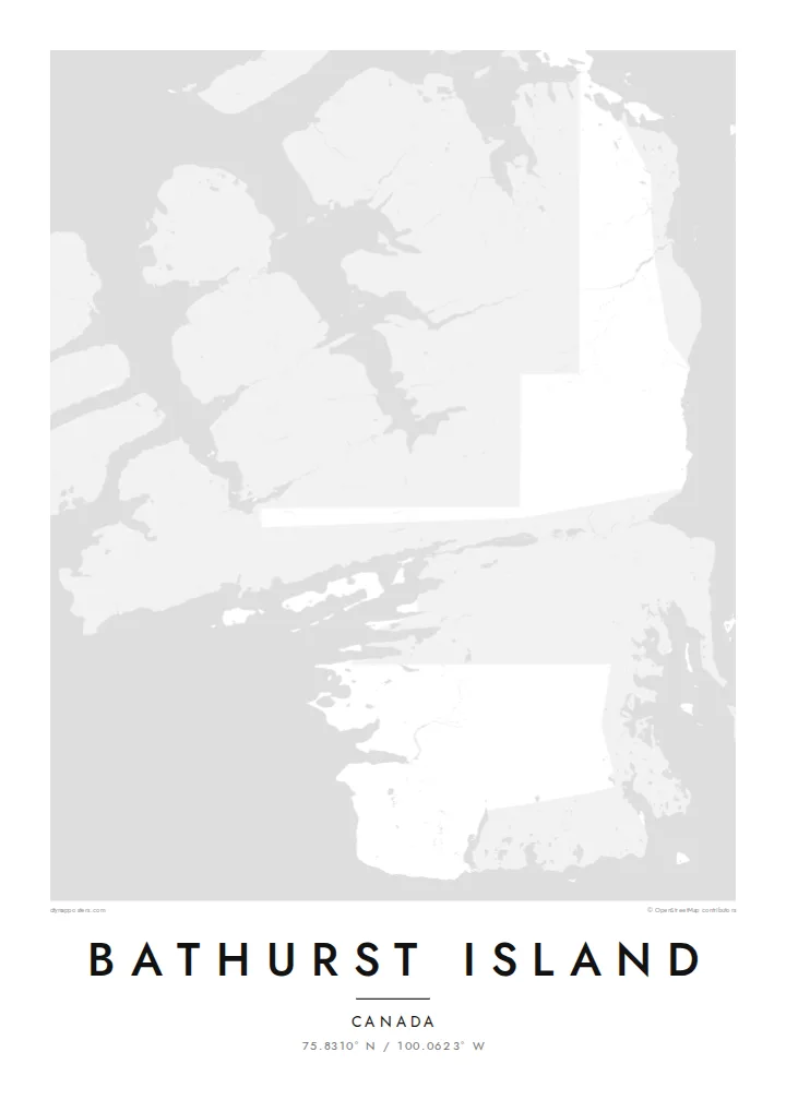
A low valley runs across the centre of the island and is protected as a national wildlife area. On the poster it shows as a soft break between the higher ground on either side.
ໂປສເຕີແຜນທີ່ແບບມິນິມອລ · ແຄນາດາ
75.8310° N / 100.0623° W
A broad, ragged island of the high Arctic, its coast cut by long inlets and its interior laced with pale river valleys.


ເມືອງດຽວ, ຫ້າບັນຍາກາດ
ແຕະເລືອກສະໄຕລ໌ເພື່ອເບິ່ງຢູ່ເທິງຝາ. ທຸກສະໄຕລ໌ລາຄາເທົ່າກັນ — ພິມ, ໃສ່ກອບ ຫຼື ເປັນໄຟລ໌ HD.
 ພິກເຊວຈິງ · ໄຟລ໌ພິມ 24 × 36″
ຄົມຊັດພ້ອມພິມ
ນີ້ແມ່ນພາບຕັດ 100% ຈາກໄຟລ໌ພິມຕົວຈິງ. ໂປສເຕີທຸກໃບ — ພິມ, ໃສ່ກອບ ຫຼື ດາວໂຫຼດ — ຖືກສ້າງຢູ່ເຊີບເວີຂອງພວກເຮົາທີ່ 300 DPI, ສູງເຖິງ 7,200 × 10,800 ພິກເຊວ, ດັ່ງນັ້ນເສັ້ນທາງນ້ອຍທີ່ສຸດກໍ່ຍັງຄົມຊັດເມື່ອພິມຂະໜາດ 24 × 36″.
ຢູ່ເທິງຝາ


ແຜນທີ່
Bathurst Island is in the Queen Elizabeth Islands of Nunavut. It is one of the larger pieces of the Canadian Arctic Archipelago, and no one lives there permanently. On a map it reads as a single mass with a deeply notched outline. Bays push inland from every side, peninsulas reach out toward neighbouring islands, and the channels around it are wide enough to frame the land cleanly on the page.
There are no roads or towns, so the drawing is built from natural lines alone. Rivers run in shallow valleys across a low, rolling interior, small lakes are spread over the lowlands, and most of the detail sits along the shoreline. Near the middle of the island lies Polar Bear Pass, a lowland corridor protected for its wetlands and wildlife. It crosses the land from one coast to the other.
A Bathurst Island map poster suits someone drawn to remote places rather than famous skylines. The composition is quiet and almost abstract, a study of coastline against open water. It works well for anyone who has travelled or worked in the Arctic or followed its research expeditions. It also suits someone who wants a map with no streets at all, where the shape of the land does all the work.
A low valley runs across the centre of the island and is protected as a national wildlife area. On the poster it shows as a soft break between the higher ground on either side.
Long inlets and bays cut into the island from all directions. They give the outline a jagged, hand-drawn quality that holds the eye even at small print sizes.
Open channels separate Bathurst from its neighbours in the archipelago. They leave generous water around the land, so the composition feels spacious rather than crowded.
ເຮັດໃຫ້ເປັນຂອງທ່ານ
ເພີ່ມວັນທີ, ຊື່ ຫຼື ຂໍ້ຄວາມຂອງທ່ານເອງ, ປ່ຽນສະໄຕລ໌, ຂະໜາດ ຫຼື ທິດທາງ.
ຕົວຢ່າງຟຣີມີຄວາມລະອຽດຕ່ຳ ແລະ ມີລາຍນ້ຳ. ໂປສເຕີພິມ ແລະ ໄຟລ໌ HD ຖືກສ້າງທີ່ 300 DPI, ສູງເຖິງ 7,200 × 10,800 px, ບໍ່ມີລາຍນ້ຳ.
ເປັນຫຍັງຕ້ອງ Bathurst Island
People choose this map for its restraint. There is no grid to read and no landmark to recognise, only a coastline shaped by ice and sea. That makes it a strong piece for a study, a hallway or a wall that needs something calm and unusual.
You can set your own title, subtitle and coordinates line, perhaps marking an expedition year or a date that matters to you. Then pick one of five styles. Blueprint and Noir bring out the water around the island, while Paper and Sand soften it.
ສັ່ງໂປສເຕີ Bathurst Island| ຂະໜາດພິມ | ຄວາມລະອຽດ | ໄຟລ໌ |
|---|---|---|
| 30 × 40 cm11.8 × 15.7″ | 3,543 × 4,724 px | PNG · PDF |
| 29.7 × 42 cm (A3)11.7 × 16.5″ | 3,508 × 4,961 px | PNG · PDF |
| 42 × 59.4 cm (A2)16.5 × 23.4″ | 4,961 × 7,016 px | PNG · PDF |
| 45.7 × 61 cm18 × 24″ | 5,400 × 7,200 px | PNG · PDF |
| 50 × 70 cm19.7 × 27.6″ | 5,906 × 8,268 px | PNG · PDF |
| 61 × 91.4 cm24 × 36″ | 7,200 × 10,800 px | PNG · PDF |
ເພື່ອປຽບທຽບ, ຕົວຢ່າງຟຣີກວ້າງ 900 px, ມີລາຍນ້ຳ ແລະ ເໝາະສຳລັບໜ້າຈໍ. ໄຟລ໌ HD ມີຄວາມລະອຽດສູງກວ່າເຖິງ 8 ເທົ່າໃນແຕ່ລະດ້ານ ແລະ ພິມອອກມາຄົມຊັດເຕັມຂະໜາດໂປສເຕີ.
ເລືອກສະໄຕລ໌ຢູ່ເທິງສຸດຂອງໜ້າ ຈາກນັ້ນເລືອກ Printed Poster — ຂະໜາດ ແລະ ຖ້າຕ້ອງການ ກອບຮູບ — ຫຼື Digital HD Files. ການຊຳລະເງິນມີພຽງຂັ້ນຕອນດຽວ ແລະ ໜ້າຄຳສັ່ງຊື້ຂອງທ່ານຈະອັບເດດທັນທີທີ່ຊຳລະເງິນສຳເລັດ.
ພິມໃສ່ເຈ້ຍດ້ານພຣີມຽມ 200 gsm ໃນໜຶ່ງໃນຫົກຂະໜາດ, ຈາກ 30 × 40 cm ຫາ 24 × 36″. ໂປສເຕີພິມເລີ່ມຕົ້ນທີ່ $39, ລວມຄ່າສົ່ງ.
ໄດ້. ເລືອກກອບໄມ້ແທ້ສີດຳ, ສີຂາວ, ໄມ້ໂອກທຳມະຊາດ ຫຼື ໄມ້ສີເຂັ້ມ. ມາພ້ອມກະຈົກກັນແຕກ ແລະ ພ້ອມແຂວນໄດ້ທັນທີ. ໂປສເຕີໃສ່ກອບເລີ່ມຕົ້ນທີ່ $99, ລວມຄ່າສົ່ງ.
ຈັດສົ່ງຟຣີໄປ 60+ ປະເທດ. ໂປສເຕີແຕ່ລະອັນຖືກພິມໂດຍຄູ່ຮ່ວມງານພິມທີ່ຢູ່ໃກ້ທີ່ສຸດໃນ 30+ ປະເທດ ແລະ ປົກກະຕິຈະຮອດພາຍໃນ 3–7 ວັນທຳການ. ທ່ານສາມາດຕິດຕາມສະຖານະ ແລະ ເລກພັດສະດຸໄດ້ທີ່ ຄຳສັ່ງຊື້ຂອງຂ້ອຍ. ບາງປະເທດໃຊ້ເວລາ 2–5 ອາທິດ, ແລະ ຖ້າປະເທດໃດທີ່ເຮົາຍັງບໍ່ໄດ້ຈັດສົ່ງໄປ, ເວັບໄຊຈະແຈ້ງໃຫ້ທ່ານຮູ້ກ່ອນຊຳລະເງິນ.
ສົ່ງຮູບຖ່າຍໃຫ້ພວກເຮົາພາຍໃນ 14 ວັນຫຼັງໄດ້ຮັບສິນຄ້າ ແລ້ວພວກເຮົາຈະພິມໃຫ້ໃໝ່ຟຣີ ຫຼື ຄືນເງິນໃຫ້ທ່ານ.
ໄດ້. ໃນຕົວແກ້ໄຂຢູ່ໜ້ານີ້ ປ່ຽນຫົວຂໍ້, ຫົວຂໍ້ຍ່ອຍ ແລະ ແຖວພິກັດເປັນຫຍັງກໍ່ໄດ້ຕາມໃຈມັກ ແລ້ວເລືອກສະໄຕລ໌ ແລະ ຂະໜາດ. ຄຳສັ່ງຊື້ແບບພິມ, ໃສ່ກອບ ແລະ ດິຈິຕອລ ຈະໃຊ້ດີໄຊນ໌ຂອງທ່ານທັງໝົດ.
ໃນລາຄາ $9 ທ່ານຈະໄດ້ຮັບໄຟລ໌ PNG ແລະ PDF ພ້ອມພິມທີ່ 300 DPI ໃນທັງຫົກຂະໜາດ, ບໍ່ມີລາຍນ້ຳ, ພິມທີ່ໃດກໍ່ໄດ້. ຍັງບໍ່ແນ່ໃຈບໍ? ດາວໂຫຼດຕົວຢ່າງທີ່ມີລາຍນ້ຳຟຣີກ່ອນ.
ໃກ້ຄຽງ
