Cliff-bound coastline
The shoreline is mostly steep rock, with only a few inlets where boats can approach. On the poster the edge of the island appears sharp and irregular, giving the landmass a clear, almost sculpted outline.
Minimalistinis žemėlapio plakatas · Graikija
35.8644° N / 23.2989° E
A small, steep-sided island between Kythera and Crete, its rocky outline broken by a few coves and a single harbour.


Vienas miestas, penkios nuotaikos
Palieskite stilių, kad pamatytumėte jį ant sienos. Visi stiliai kainuoja vienodai — spausdinti, įrėminti ar kaip HD failai.
 Tikri pikseliai · 24 × 36″ spaudinio failas
Ryškus spaudai
Tai 100% tikro spaudinio failo iškarpa. Kiekvienas plakatas — spausdintas, įrėmintas ar atsisiųstas — sukuriamas mūsų serveriuose 300 DPI raiška, iki 7,200 × 10,800 pikselių, todėl net mažiausios gatvelės išlieka ryškios 24 × 36″ spaudinyje.
Ant sienos


Žemėlapis
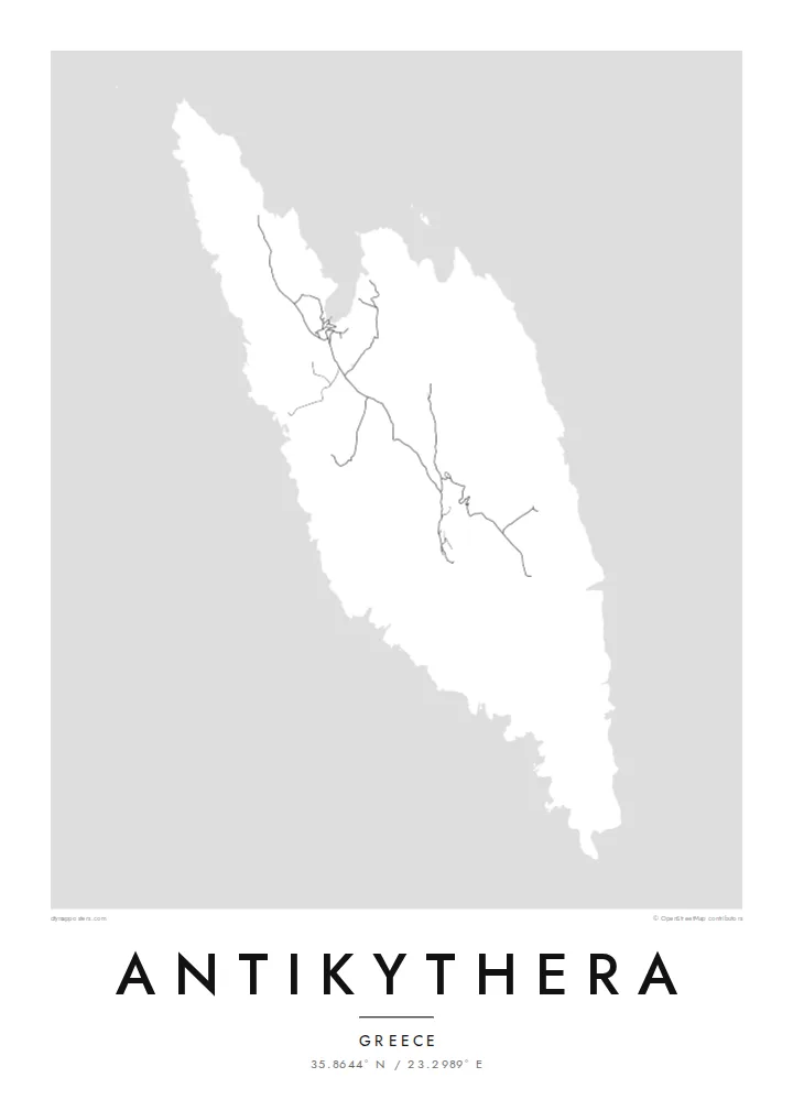
Antikythera sits alone in the strait between Kythera and Crete, a compact wedge of limestone with very little flat ground. From above, the island reads as a rough, elongated shape fringed by cliffs, with a handful of tracks threading between a small harbour settlement and scattered hamlets. The sea takes up most of the frame, and the land becomes a single pale form surrounded by open water.
The island is known worldwide for what was found just offshore. At the start of the twentieth century, sponge divers came across an ancient shipwreck here, and among its cargo was the Antikythera mechanism, a geared bronze device often described as the oldest known analogue computer. The object is now kept in the National Archaeological Museum in Athens, but its name will always point back to this coastline.
An Antikythera map poster is an exercise in restraint. There is no dense grid to fill the paper, only a coastline, a thin network of roads and the contour of the island against a wide field of white or black. The result is quiet and graphic, a shape that people who know the island tend to recognise at once, and that others find simply striking.
The shoreline is mostly steep rock, with only a few inlets where boats can approach. On the poster the edge of the island appears sharp and irregular, giving the landmass a clear, almost sculpted outline.
A small sheltered cove on the northern side serves as the island's port and its link to the ferries. It is where the few roads converge, which makes it the natural focal point of the map.
The waters off the island hold the wreck that yielded the famous mechanism. Nothing marks the spot on a street map, yet the empty sea around the coast carries that story for anyone who knows it.
Sukurkite savo
Pridėkite datą, vardą ar savo žodžius, keiskite stilių, dydį ar orientaciją.
Nemokama peržiūra yra mažos raiškos ir su vandens ženklu. Spaudiniai ir HD failai kuriami 300 DPI raiška, iki 7,200 × 10,800 px, be vandens ženklo.
Kodėl Antikythera
Antikythera appeals to people who care about the history of science, to divers and sailors, and to anyone who has made the long ferry crossing to reach it. The poster is less about streets than about one island standing alone in open sea, a small object with an outsized story.
You can add your own title and subtitle, such as the date of a visit or a line about the mechanism, and adjust the coordinates line. Choose from Classic black & white, Noir, Paper, Blueprint or Sand; Blueprint suits the scientific theme particularly well. Download HD files for $9 or order a printed poster.
Užsisakyti Antikythera plakatą| Spaudinio dydis | Raiška | Failai |
|---|---|---|
| 30 × 40 cm11.8 × 15.7″ | 3,543 × 4,724 px | PNG · PDF |
| 29.7 × 42 cm (A3)11.7 × 16.5″ | 3,508 × 4,961 px | PNG · PDF |
| 42 × 59.4 cm (A2)16.5 × 23.4″ | 4,961 × 7,016 px | PNG · PDF |
| 45.7 × 61 cm18 × 24″ | 5,400 × 7,200 px | PNG · PDF |
| 50 × 70 cm19.7 × 27.6″ | 5,906 × 8,268 px | PNG · PDF |
| 61 × 91.4 cm24 × 36″ | 7,200 × 10,800 px | PNG · PDF |
Palyginimui: nemokama peržiūra yra 900 px pločio, su vandens ženklu ir skirta ekranams. HD failų raiška kiekviena kryptimi iki 8 kartų didesnė, todėl jie puikiai spausdinami viso plakato dydžiu.
Pasirinkite stilių puslapio viršuje, tada pasirinkite Spausdintą plakatą — dydį ir, jei norite, rėmelį — arba Skaitmeninius HD failus. Užsakymas atliekamas vienu žingsniu, o jūsų užsakymo puslapis atsinaujina iš karto, kai tik įvyksta apmokėjimas.
Jis spausdinamas ant aukščiausios kokybės 200 g/m² matinio popieriaus vienu iš šešių dydžių, nuo 30 × 40 cm iki 24 × 36″. Spausdintų plakatų kaina prasideda nuo $39, pristatymas įskaičiuotas.
Taip. Pasirinkite masyvaus medžio rėmelį juodos, baltos, natūralaus ąžuolo ar tamsaus medžio spalvos. Jis komplektuojamas su atspariu dūžiams stiklu ir paruoštas kabinti iš karto. Įrėmintų plakatų kaina prasideda nuo $99, pristatymas įskaičiuotas.
Pristatymas nemokamas į 60+ šalių. Kiekvieną plakatą atspausdina artimiausias iš mūsų spaudos partnerių 30+ šalių, o pristatoma paprastai per 3–7 darbo dienas. Būseną ir siuntos sekimą rasite skiltyje „Mano užsakymai“. Į kai kurias šalis siunta keliauja 2–5 savaites, o jei dar nesiunčiame į jūsų šalį, svetainė apie tai praneša prieš apmokėjimą.
Atsiųskite mums nuotrauką per 14 dienų nuo pristatymo, ir mes nemokamai perspausdinsime plakatą arba grąžinsime pinigus.
Taip. Šio puslapio redaktoriuje pakeiskite pavadinimą, paantraštę ir koordinačių eilutę pagal savo norą bei pasirinkite stilių ir dydį. Spausdinti, įrėminti ir skaitmeniniai užsakymai naudos būtent jūsų sukurtą dizainą.
Už $9 gaunate 300 DPI PNG ir spaudai paruoštus PDF failus visais šešiais dydžiais, be vandens ženklo, kad galėtumėte spausdinti bet kur. Dar neapsisprendėte? Pirmiausia atsisiųskite nemokamą peržiūrą su vandens ženklu.
Netoliese
