Misumi West Port
A carefully engineered Meiji-era harbour of cut stone, with canals and quays, lies near the tip of the peninsula. It is one of the few ports of its era to survive largely intact.
Minimalistinis žemėlapio plakatas · Japonija
32.6222° N / 130.6618° E
A coastal city at the root of the Uto Peninsula, facing two inland seas with a Meiji-era stone port at its western tip.



Vienas miestas, penkios nuotaikos
Palieskite stilių, kad pamatytumėte jį ant sienos. Visi stiliai kainuoja vienodai — spausdinti, įrėminti ar kaip HD failai.
 Tikri pikseliai · 24 × 36″ spaudinio failas
Ryškus spaudai
Tai 100% tikro spaudinio failo iškarpa. Kiekvienas plakatas — spausdintas, įrėmintas ar atsisiųstas — sukuriamas mūsų serveriuose 300 DPI raiška, iki 7,200 × 10,800 pikselių, todėl net mažiausios gatvelės išlieka ryškios 24 × 36″ spaudinyje.
Ant sienos


Žemėlapis
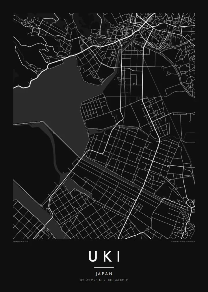
Uki sits in Kumamoto Prefecture at the base of the Uto Peninsula, which reaches west toward the Amakusa islands. On a map the city stretches along the peninsula. The Ariake Sea lies to the north and the Yatsushiro Sea to the south, and small towns and fishing harbours are strung along both shores. Hills run down the centre of the peninsula, with farmland and orchards on their lower slopes.
At the western end lies Misumi West Port, a stone harbour built in the late nineteenth century to Dutch designs. It is now a UNESCO World Heritage site as part of the Sites of Japan's Meiji Industrial Revolution. The Yatsushiro Sea off Uki's coast is also associated with the shiranui, a rare optical phenomenon of flickering lights on the water described in local tradition.
A Uki map poster traces a long, narrow city defined by its shorelines. Coastal roads follow the edge of the land, while a railway runs out along the peninsula toward the port. Smaller settlements appear as clusters where valleys meet the sea. The water surrounding almost every side gives the map a strong, clean silhouette.
A carefully engineered Meiji-era harbour of cut stone, with canals and quays, lies near the tip of the peninsula. It is one of the few ports of its era to survive largely intact.
The Ariake Sea and the Yatsushiro Sea border the city on opposite sides. On the map the peninsula becomes a long strip of land between two open bodies of water.
Hills run along the centre of the peninsula, with roads and small valleys branching toward the coasts. This inland ridge divides the city's northern and southern shores.
Sukurkite savo
Pridėkite datą, vardą ar savo žodžius, keiskite stilių, dydį ar orientaciją.
Nemokama peržiūra yra mažos raiškos ir su vandens ženklu. Spaudiniai ir HD failai kuriami 300 DPI raiška, iki 7,200 × 10,800 px, be vandens ženklo.
Kodėl Uki
Uki is a place of coastal drives, fishing harbours and evenings looking across the water toward Amakusa. A map of the peninsula keeps that geography in view for residents, for visitors and for anyone with family roots in Kumamoto.
Choose Classic black & white, Noir, Paper, Blueprint or Sand, and add your own title, subtitle and coordinates. The free preview lets you check the framing first. HD files cost $9, and printed posters can ship from partners in more than 30 countries.
Užsisakyti Uki plakatą| Spaudinio dydis | Raiška | Failai |
|---|---|---|
| 30 × 40 cm (11.8 × 15.7″) | 3,543 × 4,724 px | PNG · PDF |
| 29.7 × 42 cm (A3, 11.7 × 16.5″) | 3,508 × 4,961 px | PNG · PDF |
| 42 × 59.4 cm (A2, 16.5 × 23.4″) | 4,961 × 7,016 px | PNG · PDF |
| 45.7 × 61 cm (18 × 24″) | 5,400 × 7,200 px | PNG · PDF |
| 50 × 70 cm (19.7 × 27.6″) | 5,906 × 8,268 px | PNG · PDF |
| 61 × 91.4 cm (24 × 36″) | 7,200 × 10,800 px | PNG · PDF |
Palyginimui: nemokama peržiūra yra 900 px pločio, su vandens ženklu ir skirta ekranams. HD failų raiška kiekviena kryptimi iki 8 kartų didesnė, todėl jie puikiai spausdinami viso plakato dydžiu.
Pasirinkite stilių puslapio viršuje, tada pasirinkite Spausdintą plakatą — dydį ir, jei norite, rėmelį — arba Skaitmeninius HD failus. Užsakymas atliekamas vienu žingsniu, o jūsų užsakymo puslapis atsinaujina iš karto, kai tik įvyksta apmokėjimas.
Jis spausdinamas ant aukščiausios kokybės 200 g/m² matinio popieriaus vienu iš šešių dydžių, nuo 30 × 40 cm iki 24 × 36″. Spausdintų plakatų kaina prasideda nuo {printFrom}, pristatymas įskaičiuotas.
Taip. Pasirinkite masyvaus medžio rėmelį juodos, baltos, natūralaus ąžuolo ar tamsaus medžio spalvos. Jis komplektuojamas su atspariu dūžiams stiklu ir paruoštas kabinti iš karto. Įrėmintų plakatų kaina prasideda nuo {framedFrom}, pristatymas įskaičiuotas.
Pristatymas nemokamas visame pasaulyje. Kiekvienas plakatas spausdinamas pas artimiausią iš mūsų spaustuvių partnerių 30+ šalių ir paprastai atkeliauja per 3–7 darbo dienas. Būklę ir siuntos sekimą galite stebėti skiltyje Mano užsakymai.
Atsiųskite mums nuotrauką per 14 dienų nuo pristatymo, ir mes nemokamai perspausdinsime plakatą arba grąžinsime pinigus.
Taip. Šio puslapio redaktoriuje pakeiskite pavadinimą, paantraštę ir koordinačių eilutę pagal savo norą bei pasirinkite stilių ir dydį. Spausdinti, įrėminti ir skaitmeniniai užsakymai naudos būtent jūsų sukurtą dizainą.
Už $9 gaunate 300 DPI PNG ir spaudai paruoštus PDF failus visais šešiais dydžiais, be vandens ženklo, kad galėtumėte spausdinti bet kur. Dar neapsisprendėte? Pirmiausia atsisiųskite nemokamą peržiūrą su vandens ženklu.
