BR-101 corridor
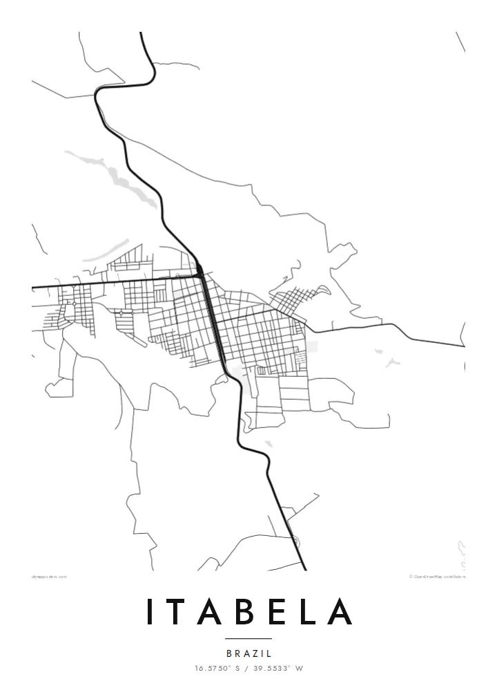
The federal highway runs past the town and forms the main line of the composition. It links Itabela with the other towns of southern Bahia and gives the map its direction.
Poster peta minimalis · Brazil
16.5750° S / 39.5533° W
A small inland town in southern Bahia, laid along the BR-101 among low hills, pasture and remnants of Atlantic Forest


Satu bandar, lima suasana
Ketik gaya untuk melihatnya di dinding. Setiap gaya harganya sama — dicetak, dibingkai atau sebagai fail HD.
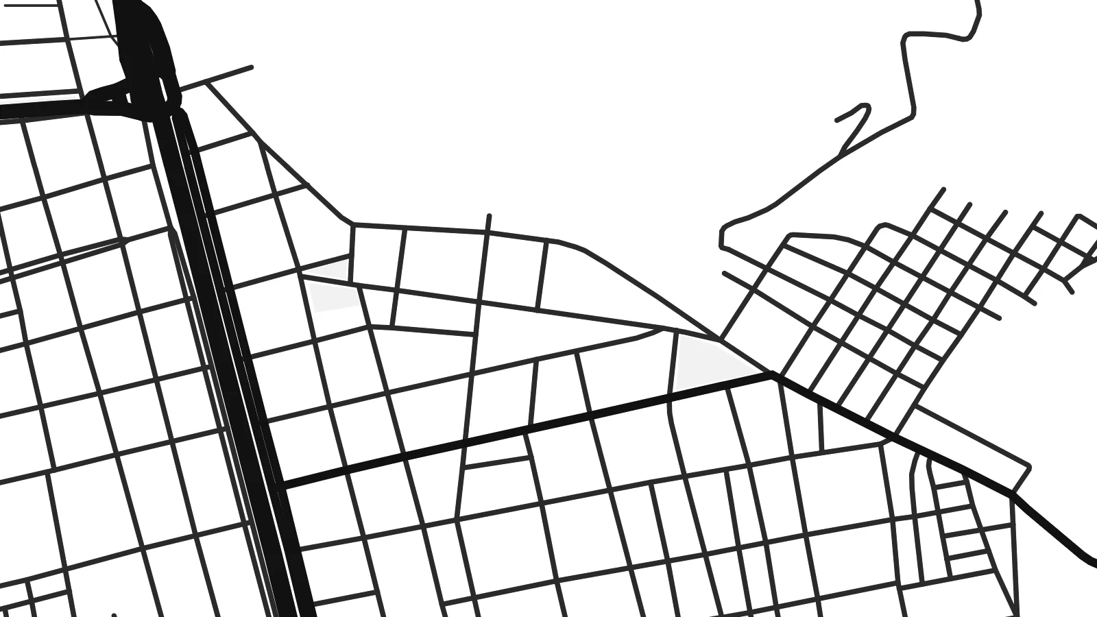 Piksel sebenar · fail cetakan 24 × 36″
Tajam untuk cetakan
Ini ialah potongan 100% daripada fail cetakan sebenar. Setiap poster — dicetak, dibingkai atau dimuat turun — dijana di pelayan kami pada 300 DPI, sehingga 7,200 × 10,800 piksel, jadi lorong sekecil mana pun kekal tajam pada cetakan 24 × 36″.
Di dinding


Peta
Itabela is a municipality in the far south of Bahia, Brazil, inland from the coast around Porto Seguro. The town lies along the BR-101 corridor, the highway that runs parallel to the Atlantic through this part of the country. From above, a compact grid of streets gathers around the road, surrounded by gently rolling land of pasture, plantations and patches of forest.
The region belongs to the hinterland of the Discovery Coast, where Portuguese sailors first sighted Brazil in 1500. Monte Pascoal, the hill they saw from the sea, lies toward the coast to the south. The surrounding land was once covered by Atlantic Forest, and fragments of it remain among the farms.
An Itabela map poster shows a modest town defined by its highway and its rural setting. The BR-101 cuts a strong line across the frame, the streets form a neat cluster beside it, and farm roads and streams spread out into the open land. It is a simple composition that fits the place well.
The federal highway runs past the town and forms the main line of the composition. It links Itabela with the other towns of southern Bahia and gives the map its direction.
The urban area is a small, regular cluster of blocks close to the highway. On the poster it forms the focal point within a much larger rural landscape.
Around the town, farm roads, streams and field boundaries cross low hills. These sparse lines suggest the pastures and forest remnants of the region.
Jadikan milik anda
Tambah tarikh, nama atau ayat anda sendiri, tukar gaya, saiz atau orientasi.
Pratonton percuma beresolusi rendah dengan tanda air. Cetakan dan fail HD dijana pada 300 DPI, sehingga 7,200 × 10,800 px, tanpa tanda air.
Kenapa Itabela
For families from Itabela and people who know the far south of Bahia, a map of the town is a personal reminder of home. It makes a warm gift for relatives who have moved to Salvador, São Paulo or abroad.
The title, subtitle and coordinates line can be personalised in Portuguese or any other language. Choose Classic black & white, Noir, Paper, Blueprint or Sand. Download HD files for $9, or order a printed poster shipped from a partner in Brazil or elsewhere.
Tempah poster Itabela| Saiz cetakan | Resolusi | Fail |
|---|---|---|
| 30 × 40 cm (11.8 × 15.7″) | 3,543 × 4,724 px | PNG · PDF |
| 29.7 × 42 cm (A3, 11.7 × 16.5″) | 3,508 × 4,961 px | PNG · PDF |
| 42 × 59.4 cm (A2, 16.5 × 23.4″) | 4,961 × 7,016 px | PNG · PDF |
| 45.7 × 61 cm (18 × 24″) | 5,400 × 7,200 px | PNG · PDF |
| 50 × 70 cm (19.7 × 27.6″) | 5,906 × 8,268 px | PNG · PDF |
| 61 × 91.4 cm (24 × 36″) | 7,200 × 10,800 px | PNG · PDF |
Sebagai perbandingan, pratonton percuma selebar 900 px, bertera air dan untuk skrin sahaja. Fail HD mempunyai resolusi sehingga 8× ganda pada setiap arah dan dicetak dengan kemas pada saiz poster penuh.
Pilih gaya di bahagian atas halaman, kemudian pilih Poster Cetakan — saiz dan, jika mahu, bingkai — atau Fail Digital HD. Pembayaran hanya satu langkah, dan halaman pesanan anda akan dikemas kini sebaik sahaja pembayaran selesai.
Ia dicetak pada kertas matte premium 200 gsm dalam salah satu daripada enam saiz, dari 30 × 40 cm hingga 24 × 36″. Poster cetakan bermula pada {printFrom}, penghantaran percuma.
Boleh. Pilih bingkai kayu pejal dalam warna hitam, putih, oak semula jadi atau kayu gelap. Ia dilengkapi kaca tahan pecah dan sedia untuk digantung. Poster berbingkai bermula pada {framedFrom}, penghantaran percuma.
Penghantaran percuma ke seluruh dunia. Setiap poster dicetak oleh rakan cetakan kami yang paling dekat di lebih 30 negara dan biasanya tiba dalam 3–7 hari bekerja. Anda boleh menyemak status dan penjejakan di bawah Pesanan Saya.
Hantarkan kami gambar dalam masa 14 hari selepas penghantaran dan kami akan mencetak semula secara percuma atau memberikan bayaran balik.
Boleh. Dalam editor di halaman ini, ubah tajuk, subtajuk dan baris koordinat mengikut kehendak anda, kemudian pilih gaya dan saiz. Pesanan cetakan, berbingkai dan digital semuanya menggunakan reka bentuk anda dengan tepat.
Dengan harga $9, anda dapat fail PNG 300 DPI dan PDF sedia cetak dalam kesemua enam saiz, tanpa tanda air, untuk dicetak di mana-mana sahaja. Belum pasti? Muat turun pratonton percuma bertanda air dahulu.
