Town centre blocks
The centre follows a fairly regular pattern of streets. It is the most orderly part of the map, and beyond it the terrain takes over.
मिनिमलिस्ट नक्सा पोस्टर · मेक्सिको
14.9920° N / 92.1642° W
A coffee town on the slopes above Tapachula, where streets climb toward the Tacaná volcano near the Guatemalan border.


एउटै शहर, पाँच मुड
पर्खालमा कस्तो देखिन्छ हेर्न कुनै स्टाइल छान्नुहोस्। हरेक स्टाइलको मूल्य उस्तै हुन्छ — प्रिन्ट, फ्रेम वा HD फाइलको रूपमा।
 वास्तविक पिक्सेल · 24 × 36″ प्रिन्ट फाइल
प्रिन्टमा प्रस्ट
यो वास्तविक प्रिन्ट फाइलको 100% क्रप हो। हरेक पोस्टर — प्रिन्ट, फ्रेम वा डाउनलोड — हाम्रो सर्भरमा 300 DPI मा, 7,200 × 10,800 पिक्सेलसम्म रेन्डर हुन्छ, त्यसैले सबैभन्दा साना गल्लीहरू पनि 24 × 36″ प्रिन्टमा स्पष्ट देखिन्छन्।
भित्तामा


नक्सा
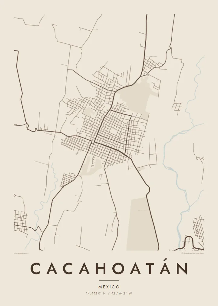
Cacahoatán lies in the Soconusco region of Chiapas, in Mexico's far south. It is a short drive north of Tapachula and close to the border with Guatemala. The town sits where the coastal plain begins to rise toward the Sierra Madre de Chiapas and the Tacaná volcano. The map reflects that position: a compact centre, with roads that bend and climb as they leave it.
The name is usually traced to Nahuatl and linked to cacao, a crop grown in this region long before the Spanish arrived. Today the surrounding hillsides are better known for coffee. Farms and small settlements are scattered across the slopes, and on the map they appear as winding rural roads and a loose network of paths above the town.
Rivers coming down from the mountains cut deep, curving lines through the landscape and divide it into ridges and valleys. A Cacahoatán map poster captures the contrast between the ordered blocks of the town centre and the steep country around it. Few maps show this part of the Mexican south in so much detail.
The centre follows a fairly regular pattern of streets. It is the most orderly part of the map, and beyond it the terrain takes over.
Coffee farms cover the hills above town. Rural roads wind through them in long curves, giving the upper part of the map a loose, flowing texture.
Streams and rivers flowing down from the Tacaná area cut through the landscape. They draw natural lines between the ridges around the town.
आफ्नै बनाउनुहोस्
मिति, नाम वा आफ्नै एक लाइन थप्नुहोस्, शैली, साइज वा दिशा बदल्नुहोस्।
नि:शुल्क प्रिभ्यू कम-रिजोलुसन र वाटरमार्कसहित हुन्छ। प्रिन्ट र HD फाइलहरू 300 DPI मा, 7,200 × 10,800 px सम्म, वाटरमार्क बिना रेन्डर गरिन्छन्।
किन Cacahoatán
Families from the Soconusco, coffee growers and people who have crossed this border region all know Cacahoatán as a place between the mountains and the coast. A map of the town brings that landscape into a home or office in a calm, understated form.
The title, subtitle and coordinates line are yours to change, so you can add a family name or a date. Choose from five styles: Classic black & white, Noir, Paper, Blueprint or Sand. Order digital files or a printed poster.
Cacahoatán पोस्टर अर्डर गर्नुहोस्| प्रिन्ट साइज | रिजोल्युसन | फाइलहरू |
|---|---|---|
| 30 × 40 cm11.8 × 15.7″ | 3,543 × 4,724 px | PNG · PDF |
| 29.7 × 42 cm (A3)11.7 × 16.5″ | 3,508 × 4,961 px | PNG · PDF |
| 42 × 59.4 cm (A2)16.5 × 23.4″ | 4,961 × 7,016 px | PNG · PDF |
| 45.7 × 61 cm18 × 24″ | 5,400 × 7,200 px | PNG · PDF |
| 50 × 70 cm19.7 × 27.6″ | 5,906 × 8,268 px | PNG · PDF |
| 61 × 91.4 cm24 × 36″ | 7,200 × 10,800 px | PNG · PDF |
तुलनाका लागि, निःशुल्क प्रिभ्यु 900 px चौडा, वाटरमार्कसहित र स्क्रिनका लागि मात्र हो। HD फाइलहरूमा हरेक दिशामा 8× सम्म बढी रिजोल्युसन हुन्छ र पूरा पोस्टर साइजमा सफा छापिन्छ।
पेजको माथिबाट कुनै स्टाइल छान्नुहोस्, त्यसपछि प्रिन्टेड पोस्टर — साइज र चाहेमा फ्रेम — वा डिजिटल HD फाइलहरू छान्नुहोस्। चेकआउट एक चरणमा हुन्छ, र पेमेन्ट भएपश्चात तपाईंको अर्डर पेज तुरुन्तै अपडेट हुन्छ।
यो प्रिमियम 200 gsm म्याट पेपरमा, 30 × 40 cm देखि 24 × 36″ सम्मका छ साइजमध्ये एकमा प्रिन्ट गरिन्छ। प्रिन्टेड पोस्टरहरू $39 बाट सुरु हुन्छन्, ढुवानी सहित।
हो। कालो, सेतो, प्राकृतिक ओक वा गाढा काठको ठोस काठको फ्रेम छान्नुहोस्। यो फुट्दैन भन्ने गिलाससहित आउँछ र झुन्ड्याउनका लागि तयार हुन्छ। फ्रेम गरिएका पोस्टरहरू $99 बाट सुरु हुन्छन्, ढुवानी सहित।
६०+ देशमा ढुवानी निःशुल्क छ। प्रत्येक पोस्टर ३०+ देशमा रहेका हाम्रा प्रिन्ट साझेदारमध्ये सबैभन्दा नजिककाद्वारा छापिन्छ र सामान्यतया ३–७ कार्यदिनभित्र पुग्छ। तपाईं “मेरा अर्डरहरू” मा गएर स्थिति र ट्र्याकिङ हेर्न सक्नुहुन्छ। केही देशमा २–५ हप्ता लाग्छ, र हामीले अझै ढुवानी नगर्ने ठाउँमा भुक्तानी गर्नुअघि नै साइटले जानकारी दिन्छ।
डेलिवरी भएको 14 दिनभित्र हामीलाई फोटो पठाउनुहोस्, हामी नि:शुल्क पुनः प्रिन्ट गरिदिनेछौं वा रिफन्ड दिनेछौं।
हो। यो पेजको एडिटरमा, शीर्षक, उपशीर्षक र कोअर्डिनेट लाइनलाई तपाईंले चाहेजस्तै बदल्नुहोस्, अनि स्टाइल र साइज छान्नुहोस्। प्रिन्टेड, फ्रेम गरिएका र डिजिटल अर्डर सबैले तपाईंको डिजाइन नै प्रयोग गर्छन्।
$9 मा तपाईंले सबै छ साइजमा 300 DPI PNG र प्रिन्ट-रेडी PDF फाइलहरू पाउनुहुन्छ, वाटरमार्क बिना, जुनसुकै ठाउँमा प्रिन्ट गर्न मिल्ने। अझै पक्का हुनुभएको छैन? पहिले नि:शुल्क वाटरमार्क भएको प्रिभ्यू डाउनलोड गर्नुहोस्।
नजिकै
