The Mahakali River
The broad braided river along the western edge forms the international border. Its channels and sandbars give the map a loose, shifting edge instead of a hard line.
Beot el poster er a chizu · Nepal
28.9640° N / 80.1771° E
A flat Terai town at Nepal's far-western edge, set between the Mahakali River, forest reserves and the first ridges of hills.


Ta el beluu, eim el style
Chotii a style e mo omes er ngii er a bades. A rokui el style a diak el mora el ongraol — el lidudech, el ngar er a bilong, me a lechub el HD el file.
 Mera el pixel · 24 × 36″ el print file
Kmal ungil el print
Tiaikid a 100% el cheldechedechal a mera el print file. A rokui el poster — lidudech, ngar er a bilong, me a lechub e download — a mengedmokl er a server er kid er a 300 DPI, el mo er a 7,200 × 10,800 pixel, me a kekerei el rael a blechoel el mo klemedengei er a 24 × 36″ el print.
Er a bab er a mederrekong


A chizu
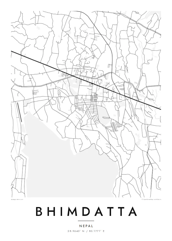
Bhimdatta, long known as Mahendranagar, is the main town of Kanchanpur District in Sudurpashchim Pradesh, in the far west of Nepal. It sits on the level plain of the Terai, close to the border with India. The flat ground shows on a map. Streets spread across open land without the switchbacks of hill towns, and the edges run out into fields, irrigation channels and patches of forest.
The Mahakali River, which marks this stretch of the border between Nepal and India, runs just west of the town. It sets the western limit of the map. Across it is the Indian town of Banbasa, and the crossing between them is one of the busiest in western Nepal. To the south lies Shuklaphanta National Park, a wide area of grassland and forest that appears on a Bhimdatta map poster as a large, quiet space.
The town was renamed in honour of Bhimdatta Panta, a twentieth-century activist remembered for his campaigns for farmers' rights in the far west. It is also near the western end of the Mahendra Highway, the east–west route that crosses the country's lowland belt. That road ties Bhimdatta to the rest of Nepal, so the town reads as a western terminus as well as a border town.
The broad braided river along the western edge forms the international border. Its channels and sandbars give the map a loose, shifting edge instead of a hard line.
The national park south of town is a large expanse of grassland and forest with almost no streets. On the poster it becomes a calm open area next to the urban blocks.
The Mahendra Highway reaches this corner of the country after crossing the lowlands from the east. On the map it is the long straight line that anchors the town.
Meruul el bo er kau
Mruul a sils, ngakl me a tekoi er kau, me ke olsisebii a style, klungel me a orientation.
A ngeasek el preview a kekerei a resolution e ngar er ngii a watermark. A Prints me a HD files a mengedmokl er a 300 DPI, el mo er a 7,200 × 10,800 px, el diak a watermark.
Ngera me a Bhimdatta
For people from Kanchanpur, or those who have crossed the border here or travelled Nepal's lowland highway to its western end, this map marks a real point of arrival. The flat plain, the river and the reserve make a clear, balanced composition on a wall.
You can edit the title, subtitle and coordinates, for example to use Mahendranagar, the older name, or a date that matters to you. Then pick one of five styles: Classic black and white, Noir, Paper, Blueprint or Sand.
Oid a Bhimdatta el poster| Klungel er a print | Resolution | File |
|---|---|---|
| 30 × 40 cm11.8 × 15.7″ | 3,543 × 4,724 px | PNG · PDF |
| 29.7 × 42 cm (A3)11.7 × 16.5″ | 3,508 × 4,961 px | PNG · PDF |
| 42 × 59.4 cm (A2)16.5 × 23.4″ | 4,961 × 7,016 px | PNG · PDF |
| 45.7 × 61 cm18 × 24″ | 5,400 × 7,200 px | PNG · PDF |
| 50 × 70 cm19.7 × 27.6″ | 5,906 × 8,268 px | PNG · PDF |
| 61 × 91.4 cm24 × 36″ | 7,200 × 10,800 px | PNG · PDF |
A preview el diak el oldars a 900 px a klungel, ngar er ngii a watermark, e ng el kirel a screen. A HD file a ngar er ngii a 8× el klou el resolution, e ungil el print er a rokui el klungel er a poster.
Mengai a style er a eou er a page, e mongdibel a Printed Poster — el size, e a lechub e bilong — me a lechub e Digital HD Files. A checkout a di di tang el rrael, e a order page er kau a mo mechesang sel mo merek a udoud.
Ngii a lidudech er a klou el ungil 200 gsm matte el babier er a tang er a euid el size, mei er a 30 × 40 cm el mo er a 24 × 36″. A lidudech el poster a mo mekedeb er a $39, e a shipping a diak longraol.
Choi. Melilt a mera el kerrekar el frame er a chelellakl, chesisebangiau, natural oak, me a chelebacheb el kerrekar. Ngii a ngar er ngii a glazing el diak lebo lengebechel, e mo klemedengei el mo lomelilt. A framed poster a mo mekedeb er a $99, e a shipping a diak longraol.
A ngarngii a mengedub el mo er a 60+ el beluu. A chelsel poster a mebo mengelebed er a ngii el print partner er tial ngii el kmal ngar er ngii er a 30+ el beluu, ma e ng di meruul er a 3–7 el ngarngii el rak. Ke mo mesaul a status me a tracking er ngii er a My Orders. A ta el beluu a mo mekesai 2–5 el ngarngii el bak, ma el di ngar a beluu el diak mo medengelii, a site a mo kmeklii er kau el mei ng diak le mo tuobed.
Molecha a picture er kid er a uleb el 14 el sils er a lebo er a lomtok, e kid a mo di ngmuu el mengedmokl er ngii, me a lechub e mo msang a udoud er kau.
Choi. Er a editor er tia el page, molecha a title, subtitle, me a coordinates el rael el mo uangii el soam, e melilt a style me a size. A lidudech, framed, me a digital el order a rokui el mo use er a mera el design er kau.
Er a $9 e kau a mo ngmai a 300 DPI PNG me a print-ready PDF el files er a rokui el euid el size, el diak a watermark, el sebechem el mo lidudech er bek el basio. Diak dimo medengei? Download a ngeasek el preview el ngar er ngii a watermark er a uchei.
Kmeed
