Lincoln Highway
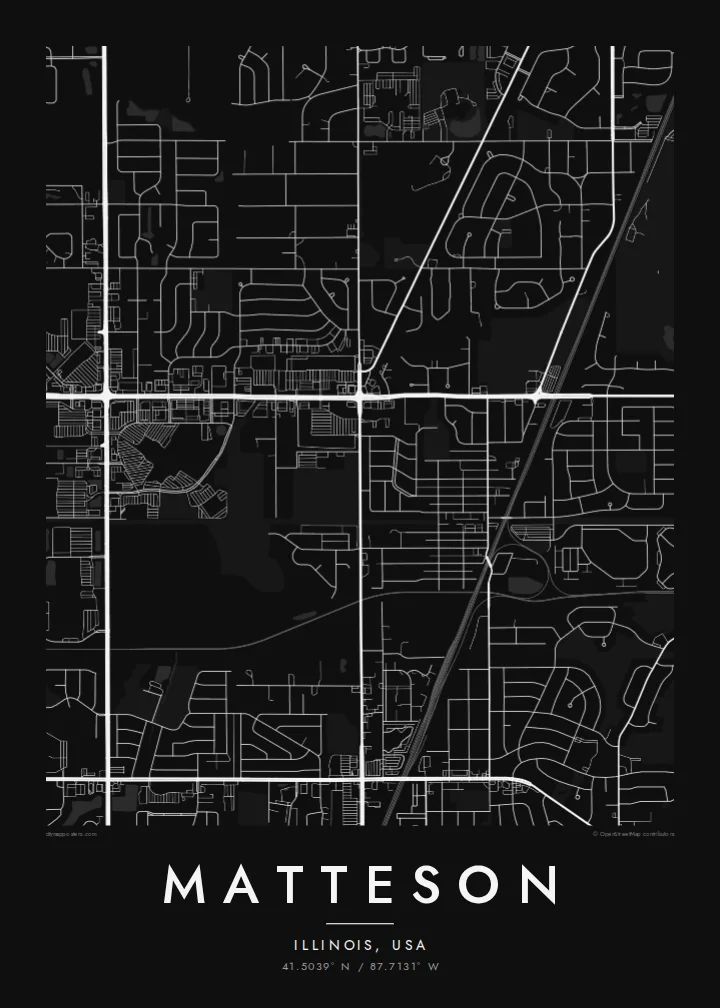
US 30 crosses the village east to west along the route of the Lincoln Highway, the early twentieth-century road linking New York and San Francisco. On the poster it is one of the longest straight lines.
Minimalistyczny plakat z mapą · Stany Zjednoczone
41.5039° N / 87.7131° W
A south-suburban Chicago grid where Interstate 57, the Lincoln Highway and the Metra Electric line cut clean lines across former prairie.



Jedno miasto, pięć nastrojów
Dotknij stylu, aby zobaczyć go na ścianie. Każdy styl kosztuje tyle samo — jako druk, w ramie lub pliki HD.
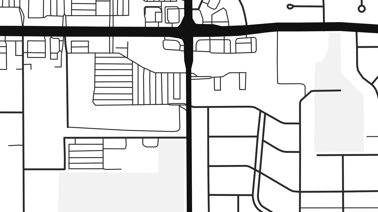 Rzeczywiste piksele · plik do druku 24 × 36″
Ostrość do druku
To jest wycinek w skali 100% z prawdziwego pliku do druku. Każdy plakat — drukowany, oprawiony lub pobrany — jest renderowany na naszych serwerach w rozdzielczości 300 DPI, do 7,200 × 10,800 pikseli, dzięki czemu nawet najmniejsze ulice pozostają ostre na wydruku 24 × 36″.
Na ścianie


Mapa
Matteson sits on the flat land south of Chicago, where the old prairie was divided into survey-mile squares long before the houses arrived. From above, that pattern is still easy to read. Section-line roads run straight north–south and east–west, and the residential streets inside each square form the loops, cul-de-sacs and short crescents typical of postwar Illinois suburbs.
The village began as a railroad settlement and is named after Joel Matteson, a governor of Illinois in the 1850s. The rail corridor still runs through town and now carries Metra Electric commuter trains toward downtown Chicago. On the map it reads as a long, unbroken line, and most streets meet it at right angles instead of crossing it at random.
Two major roads frame the picture. Interstate 57 runs north–south through the village with its interchange ramps, and US 30, the historic Lincoln Highway, runs east–west along one of the country's earliest coast-to-coast routes. A Matteson map poster shows where a transcontinental road, a commuter railway and quiet residential blocks meet, all in one orderly composition.
US 30 crosses the village east to west along the route of the Lincoln Highway, the early twentieth-century road linking New York and San Francisco. On the poster it is one of the longest straight lines.
The interstate runs north–south through the village. Its interchange ramps are the most curved, sculptural shapes on an otherwise rectilinear map.
Between the section-line roads, subdivisions use curving drives and cul-de-sacs. Each square mile gets its own pattern of rounded lines inside a rigid outer frame.
Spersonalizuj
Dodaj datę, imię lub własny tekst, zmień styl, rozmiar lub orientację.
Darmowy podgląd ma niską rozdzielczość i znak wodny. Wydruki i pliki HD są renderowane w 300 DPI, do 7,200 × 10,800 px, bez znaku wodnego.
Dlaczego Matteson
For people who grew up in the south suburbs or rode the Metra from here, the map is a quiet record of daily routes: the station, the highway ramps, the street where the family house stood. It suits a hallway, a home office or a first apartment in the city.
You can set your own title, subtitle and coordinates line, for example a family name or a move-in date, and choose Classic black & white, Noir, Paper, Blueprint or Sand. The $9 digital download includes six print sizes as 300 DPI PNG and PDF files. Printed and framed versions ship from partners in 30+ countries.
Zamów plakat Matteson| Rozmiar wydruku | Rozdzielczość | Pliki |
|---|---|---|
| 30 × 40 cm11.8 × 15.7″ | 3,543 × 4,724 px | PNG · PDF |
| 29.7 × 42 cm (A3)11.7 × 16.5″ | 3,508 × 4,961 px | PNG · PDF |
| 42 × 59.4 cm (A2)16.5 × 23.4″ | 4,961 × 7,016 px | PNG · PDF |
| 45.7 × 61 cm18 × 24″ | 5,400 × 7,200 px | PNG · PDF |
| 50 × 70 cm19.7 × 27.6″ | 5,906 × 8,268 px | PNG · PDF |
| 61 × 91.4 cm24 × 36″ | 7,200 × 10,800 px | PNG · PDF |
Dla porównania: darmowy podgląd ma 900 px szerokości, znak wodny i jest przeznaczony na ekran. Pliki HD mają do 8× wyższą rozdzielczość w każdym kierunku i drukują się wyraźnie w pełnym rozmiarze plakatu.
Wybierz styl na górze strony, a następnie wybierz Plakat drukowany — rozmiar i opcjonalnie ramę — albo Pliki cyfrowe HD. Płatność zajmuje jeden krok, a strona zamówienia aktualizuje się od razu po jej zaksięgowaniu.
Jest drukowany na papierze matowym premium 200 g/m² w jednym z sześciu rozmiarów, od 30 × 40 cm do 24 × 36″. Drukowane plakaty zaczynają się od $39, z darmową wysyłką.
Tak. Wybierz ramę z litego drewna w kolorze czarnym, białym, naturalnego dębu lub ciemnego drewna. Zawiera nietłukące szkło i jest gotowa do powieszenia. Plakaty w ramach zaczynają się od $99, z darmową wysyłką.
Wysyłka jest darmowa do ponad 60 krajów. Każdy plakat drukuje najbliższy z naszych partnerów drukarskich w ponad 30 krajach, a dostawa zajmuje zwykle 3–7 dni roboczych. Status i numer przesyłki sprawdzisz w zakładce Moje zamówienia. W kilku krajach dostawa trwa 2–5 tygodni, a jeśli jeszcze tam nie wysyłamy, strona poinformuje Cię o tym przed płatnością.
Wyślij nam zdjęcie w ciągu 14 dni od dostawy, a bezpłatnie wydrukujemy go ponownie lub zwrócimy pieniądze.
Tak. W edytorze na tej stronie zmień tytuł, podtytuł i linię ze współrzędnymi na dowolne, po czym wybierz styl i rozmiar. Zamówienia drukowane, w ramie i cyfrowe zawsze odzwierciedlają dokładnie Twój projekt.
Za $9 otrzymujesz pliki PNG w 300 DPI oraz PDF gotowe do druku, we wszystkich sześciu rozmiarach, bez znaku wodnego, do wydruku w dowolnym miejscu. Nie masz pewności? Najpierw pobierz darmowy podgląd ze znakiem wodnym.
W pobliżu
